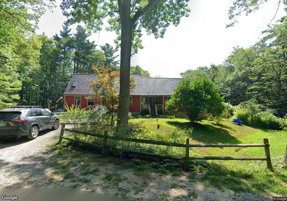
12 Brigham Hill Rd S Fitzwilliam, NH 03447
Estimated Value: $498,000 - $593,000
6
Beds
3
Baths
2,712
Sq Ft
$198/Sq Ft
Est. Value
About This Home
This home is located at 12 Brigham Hill Rd S, Fitzwilliam, NH 03447 and is currently estimated at $537,597, approximately $198 per square foot. 12 Brigham Hill Rd S is a home located in Cheshire County with nearby schools including Dr. George S. Emerson Elementary School and Monadnock Regional High School.
Ownership History
Date
Name
Owned For
Owner Type
Purchase Details
Closed on
Feb 22, 2024
Sold by
Poston Jeffrey V and Poston Cathy P
Bought by
J V & Cathy P Poston Irt and Poston
Current Estimated Value
Purchase Details
Closed on
Jun 28, 2000
Sold by
Rumba Richard G and Rumba Lynne A
Bought by
Poston Jeffrey V and Poston Cathy D
Home Financials for this Owner
Home Financials are based on the most recent Mortgage that was taken out on this home.
Original Mortgage
$129,200
Interest Rate
8.59%
Mortgage Type
Purchase Money Mortgage
Create a Home Valuation Report for This Property
The Home Valuation Report is an in-depth analysis detailing your home's value as well as a comparison with similar homes in the area
Home Values in the Area
Average Home Value in this Area
Purchase History
| Date | Buyer | Sale Price | Title Company |
|---|---|---|---|
| J V & Cathy P Poston Irt | -- | None Available | |
| Poston Jeffrey V | $161,500 | -- |
Source: Public Records
Mortgage History
| Date | Status | Borrower | Loan Amount |
|---|---|---|---|
| Previous Owner | Poston Jeffrey V | $129,200 |
Source: Public Records
Tax History Compared to Growth
Tax History
| Year | Tax Paid | Tax Assessment Tax Assessment Total Assessment is a certain percentage of the fair market value that is determined by local assessors to be the total taxable value of land and additions on the property. | Land | Improvement |
|---|---|---|---|---|
| 2024 | $7,416 | $405,900 | $59,400 | $346,500 |
| 2023 | $6,868 | $405,900 | $59,400 | $346,500 |
| 2022 | $6,661 | $405,900 | $59,400 | $346,500 |
| 2021 | $5,781 | $223,800 | $40,000 | $183,800 |
| 2020 | $5,719 | $222,000 | $40,000 | $182,000 |
| 2019 | $5,883 | $222,100 | $40,000 | $182,100 |
| 2018 | $6,251 | $222,100 | $40,000 | $182,100 |
| 2016 | $5,495 | $198,100 | $32,500 | $165,600 |
| 2015 | $5,291 | $198,100 | $32,500 | $165,600 |
| 2014 | $5,894 | $198,800 | $32,500 | $166,300 |
| 2013 | $5,634 | $198,800 | $32,500 | $166,300 |
Source: Public Records
Map
Nearby Homes
- 53 Laurel Lake Rd
- 319 W Lake Rd
- 612 Royalston Rd
- 433 Royalston Rd
- 34 E Lake Rd
- 18 Lakeside Dr
- 60 Fern Cir Unit 1-59
- 74 Fern Cir
- 257 Lakeside Dr
- 45 Camp Cir
- 69 Camp Cir
- 115 Brook Side Rd Unit 2-12
- 801 Rt 12 S
- 314 Richmond Rd
- 117 Templeton Turnpike
- lot 12 N Fitzwilliam Rd
- 108 Royalston Rd N
- 9 Templeton Turnpike
- 32/2-1 New Hampshire 119
- 206 New Hampshire 119
- 205 Howeville Rd
- 18 Laurel Heights
- 206 Howeville Rd
- 191 Howeville Rd
- 30 Brigham Hill Rd S
- 17 Sandy Hollow Rd
- 216 Howeville Rd
- 35 Brigham Hill Rd S
- 27 Laurel Heights
- 46 Brigham Hill Rd S
- 161 Howeville Rd
- 503 E Lake Rd
- 234 Howeville Rd
- 509 E Lake Rd
- 151 Howeville Rd
- 511 E Lake Rd
- 160 Howeville Rd
- 39 Laurel Heights Unit 5
- 495 E Lake Rd
- 245 Howeville Rd