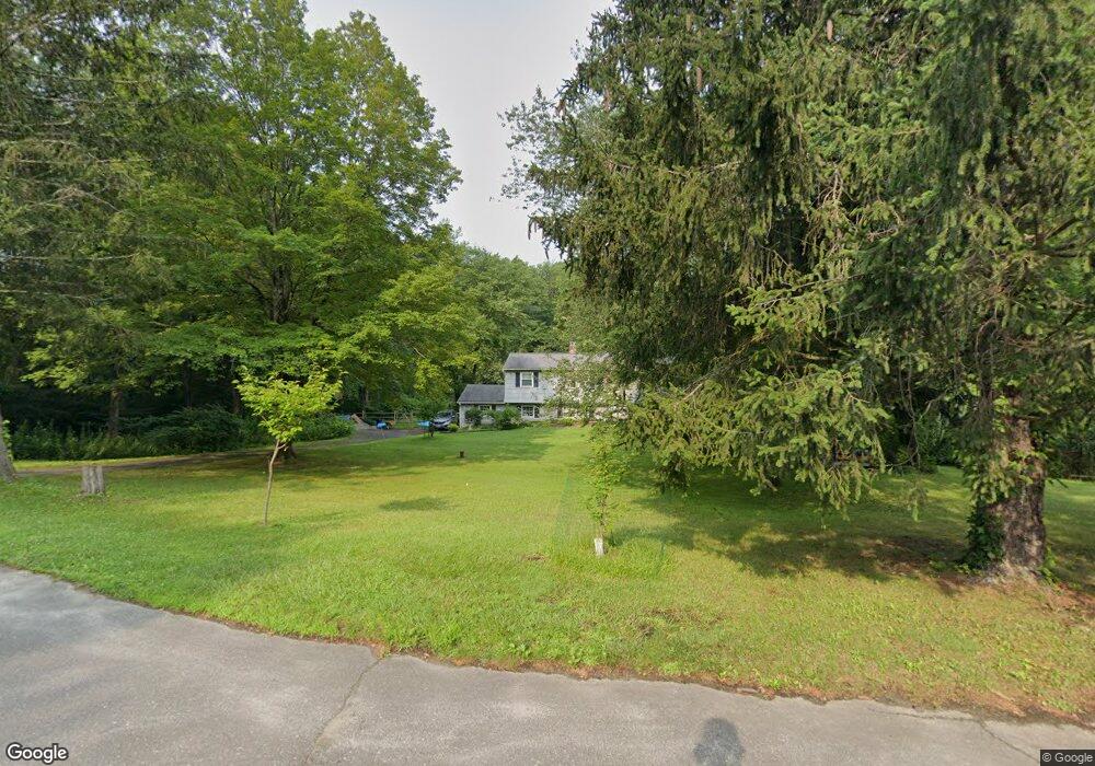
12 Buckboard Ridge Bethel, CT 06801
Estimated Value: $528,090 - $648,000
3
Beds
2
Baths
1,759
Sq Ft
$322/Sq Ft
Est. Value
About This Home
This home is located at 12 Buckboard Ridge, Bethel, CT 06801 and is currently estimated at $565,773, approximately $321 per square foot. 12 Buckboard Ridge is a home located in Fairfield County with nearby schools including R.M.T. Johnson School, Bethel Middle School, and Bethel High School.
Ownership History
Date
Name
Owned For
Owner Type
Purchase Details
Closed on
Mar 2, 2005
Sold by
Owens Logan
Bought by
Nuzzo Ralph and Nuzzo Suzanne
Current Estimated Value
Home Financials for this Owner
Home Financials are based on the most recent Mortgage that was taken out on this home.
Original Mortgage
$328,000
Interest Rate
4.87%
Purchase Details
Closed on
Sep 30, 1997
Sold by
Urban Paul and Urban Janis
Bought by
Owens Logan and Reidt Warren
Create a Home Valuation Report for This Property
The Home Valuation Report is an in-depth analysis detailing your home's value as well as a comparison with similar homes in the area
Home Values in the Area
Average Home Value in this Area
Purchase History
| Date | Buyer | Sale Price | Title Company |
|---|---|---|---|
| Nuzzo Ralph | $410,000 | -- | |
| Owens Logan | $210,500 | -- |
Source: Public Records
Mortgage History
| Date | Status | Borrower | Loan Amount |
|---|---|---|---|
| Open | Owens Logan | $255,000 | |
| Closed | Owens Logan | $50,000 | |
| Closed | Owens Logan | $328,000 | |
| Previous Owner | Owens Logan | $185,000 |
Source: Public Records
Tax History Compared to Growth
Tax History
| Year | Tax Paid | Tax Assessment Tax Assessment Total Assessment is a certain percentage of the fair market value that is determined by local assessors to be the total taxable value of land and additions on the property. | Land | Improvement |
|---|---|---|---|---|
| 2024 | $8,711 | $298,620 | $107,590 | $191,030 |
| 2023 | $8,490 | $298,620 | $107,590 | $191,030 |
| 2022 | $7,760 | $224,350 | $107,590 | $116,760 |
| 2021 | $7,686 | $224,350 | $107,590 | $116,760 |
| 2020 | $7,570 | $224,350 | $107,590 | $116,760 |
| 2019 | $7,496 | $224,350 | $107,590 | $116,760 |
| 2018 | $7,374 | $224,350 | $107,590 | $116,760 |
| 2017 | $7,361 | $223,860 | $106,820 | $117,040 |
| 2016 | $7,202 | $223,860 | $106,820 | $117,040 |
| 2015 | $7,204 | $223,860 | $106,820 | $117,040 |
| 2014 | $7,188 | $223,860 | $106,820 | $117,040 |
Source: Public Records
Map
Nearby Homes
- 14 Winthrop Rd
- 3A Wolfpits Rd
- 16 Ichabod Ln
- 74 Wolfpits Rd
- 2 Judd Ave
- 4 Highland Ave
- 4 Stone Dam Rd
- 62 Codfish Hill Rd
- 12 Waterhorse Brook Dr
- 10 Jennifers Way
- 6 Gretchen Ln
- 43 Katrina Cir
- 149 Chestnut Ridge Rd
- 11 Marywood Rd
- 48 & 50 Nashville Rd
- 45 Maple Avenue Extension
- 39 Main St Unit 2-2
- 32 Hickok Ave
- 12 Canaan Dr
- 38 Aunt Pattys Ln W
- 10 Buckboard Ridge
- 53 Putnam Park Rd
- 9 Buckboard Ridge
- 8 Buckboard Ridge
- 49A Putnam Park Rd
- 7 Buckboard Ridge
- 1 Carriage Dr
- 4 Wagon Rd
- 6 Wagon Rd
- 3 Carriage Dr
- 55 Putnam Park Rd
- 5 Buckboard Ridge
- 51 Putnam Park Rd
- 47 Putnam Park Rd
- 41 Putnam Park Rd
- 10 Wagon Rd
- 6 Buckboard Ridge
- 8 Wagon Rd
- 41A Putnam Park Rd
- 45 Putnam Park Rd