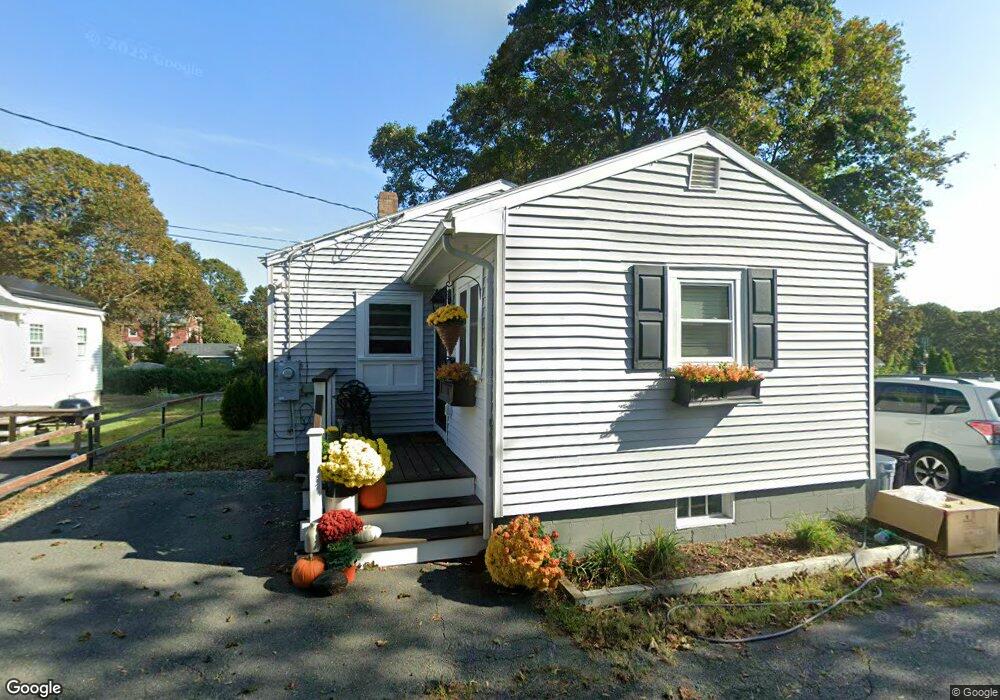
12 Collins Ave Gloucester, MA 01930
Riverview NeighborhoodEstimated Value: $432,000 - $650,000
3
Beds
1
Bath
837
Sq Ft
$650/Sq Ft
Est. Value
About This Home
This home is located at 12 Collins Ave, Gloucester, MA 01930 and is currently estimated at $543,926, approximately $649 per square foot. 12 Collins Ave is a home located in Essex County with nearby schools including Beeman Memorial, Ralph B O'maley Middle School, and Gloucester High School.
Ownership History
Date
Name
Owned For
Owner Type
Purchase Details
Closed on
Aug 15, 2018
Sold by
Rich Wayne I
Bought by
Laurie Heather M
Current Estimated Value
Home Financials for this Owner
Home Financials are based on the most recent Mortgage that was taken out on this home.
Original Mortgage
$270,325
Outstanding Balance
$233,462
Interest Rate
4.25%
Mortgage Type
New Conventional
Estimated Equity
$310,464
Create a Home Valuation Report for This Property
The Home Valuation Report is an in-depth analysis detailing your home's value as well as a comparison with similar homes in the area
Home Values in the Area
Average Home Value in this Area
Purchase History
| Date | Buyer | Sale Price | Title Company |
|---|---|---|---|
| Laurie Heather M | $302,500 | -- |
Source: Public Records
Mortgage History
| Date | Status | Borrower | Loan Amount |
|---|---|---|---|
| Open | Laurie Heather M | $270,325 |
Source: Public Records
Tax History
| Year | Tax Paid | Tax Assessment Tax Assessment Total Assessment is a certain percentage of the fair market value that is determined by local assessors to be the total taxable value of land and additions on the property. | Land | Improvement |
|---|---|---|---|---|
| 2025 | $4,408 | $453,500 | $206,800 | $246,700 |
| 2024 | $4,279 | $439,800 | $197,000 | $242,800 |
| 2023 | $4,279 | $404,100 | $175,900 | $228,200 |
| 2022 | $4,007 | $341,600 | $149,500 | $192,100 |
| 2021 | $4,007 | $322,100 | $135,900 | $186,200 |
| 2020 | $3,714 | $301,200 | $135,900 | $165,300 |
| 2019 | $3,641 | $286,900 | $135,900 | $151,000 |
| 2018 | $3,560 | $275,300 | $135,900 | $139,400 |
| 2017 | $3,535 | $268,000 | $129,500 | $138,500 |
| 2016 | $3,340 | $245,400 | $129,900 | $115,500 |
| 2015 | $3,301 | $241,800 | $129,900 | $111,900 |
Source: Public Records
Map
Nearby Homes
- 13 Honeysuckle Rd
- 3 Deacon Farm Ln
- 31 Echo Ave
- 2 Breezy Point Rd
- 13 Mystic Ave
- 672 Washington St
- 8 Mystic Ave
- 6 Monroe Ct
- 167 Atlantic St
- 98 Maplewood Ave
- 178 Atlantic St
- 9 Cleveland Place
- 12 Arthur St
- 40 Sargent St
- 226 Atlantic St
- 15 Harvard St
- 19 Trask St Unit 2
- 145 Essex Ave Unit 402
- 33 Maplewood Ave Unit 310
- 50 Warner St
Your Personal Tour Guide
Ask me questions while you tour the home.