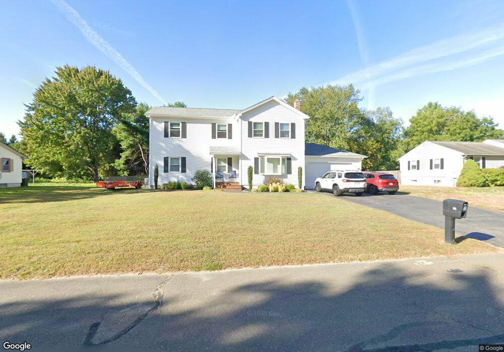
12 Concord Dr Easthampton, MA 01027
Estimated Value: $421,000 - $519,629
3
Beds
1
Bath
1,080
Sq Ft
$435/Sq Ft
Est. Value
About This Home
This home is located at 12 Concord Dr, Easthampton, MA 01027 and is currently estimated at $469,657, approximately $434 per square foot. 12 Concord Dr is a home located in Hampshire County with nearby schools including Easthampton High School, Hilltown Cooperative Charter Public School, and Calvary Baptist Christian School.
Ownership History
Date
Name
Owned For
Owner Type
Purchase Details
Closed on
Aug 8, 2017
Sold by
Travis Jean C
Bought by
Forrestall Jesse
Current Estimated Value
Purchase Details
Closed on
Jul 29, 2011
Sold by
Paquette Kathleen S
Bought by
Travis Jean C and Forrestall Jesse
Home Financials for this Owner
Home Financials are based on the most recent Mortgage that was taken out on this home.
Original Mortgage
$187,102
Interest Rate
4.75%
Mortgage Type
FHA
Purchase Details
Closed on
Dec 24, 2009
Sold by
Cowan Earl L and Cowan Irene A
Bought by
Cowan Earl L and Cowan Irene A
Purchase Details
Closed on
Oct 15, 1990
Sold by
Beaudry Edward A
Bought by
Cowan Earl L
Create a Home Valuation Report for This Property
The Home Valuation Report is an in-depth analysis detailing your home's value as well as a comparison with similar homes in the area
Home Values in the Area
Average Home Value in this Area
Purchase History
| Date | Buyer | Sale Price | Title Company |
|---|---|---|---|
| Forrestall Jesse | -- | -- | |
| Travis Jean C | $195,000 | -- | |
| Cowan Earl L | -- | -- | |
| Cowan Earl L | $118,000 | -- |
Source: Public Records
Mortgage History
| Date | Status | Borrower | Loan Amount |
|---|---|---|---|
| Previous Owner | Travis Jean C | $187,102 | |
| Previous Owner | Cowan Earl L | $50,000 |
Source: Public Records
Tax History
| Year | Tax Paid | Tax Assessment Tax Assessment Total Assessment is a certain percentage of the fair market value that is determined by local assessors to be the total taxable value of land and additions on the property. | Land | Improvement |
|---|---|---|---|---|
| 2025 | $6,083 | $445,000 | $120,400 | $324,600 |
| 2024 | $5,865 | $432,500 | $117,000 | $315,500 |
| 2023 | $3,386 | $231,100 | $91,800 | $139,300 |
| 2022 | $3,820 | $231,100 | $91,800 | $139,300 |
| 2021 | $4,180 | $238,300 | $91,800 | $146,500 |
| 2020 | $4,104 | $231,100 | $91,800 | $139,300 |
| 2019 | $4,564 | $222,500 | $91,800 | $130,700 |
| 2018 | $3,294 | $205,900 | $86,600 | $119,300 |
| 2017 | $3,216 | $198,400 | $83,400 | $115,000 |
| 2016 | $3,093 | $198,400 | $83,400 | $115,000 |
| 2015 | $3,006 | $198,400 | $83,400 | $115,000 |
Source: Public Records
Map
Nearby Homes
- 131 West St Unit 131
- M143 &152 Glendale St
- 385 Main St
- 98 Park Hill Rd
- 11 Dragon Cir
- 336 Main St
- 6 Wilton Rd
- 36 Torrey St
- 41 South St Unit 11
- 7 Union Ct
- 19 Nicols Way Unit 19
- 0 Glendale Rd
- 1 Ashley Cir
- Lot 3R Pomeroy Meadow Rd
- 18 Nicols Way Unit 18
- 6 S St & Abutting Lots
- 12 Golden Cir
- 33 Knipfer Ave
- 4 Gaugh St
- 38 College Hwy
- 14 Concord Dr
- 10 Concord Dr
- 41 Hannum Brook Dr
- 39 Hannum Brook Dr
- 43 Hannum Brook Dr
- 8 Concord Dr
- 9 Concord Dr
- 11 Concord Dr
- 16 Concord Dr
- 37 Hannum Brook Dr
- 7 Concord Dr
- 13 Concord Dr
- 45 Hannum Brook Dr
- 6 Concord Dr
- 42 Hannum Brook Dr
- 44 Hannum Brook Dr
- 35 Hannum Brook Dr
- 5 Concord Dr
- 40 Hannum Brook Dr
- 47 Hannum Brook Dr
Your Personal Tour Guide
Ask me questions while you tour the home.