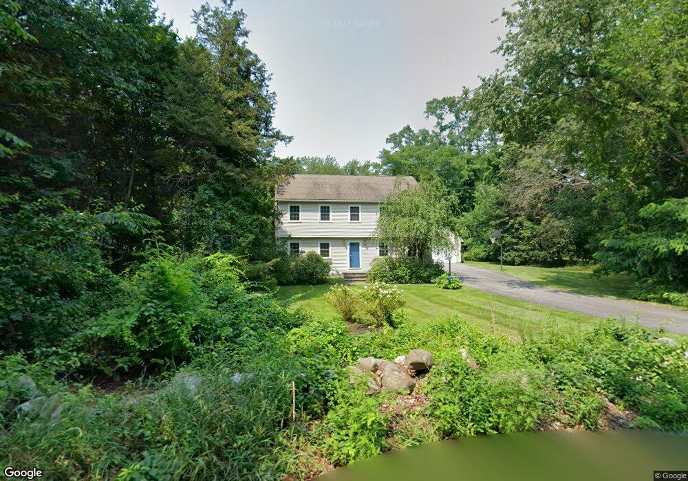
12 Crane Rd Littleton, MA 01460
Estimated Value: $655,000 - $820,000
4
Beds
2
Baths
1,964
Sq Ft
$388/Sq Ft
Est. Value
About This Home
This home is located at 12 Crane Rd, Littleton, MA 01460 and is currently estimated at $761,350, approximately $387 per square foot. 12 Crane Rd is a home located in Middlesex County with nearby schools including Shaker Lane Elementary School, Russell Street Elementary School, and Littleton Middle School.
Ownership History
Date
Name
Owned For
Owner Type
Purchase Details
Closed on
Oct 29, 2018
Sold by
Garbero Armando D and Garbero Petra V
Bought by
Garbero Petra V
Current Estimated Value
Purchase Details
Closed on
Mar 9, 1984
Bought by
Garbero Armando
Create a Home Valuation Report for This Property
The Home Valuation Report is an in-depth analysis detailing your home's value as well as a comparison with similar homes in the area
Purchase History
We collect this data history from publicly available records. To have your information removed, we recommend requesting removal directly through your county’s website.
| Date | Buyer | Sale Price | Title Company |
|---|---|---|---|
| Garbero Petra V | -- | -- | |
| Garbero Armando | -- | -- |
Source: Public Records
Mortgage History
We collect this data history from publicly available records. To have your information removed, we recommend requesting removal directly through your county’s website.
| Date | Status | Borrower | Loan Amount |
|---|---|---|---|
| Previous Owner | Garbero Armando | $66,000 | |
| Previous Owner | Garbero Armando | $128,000 |
Source: Public Records
Tax History
| Year | Tax Paid | Tax Assessment Tax Assessment Total Assessment is a certain percentage of the fair market value that is determined by local assessors to be the total taxable value of land and additions on the property. | Land | Improvement |
|---|---|---|---|---|
| 2025 | $99 | $668,200 | $248,400 | $419,800 |
| 2024 | $9,882 | $665,900 | $248,400 | $417,500 |
| 2023 | $9,441 | $581,000 | $228,800 | $352,200 |
| 2022 | $8,857 | $500,100 | $228,800 | $271,300 |
| 2021 | $8,280 | $467,800 | $220,100 | $247,700 |
| 2020 | $7,933 | $446,400 | $204,800 | $241,600 |
| 2019 | $7,717 | $423,100 | $178,700 | $244,400 |
| 2018 | $7,557 | $416,600 | $176,500 | $240,100 |
| 2017 | $7,561 | $416,600 | $176,500 | $240,100 |
| 2016 | $7,336 | $414,700 | $176,500 | $238,200 |
| 2015 | $7,108 | $392,700 | $152,600 | $240,100 |
Source: Public Records
Map
Nearby Homes
- 41 Leonard Rd Unit 41
- 52 Bulkeley Rd
- 221 Whitcomb Ave
- 303 Harwood Ave
- 140 Barteau Ln
- 146 Tahattawan Rd
- 368 Hill Rd
- 11 Taylor St
- 11-15 Taylor St
- 5 Kimball St
- 11 Lillian Rd
- 773 Massachusetts Ave Unit B9
- 773 Massachusetts Ave Unit C5
- 773 Massachusetts Ave Unit C9
- 85 Colonial Dr
- 31 Patricia Way Unit 31
- 6A Wampanoag Dr
- 58 Spencer Rd Unit 26K
- 15 Spencer Rd Unit 12E
- 1 Patricia Way Unit 1
Your Personal Tour Guide
Ask me questions while you tour the home.