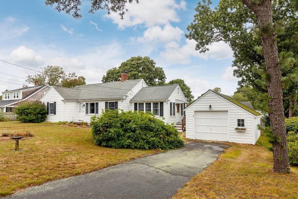
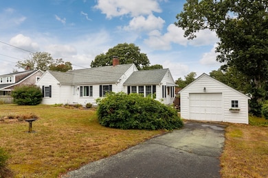
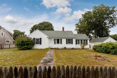
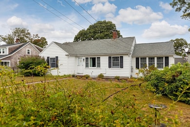
12 Cross St Dennis Port, MA 02639
Dennis Port NeighborhoodEstimated payment $3,342/month
Highlights
- Golf Course Community
- Property is near public transit
- 1 Fireplace
- Medical Services
- Ranch Style House
- No HOA
About This Home
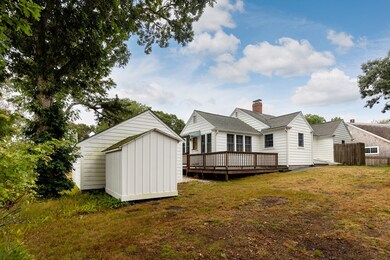
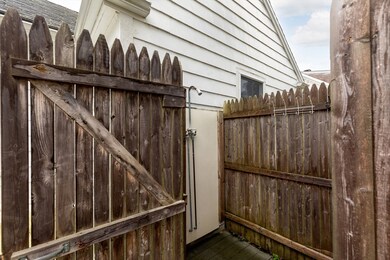
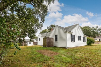
Exceptional opportunity in the heart of Dennis Port, just moments from Nantucket Sound beaches. 12 Cross Street offers a versatile layout with bright living areas, spacious bedrooms, a fireplace, and a four-season sunroom. Outdoor living is enhanced by a Trex deck and shower, perfect for summer entertaining. Ideal as a summer retreat, weekend getaway, or year-round residence, this home combines Cape Cod charm with strong rental potential. Its walk-to-beach location provides easy access to local dining and village amenities while low-maintenance finishes make ownership simple. Designed to maximize occupancy and enjoyment, it also features a brand-new 3-bedroom septic system installed in 2024. Whether you're expanding your investment portfolio or seeking a home that balances personal use with income opportunity, this property is a rare find in a prime location.
Home Details
Home Type
- Single Family
Est. Annual Taxes
- $2,341
Year Built
- Built in 1948
Lot Details
- 9,583 Sq Ft Lot
- Cleared Lot
Parking
- 1 Car Detached Garage
- Off-Street Parking
Home Design
- Manufactured Home on a slab
- Ranch Style House
- Frame Construction
- Shingle Roof
Interior Spaces
- 1,132 Sq Ft Home
- 1 Fireplace
Bedrooms and Bathrooms
- 2 Bedrooms
- 1 Full Bathroom
Location
- Property is near public transit
Utilities
- No Cooling
- Forced Air Heating System
- Heating System Uses Oil
- Electric Water Heater
- Private Sewer
Listing and Financial Details
- Assessor Parcel Number M:000075 P:032000,2273541
Community Details
Overview
- No Home Owners Association
Amenities
- Medical Services
- Shops
- Coin Laundry
Recreation
- Golf Course Community
- Jogging Path
Map
Home Values in the Area
Average Home Value in this Area
Tax History
| Year | Tax Paid | Tax Assessment Tax Assessment Total Assessment is a certain percentage of the fair market value that is determined by local assessors to be the total taxable value of land and additions on the property. | Land | Improvement |
|---|---|---|---|---|
| 2025 | $2,341 | $540,700 | $195,800 | $344,900 |
| 2024 | $2,210 | $503,500 | $188,300 | $315,200 |
| 2023 | $2,139 | $458,100 | $171,200 | $286,900 |
| 2022 | $2,050 | $366,000 | $154,200 | $211,800 |
| 2021 | $1,977 | $327,900 | $151,200 | $176,700 |
| 2020 | $1,831 | $300,200 | $139,600 | $160,600 |
| 2019 | $1,728 | $280,100 | $136,800 | $143,300 |
| 2018 | $24,104 | $270,300 | $141,100 | $129,200 |
| 2017 | $1,571 | $255,500 | $130,300 | $125,200 |
| 2016 | $1,565 | $239,600 | $135,700 | $103,900 |
| 2015 | $1,533 | $239,600 | $135,700 | $103,900 |
| 2014 | $1,368 | $215,400 | $119,400 | $96,000 |
Property History
| Date | Event | Price | List to Sale | Price per Sq Ft |
|---|---|---|---|---|
| 11/07/2025 11/07/25 | Pending | -- | -- | -- |
| 09/15/2025 09/15/25 | For Sale | $600,000 | 0.0% | $530 / Sq Ft |
| 08/31/2025 08/31/25 | Pending | -- | -- | -- |
| 08/28/2025 08/28/25 | For Sale | $600,000 | -- | $530 / Sq Ft |
Purchase History
| Date | Type | Sale Price | Title Company |
|---|---|---|---|
| Deed | $110,000 | -- |
Mortgage History
| Date | Status | Loan Amount | Loan Type |
|---|---|---|---|
| Closed | $74,900 | Purchase Money Mortgage |
Source: MLS Property Information Network (MLS PIN)
MLS Number: 73422879
APN: DENN-000075-000000-000032
Disclaimer: Certain information contained herein is derived from information provided by parties other than Homes.com. All information provided is deemed reliable, but is not guaranteed to be accurate and should be independently verified.
![]() The property listing data and information, or the Images, set forth herein were provided to MLS Property Information Network, Inc. from third party sources, including sellers, lessors and public records, and were compiled by MLS Property Information Network, Inc. The property listing data and information, and the Images, are for the personal, non-commercial use of consumers having a good faith interest in purchasing or leasing listed properties of the type displayed to them and may not be used for any purpose other than to identify prospective properties which such consumers may have a good faith interest in purchasing or leasing. MLS Property Information Network, Inc. and its subscribers disclaim any and all representations and warranties as to the accuracy of the property listing data and information, or as to the accuracy of any of the Images, set forth herein.
The property listing data and information, or the Images, set forth herein were provided to MLS Property Information Network, Inc. from third party sources, including sellers, lessors and public records, and were compiled by MLS Property Information Network, Inc. The property listing data and information, and the Images, are for the personal, non-commercial use of consumers having a good faith interest in purchasing or leasing listed properties of the type displayed to them and may not be used for any purpose other than to identify prospective properties which such consumers may have a good faith interest in purchasing or leasing. MLS Property Information Network, Inc. and its subscribers disclaim any and all representations and warranties as to the accuracy of the property listing data and information, or as to the accuracy of any of the Images, set forth herein.
- 104 Toms Path
- 104 Toms Path
- 10 Candlewood Ln Unit 2-1
- 12 Candlewood Ln Unit 2-9
- 12 Candlewood Ln Unit 1-6
- 73 Division St
- 47 Telegraph Rd Unit 1
- 102 Sea St
- 9 Country Ln
- 148 Belmont Rd
- 22 Ferncliff Rd
- 141 Division St
- 141 Division St
- 405 Old Wharf Rd Unit B204
- 405 Old Wharf Rd Unit B204
- 72 Bassett Ln
- 268 Main St
- 3 Fairbanks Dr
- 45 Route 28
- 1 Belmont Rd Unit 630
