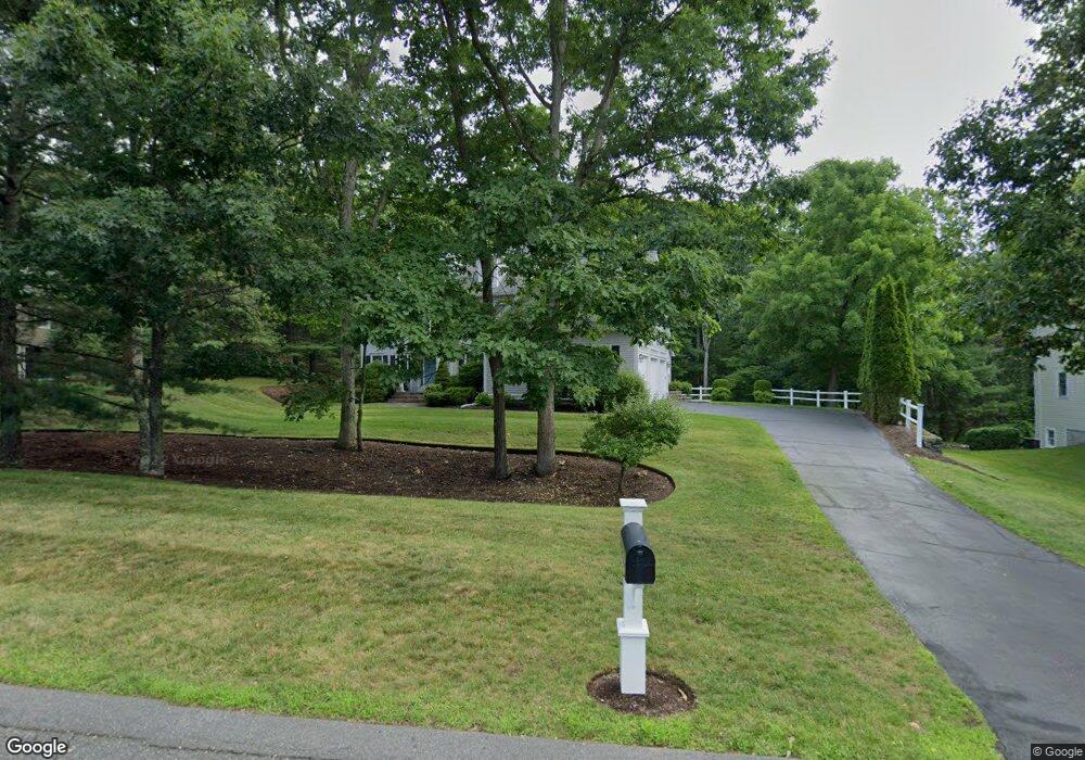
12 Deer Path Natick, MA 01760
Estimated Value: $1,787,000 - $1,950,000
4
Beds
5
Baths
4,084
Sq Ft
$457/Sq Ft
Est. Value
About This Home
This home is located at 12 Deer Path, Natick, MA 01760 and is currently estimated at $1,868,208, approximately $457 per square foot. 12 Deer Path is a home located in Middlesex County with nearby schools including Natick High School, Memorial Elementary School, and J F Kennedy Middle School.
Ownership History
Date
Name
Owned For
Owner Type
Purchase Details
Closed on
Oct 18, 2001
Sold by
Sanctuary Dev
Bought by
Dipalma Stephen J and Dipalma Nancy A
Current Estimated Value
Home Financials for this Owner
Home Financials are based on the most recent Mortgage that was taken out on this home.
Original Mortgage
$275,000
Outstanding Balance
$107,881
Interest Rate
6.92%
Mortgage Type
Purchase Money Mortgage
Estimated Equity
$1,760,327
Create a Home Valuation Report for This Property
The Home Valuation Report is an in-depth analysis detailing your home's value as well as a comparison with similar homes in the area
Home Values in the Area
Average Home Value in this Area
Purchase History
| Date | Buyer | Sale Price | Title Company |
|---|---|---|---|
| Dipalma Stephen J | $861,950 | -- |
Source: Public Records
Mortgage History
| Date | Status | Borrower | Loan Amount |
|---|---|---|---|
| Open | Dipalma Stephen J | $275,000 |
Source: Public Records
Tax History
| Year | Tax Paid | Tax Assessment Tax Assessment Total Assessment is a certain percentage of the fair market value that is determined by local assessors to be the total taxable value of land and additions on the property. | Land | Improvement |
|---|---|---|---|---|
| 2025 | $19,872 | $1,661,500 | $546,600 | $1,114,900 |
| 2024 | $19,143 | $1,561,400 | $517,700 | $1,043,700 |
| 2023 | $17,174 | $1,358,700 | $454,200 | $904,500 |
| 2022 | $16,827 | $1,261,400 | $408,900 | $852,500 |
| 2021 | $16,073 | $1,181,000 | $386,500 | $794,500 |
| 2020 | $15,845 | $1,164,200 | $369,700 | $794,500 |
| 2019 | $8,573 | $1,164,200 | $369,700 | $794,500 |
| 2018 | $15,186 | $1,163,700 | $352,900 | $810,800 |
| 2017 | $15,357 | $1,138,400 | $342,100 | $796,300 |
| 2016 | $15,345 | $1,130,800 | $342,100 | $788,700 |
| 2015 | $14,606 | $1,056,900 | $342,100 | $714,800 |
Source: Public Records
Map
Nearby Homes
- 81 Woodland St
- 14 Pinewood Ave
- 16 Wayside Rd Unit 14
- 216-218 S Main St
- 189 Eliot St
- 211 Eliot St
- 165 Woodland St
- 6 Hopewell Farm Rd
- 11 Avon St
- 8 Floral Ave Unit 8
- 11 Morgan Dr Unit 404
- 12 Floral Ave
- 7 Allison Way Unit 7
- 8 Floral Avenue Extension
- 6 Floral Avenue Extension
- 104 Eliot St
- 62 Oakland St
- 6A Lincoln St Unit 6A
- 5 Wilson St Unit 5A
- 4B Lincoln St Unit 4B
- 10 Deer Path
- 14 Deer Path
- 9 Deer Path
- 8 Deer Path
- 5 Morningside Ave
- Lot 28C Deer Path
- 7 Morningside Ave
- 5 Harvest Moon Dr
- 3 Morningside Ave
- 16 Deer Path
- 0 Harvest Moon Dr Unit Lot 27A 70786570
- 6 Deer Path
- 7 Deer Path
- 9 Morningside Ave
- 15 Deer Path Unit Lot 28A
- 15 Deer Path Unit 28A
- 15 Deer Path
- 4 Harvest Moon Dr
- 8 Morningside Ave
- 27 Harvest Moon Dr
Your Personal Tour Guide
Ask me questions while you tour the home.