Estimated Value: $547,000 - $635,000
3
Beds
3
Baths
1,356
Sq Ft
$427/Sq Ft
Est. Value
About This Home
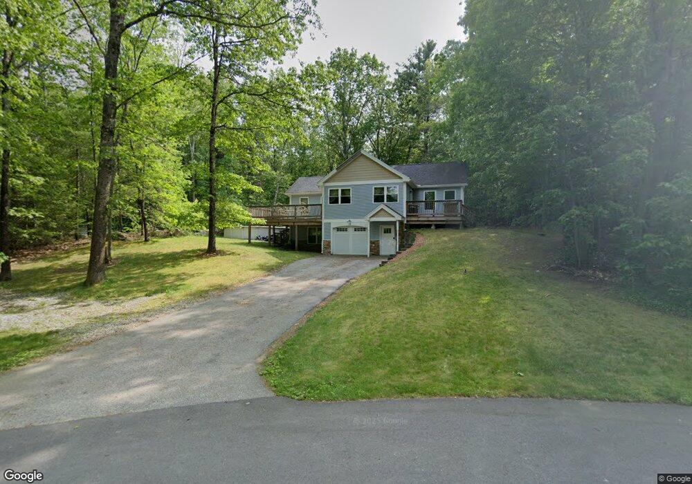
This home is located at 12 Eastman Dr, Derry, NH 03038 and is currently estimated at $578,777, approximately $426 per square foot. 12 Eastman Dr is a home located in Rockingham County with nearby schools including East Derry Memorial Elementary School, West Running Brook Middle School, and Pinkerton Academy.
Ownership History
Date
Name
Owned For
Owner Type
Purchase Details
Closed on
Nov 4, 2005
Sold by
Hooley Francis X and Hooley Deborah A
Bought by
Salvucci Mark and Salvucci Jennifer
Current Estimated Value
Home Financials for this Owner
Home Financials are based on the most recent Mortgage that was taken out on this home.
Original Mortgage
$232,000
Interest Rate
5.85%
Purchase Details
Closed on
Oct 24, 2003
Sold by
Nagri Richard J and Nagri Linda M
Bought by
Hooley Francis X and Hooley Deborah A
Home Financials for this Owner
Home Financials are based on the most recent Mortgage that was taken out on this home.
Original Mortgage
$275,000
Interest Rate
6.15%
Create a Home Valuation Report for This Property
The Home Valuation Report is an in-depth analysis detailing your home's value as well as a comparison with similar homes in the area
Home Values in the Area
Average Home Value in this Area
Purchase History
| Date | Buyer | Sale Price | Title Company |
|---|---|---|---|
| Salvucci Mark | $282,000 | -- | |
| Hooley Francis X | $289,500 | -- |
Source: Public Records
Mortgage History
| Date | Status | Borrower | Loan Amount |
|---|---|---|---|
| Open | Hooley Francis X | $61,679 | |
| Open | Hooley Francis X | $246,489 | |
| Closed | Hooley Francis X | $10,000 | |
| Closed | Salvucci Mark | $232,000 | |
| Previous Owner | Hooley Francis X | $275,000 |
Source: Public Records
Tax History Compared to Growth
Tax History
| Year | Tax Paid | Tax Assessment Tax Assessment Total Assessment is a certain percentage of the fair market value that is determined by local assessors to be the total taxable value of land and additions on the property. | Land | Improvement |
|---|---|---|---|---|
| 2024 | $9,162 | $490,200 | $201,600 | $288,600 |
| 2023 | $9,457 | $457,300 | $171,300 | $286,000 |
| 2022 | $8,707 | $457,300 | $171,300 | $286,000 |
| 2021 | $7,666 | $309,600 | $131,200 | $178,400 |
| 2020 | $7,536 | $309,600 | $131,200 | $178,400 |
| 2019 | $7,382 | $282,600 | $101,600 | $181,000 |
| 2018 | $7,356 | $282,600 | $101,600 | $181,000 |
| 2017 | $7,524 | $260,700 | $94,600 | $166,100 |
| 2016 | $7,055 | $260,700 | $94,600 | $166,100 |
| 2015 | $7,267 | $248,600 | $94,600 | $154,000 |
| 2014 | $7,314 | $248,600 | $94,600 | $154,000 |
| 2013 | $7,183 | $228,100 | $84,600 | $143,500 |
Source: Public Records
Map
Nearby Homes
- 5 Sheldon Rd
- 4 Sheldon Rd
- 20 Richardson Dr Unit R
- 294.5 Hampstead Rd
- 45 Damren Rd
- 7 Desforge Ln Unit R
- 1 Cameron Ct Unit 1
- 73 Drew Rd
- 37 Houstons Way
- 4 Colony Brook Ln
- 648 Haverhill Rd
- 2 Remington Ct
- 18 Lorri Rd
- 12 Halls Village Rd
- 50 Page Ln
- 3 Anna Cir
- 156 Little Mill Rd Unit A
- 31 N Shore Rd
- 8 Ians Path
- 0 Jack Rd