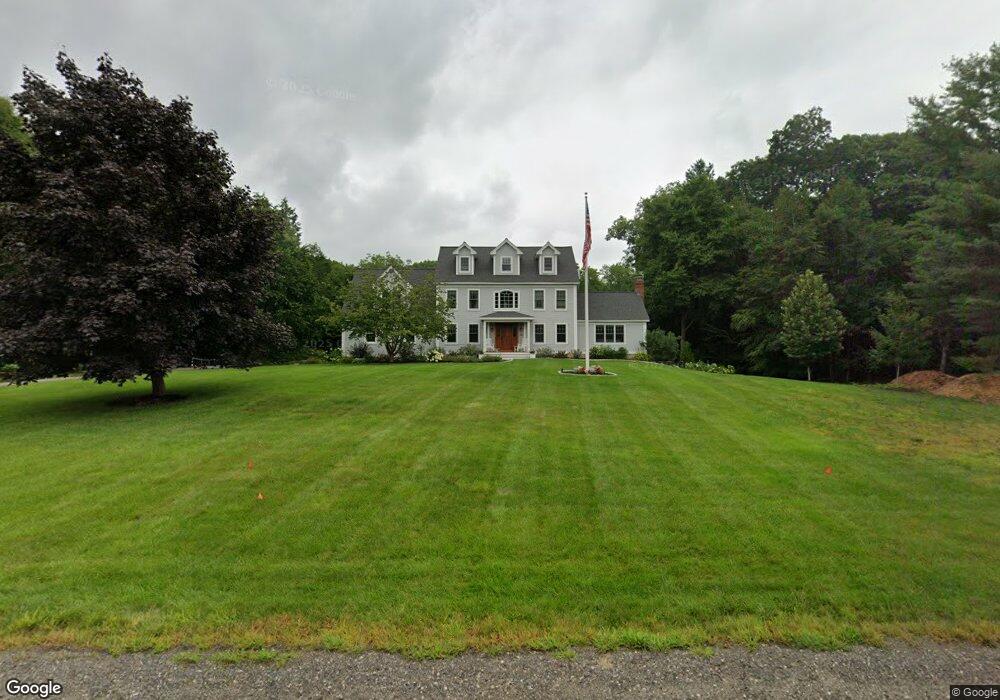
12 Gifford Farm Rd Stratham, NH 03885
Estimated Value: $1,170,000 - $1,535,000
4
Beds
4
Baths
4,686
Sq Ft
$304/Sq Ft
Est. Value
About This Home
This home is located at 12 Gifford Farm Rd, Stratham, NH 03885 and is currently estimated at $1,426,365, approximately $304 per square foot. 12 Gifford Farm Rd is a home located in Rockingham County with nearby schools including Stratham Memorial School, Cooperative Middle School, and Exeter High School.
Ownership History
Date
Name
Owned For
Owner Type
Purchase Details
Closed on
Nov 30, 2020
Sold by
Obrien Eric and Obrien Amanda
Bought by
Jennifer L Guyton Ret and Guyton
Current Estimated Value
Home Financials for this Owner
Home Financials are based on the most recent Mortgage that was taken out on this home.
Original Mortgage
$1,200,000
Outstanding Balance
$1,070,263
Interest Rate
2.8%
Mortgage Type
New Conventional
Estimated Equity
$356,102
Purchase Details
Closed on
Jul 28, 2009
Sold by
Bolduc
Bought by
Obrien Eric and Obrien Amanda
Purchase Details
Closed on
Aug 11, 1998
Sold by
Develco Of Stratham In
Bought by
Bresson Michael K and Bresson Colleen Y
Create a Home Valuation Report for This Property
The Home Valuation Report is an in-depth analysis detailing your home's value as well as a comparison with similar homes in the area
Home Values in the Area
Average Home Value in this Area
Purchase History
| Date | Buyer | Sale Price | Title Company |
|---|---|---|---|
| Jennifer L Guyton Ret | $750,000 | None Available | |
| Obrien Eric | $540,000 | -- | |
| Bresson Michael K | $339,900 | -- |
Source: Public Records
Mortgage History
| Date | Status | Borrower | Loan Amount |
|---|---|---|---|
| Open | Jennifer L Guyton Ret | $1,200,000 | |
| Previous Owner | Bresson Michael K | $100,000 | |
| Previous Owner | Bresson Michael K | $403,000 | |
| Previous Owner | Bresson Michael K | $417,000 |
Source: Public Records
Tax History Compared to Growth
Tax History
| Year | Tax Paid | Tax Assessment Tax Assessment Total Assessment is a certain percentage of the fair market value that is determined by local assessors to be the total taxable value of land and additions on the property. | Land | Improvement |
|---|---|---|---|---|
| 2024 | $16,229 | $1,237,000 | $427,400 | $809,600 |
| 2023 | $16,184 | $774,000 | $237,700 | $536,300 |
| 2022 | $14,482 | $774,000 | $237,700 | $536,300 |
| 2021 | $14,334 | $774,000 | $237,700 | $536,300 |
| 2020 | $14,667 | $774,000 | $237,700 | $536,300 |
| 2019 | $6,840 | $774,000 | $237,700 | $536,300 |
| 2018 | $13,631 | $649,100 | $179,200 | $469,900 |
| 2017 | $13,177 | $649,100 | $179,200 | $469,900 |
| 2016 | $2,122 | $649,100 | $179,200 | $469,900 |
| 2015 | $12,917 | $649,100 | $179,200 | $469,900 |
| 2014 | $12,798 | $642,800 | $179,200 | $463,600 |
| 2013 | $12,692 | $645,900 | $179,200 | $466,700 |
Source: Public Records
Map
Nearby Homes
- 00 Lovell Rd Unit 22
- 14 Balmoral Dr
- 44 High St
- 00 Scamman Rd
- 13 Dearborn Rd
- 18 Treat Farm Rd
- Unit 26 Summerwind Place Unit 26
- 24 Great Bay Rd
- 141 Dearborn Rd
- 177 Winnicutt Rd
- 227 Portsmouth Ave
- 217 Portsmouth Ave
- 39 Glengarry Dr
- 64 Boxwood Path Unit 64
- 12 Founders Square Unit A
- 40 Stratham Green
- 34 Kinloch Dr
- 4 Kildary Dr
- 638 Post Rd
- 54 Brookside Dr
- 12 Gifford Farm Rd
- 10 Gifford Farm Rd
- 14 Gifford Farm Rd
- 9 Gifford Farm Rd
- 13 Gifford Farm Rd
- 16 Gifford Farm Rd
- 15 Gifford Farm Rd
- 12 Long Hill Rd
- 8R Gifford Farm Rd
- 8 Gifford Farm Rd
- 7 Gifford Farm Rd
- 18 Gifford Farm Rd
- 17 Gifford Farm Rd
- 10 Long Hill Rd
- 19 Gifford Farm Rd
- 3 Gifford Farm Rd
- 11 Long Hill Rd
- 6 Gifford Farm Rd
- 19 Aberdeen Dr
- 21 Gifford Farm Rd