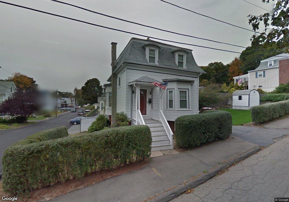
12 Grove St Saugus, MA 01906
Cliftondale NeighborhoodEstimated Value: $543,000 - $4,344,385
2
Beds
2
Baths
1,215
Sq Ft
$1,243/Sq Ft
Est. Value
About This Home
This home is located at 12 Grove St, Saugus, MA 01906 and is currently estimated at $1,510,096, approximately $1,242 per square foot. 12 Grove St is a home located in Essex County with nearby schools including Saugus High School and Pioneer Charter School Of Science II.
Create a Home Valuation Report for This Property
The Home Valuation Report is an in-depth analysis detailing your home's value as well as a comparison with similar homes in the area
Home Values in the Area
Average Home Value in this Area
Tax History
| Year | Tax Paid | Tax Assessment Tax Assessment Total Assessment is a certain percentage of the fair market value that is determined by local assessors to be the total taxable value of land and additions on the property. | Land | Improvement |
|---|---|---|---|---|
| 2025 | $5,378 | $503,600 | $294,200 | $209,400 |
| 2024 | $5,143 | $482,900 | $277,400 | $205,500 |
| 2023 | $4,986 | $442,800 | $243,800 | $199,000 |
| 2022 | $4,791 | $398,900 | $223,600 | $175,300 |
| 2021 | $4,408 | $357,200 | $194,200 | $163,000 |
| 2020 | $4,069 | $341,400 | $184,900 | $156,500 |
| 2019 | $3,954 | $324,600 | $168,100 | $156,500 |
| 2018 | $3,605 | $311,300 | $163,100 | $148,200 |
| 2017 | $3,368 | $279,500 | $152,100 | $127,400 |
| 2016 | $2,938 | $240,800 | $150,200 | $90,600 |
| 2015 | $2,757 | $229,400 | $143,100 | $86,300 |
| 2014 | $2,786 | $240,000 | $143,100 | $96,900 |
Source: Public Records
Map
Nearby Homes
- 20 Maple St
- 141 Essex St Unit D6
- 141 Essex St Unit B4
- 32-34 Mount Vernon St
- 31 Mountain Ave
- 4 Foss Ave
- 2 Ashford St
- 7 Adams Ave
- 6 Saugus Ave Unit A
- 57 Vine St
- 133 Salem St Unit 414
- 25 Auburn St
- 36 Jasper St
- 62 Main St
- 28 Naples Ave
- 25 Piedmont Ave
- 12B Cheever Ave
- 12C Cheever Ave
- 36 Central Ave
- 65 Central Ave
Your Personal Tour Guide
Ask me questions while you tour the home.