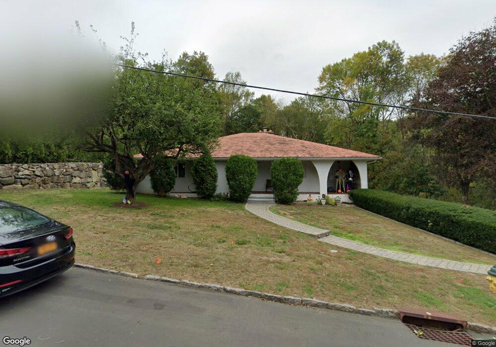
12 Highridge Rd West Harrison, NY 10604
West Harrison NeighborhoodEstimated Value: $1,099,014 - $1,420,000
Studio
--
Bath
2,428
Sq Ft
$513/Sq Ft
Est. Value
About This Home
This home is located at 12 Highridge Rd, West Harrison, NY 10604 and is currently estimated at $1,246,504, approximately $513 per square foot. 12 Highridge Rd is a home located in Westchester County with nearby schools including Samuel J. Preston Elementary School, Louis M. Klein Middle School, and Harrison High School.
Ownership History
Date
Name
Owned For
Owner Type
Purchase Details
Closed on
Nov 17, 2017
Sold by
Deteo Nancy P and Nancy P Deleo Revocable Living
Bought by
Moloney Paul C and Moloney Elizabeth
Current Estimated Value
Home Financials for this Owner
Home Financials are based on the most recent Mortgage that was taken out on this home.
Original Mortgage
$430,000
Interest Rate
3.91%
Mortgage Type
New Conventional
Purchase Details
Closed on
May 5, 2010
Sold by
Deleo Nancy P
Bought by
Deleo Nancy P
Create a Home Valuation Report for This Property
The Home Valuation Report is an in-depth analysis detailing your home's value as well as a comparison with similar homes in the area
Home Values in the Area
Average Home Value in this Area
Purchase History
| Date | Buyer | Sale Price | Title Company |
|---|---|---|---|
| Moloney Paul C | $730,000 | Judicial Title Ins | |
| Deleo Nancy P | -- | The Judicial Title Insurance | |
| Deleo Nancy P | -- | The Judicial Title Insurance |
Source: Public Records
Mortgage History
| Date | Status | Borrower | Loan Amount |
|---|---|---|---|
| Closed | Moloney Paul C | $430,000 |
Source: Public Records
Tax History
| Year | Tax Paid | Tax Assessment Tax Assessment Total Assessment is a certain percentage of the fair market value that is determined by local assessors to be the total taxable value of land and additions on the property. | Land | Improvement |
|---|---|---|---|---|
| 2024 | $18,687 | $11,250 | $510 | $10,740 |
| 2023 | $19,850 | $11,250 | $510 | $10,740 |
| 2022 | $17,598 | $11,250 | $510 | $10,740 |
| 2021 | $17,259 | $11,250 | $510 | $10,740 |
| 2020 | $18,563 | $11,250 | $510 | $10,740 |
| 2019 | $17,766 | $11,250 | $510 | $10,740 |
| 2018 | $5,843 | $11,250 | $510 | $10,740 |
| 2017 | $0 | $13,000 | $510 | $12,490 |
| 2016 | $18,558 | $13,000 | $510 | $12,490 |
| 2015 | -- | $13,000 | $510 | $12,490 |
| 2014 | -- | $13,000 | $510 | $12,490 |
| 2013 | -- | $13,000 | $510 | $12,490 |
Source: Public Records
Map
Nearby Homes
- 40 Brae Burn Dr
- 5 Augusta Ct
- 65 Buckout Rd
- 21 Brae Burn Dr
- 144 Old Lake St
- 18 Stone Bridge Rd
- 27 Woodside Ave
- 0 Barnes Ln Unit KEY881504
- 15 Stone Bridge Rd
- 14 Stone Bridge Rd
- 12 Crestview Dr
- 196 Underhill Ave Unit 2A
- 165 Columbus Ave Unit 2A
- 1 Cedar Ln
- 78 Woodcrest Ave
- 96 White Plains Ave
- 6 Century Ridge Rd
- 126 Underhill Ave Unit 1A
- 96 Underhill Ave Unit 2B
- 107 Underhill Ave
- 10 Highridge Rd
- 15 Highridge Rd
- 1 Pinehurst Dr
- 8 Highridge Rd
- 7 Highridge Rd
- 17 Highridge Rd
- 6 Highridge Rd
- 3 Pinehurst Dr
- 16 Rocky Ridge Rd
- 19 Highridge Rd
- 17 Rocky Ridge Rd
- 2 Pinehurst Dr
- 14 Rocky Ridge Rd
- 20 Highridge Rd
- 497 Lake St
- 5 Pinehurst Dr
- 21 Highridge Rd
- 15 Rocky Ridge Rd
- 2 Highridge Rd
- 12 Rocky Ridge Rd
Your Personal Tour Guide
Ask me questions while you tour the home.