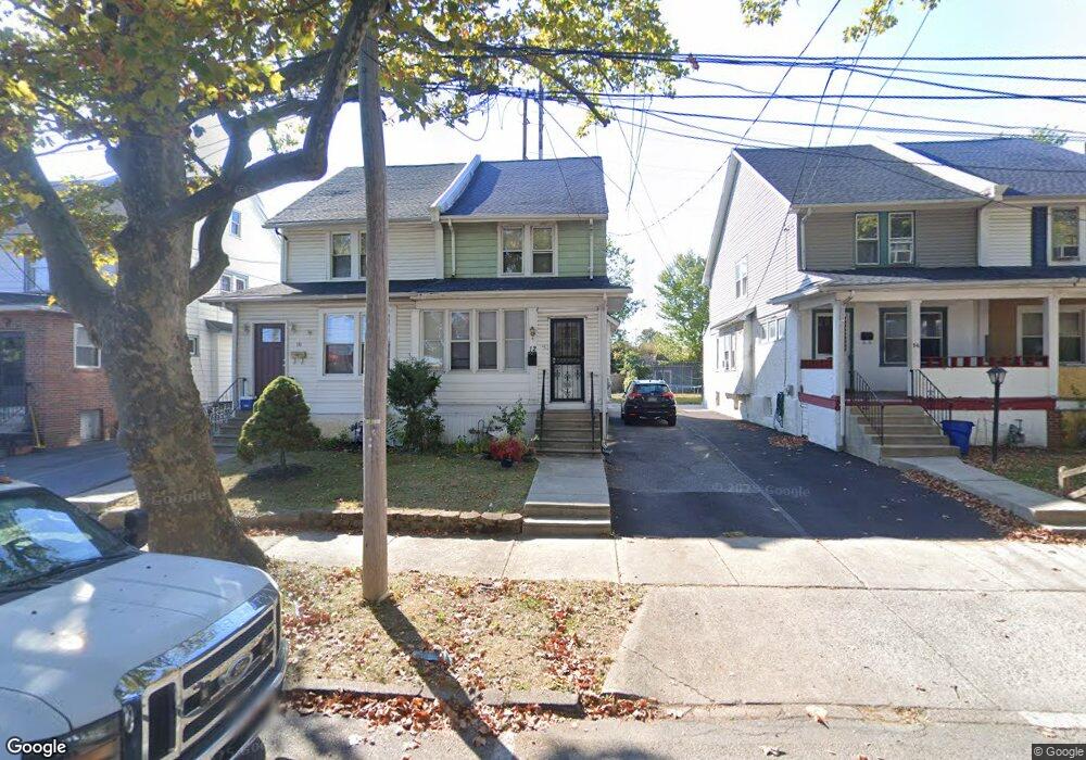
12 Hirst Ave Lansdowne, PA 19050
Estimated Value: $173,000 - $271,000
3
Beds
1
Bath
1,539
Sq Ft
$149/Sq Ft
Est. Value
About This Home
This home is located at 12 Hirst Ave, Lansdowne, PA 19050 and is currently estimated at $228,645, approximately $148 per square foot. 12 Hirst Ave is a home located in Delaware County with nearby schools including East Lansdowne Elementary School, Penn Wood Middle School, and Penn Wood High School - Cypress Street Campus.
Ownership History
Date
Name
Owned For
Owner Type
Purchase Details
Closed on
Mar 31, 2004
Sold by
Byrne Richard and Byrne Loretta
Bought by
Durand Evelyne
Current Estimated Value
Home Financials for this Owner
Home Financials are based on the most recent Mortgage that was taken out on this home.
Original Mortgage
$76,000
Outstanding Balance
$35,515
Interest Rate
5.56%
Mortgage Type
Fannie Mae Freddie Mac
Estimated Equity
$193,130
Purchase Details
Closed on
Jul 17, 1998
Sold by
Mahoney John and Estate Of Elizabeth T Hammond
Bought by
Byrne Richard and Byrne Loretta
Home Financials for this Owner
Home Financials are based on the most recent Mortgage that was taken out on this home.
Original Mortgage
$34,575
Interest Rate
6.99%
Create a Home Valuation Report for This Property
The Home Valuation Report is an in-depth analysis detailing your home's value as well as a comparison with similar homes in the area
Home Values in the Area
Average Home Value in this Area
Purchase History
| Date | Buyer | Sale Price | Title Company |
|---|---|---|---|
| Durand Evelyne | $80,000 | -- | |
| Byrne Richard | $24,500 | -- |
Source: Public Records
Mortgage History
| Date | Status | Borrower | Loan Amount |
|---|---|---|---|
| Open | Durand Evelyne | $76,000 | |
| Previous Owner | Byrne Richard | $34,575 |
Source: Public Records
Tax History Compared to Growth
Tax History
| Year | Tax Paid | Tax Assessment Tax Assessment Total Assessment is a certain percentage of the fair market value that is determined by local assessors to be the total taxable value of land and additions on the property. | Land | Improvement |
|---|---|---|---|---|
| 2025 | $5,099 | $119,340 | $45,710 | $73,630 |
| 2024 | $5,099 | $119,340 | $45,710 | $73,630 |
| 2023 | $3,813 | $119,340 | $45,710 | $73,630 |
| 2022 | $4,599 | $119,340 | $45,710 | $73,630 |
| 2021 | $6,857 | $119,340 | $45,710 | $73,630 |
| 2020 | $4,215 | $64,000 | $19,770 | $44,230 |
| 2019 | $4,145 | $64,000 | $19,770 | $44,230 |
| 2018 | $4,090 | $64,000 | $0 | $0 |
| 2017 | $3,881 | $64,000 | $0 | $0 |
| 2016 | $351 | $64,000 | $0 | $0 |
| 2015 | $351 | $64,000 | $0 | $0 |
| 2014 | $351 | $64,000 | $0 | $0 |
Source: Public Records
Map
Nearby Homes
- 608 Pembroke Ave
- 230 Wynnewood Ave
- 603 Penn St
- 226 E Greenwood Ave
- 32 N Wycombe Ave
- 209 E Greenwood Ave
- 75 E Stewart Ave
- 192 Fairview Ave
- 408 S Union Ave
- 319 E Essex Ave
- 317 E Essex Ave
- 315 E Essex Ave
- 37 E Stratford Ave
- 407 Church Ln
- 435 Bonsall Ave
- 178 N Union Ave
- 503 Bonsall Ave
- 49 Elberon Ave
- 144 Fairview Ave
- 103 Lincoln Ave