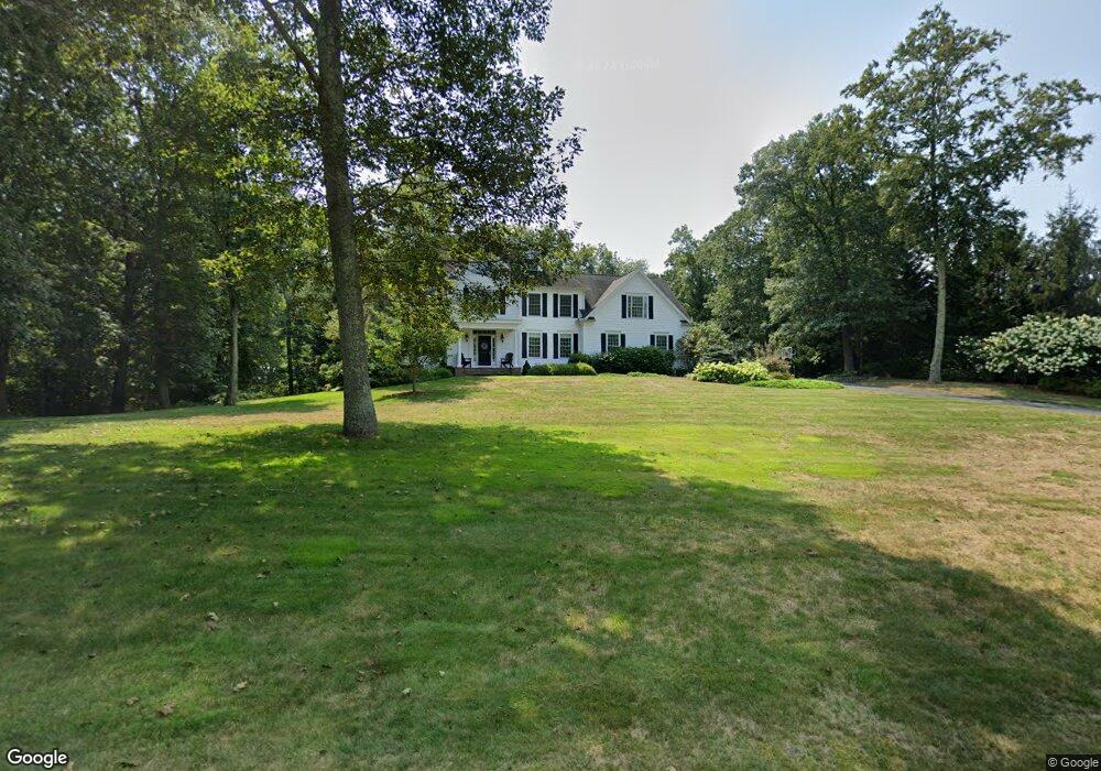
12 Houperts Way Clinton, CT 06413
Estimated Value: $789,492 - $980,000
4
Beds
3
Baths
3,607
Sq Ft
$248/Sq Ft
Est. Value
About This Home
This home is located at 12 Houperts Way, Clinton, CT 06413 and is currently estimated at $894,123, approximately $247 per square foot. 12 Houperts Way is a home located in Middlesex County with nearby schools including Lewin G. Joel Jr. School and The Morgan School.
Ownership History
Date
Name
Owned For
Owner Type
Purchase Details
Closed on
Jun 6, 2025
Sold by
Zoner Michael A
Bought by
Zoner Jerrette C
Current Estimated Value
Purchase Details
Closed on
Sep 3, 2004
Sold by
Waterside Bldg Dev Llc
Bought by
Zoner Michael N and Zoner Jerrette C
Create a Home Valuation Report for This Property
The Home Valuation Report is an in-depth analysis detailing your home's value as well as a comparison with similar homes in the area
Home Values in the Area
Average Home Value in this Area
Purchase History
| Date | Buyer | Sale Price | Title Company |
|---|---|---|---|
| Zoner Jerrette C | -- | None Available | |
| Zoner Jerrette C | -- | None Available | |
| Zoner Michael N | $575,000 | -- | |
| Zoner Michael N | $575,000 | -- |
Source: Public Records
Mortgage History
| Date | Status | Borrower | Loan Amount |
|---|---|---|---|
| Previous Owner | Zoner Michael N | $500,000 |
Source: Public Records
Tax History Compared to Growth
Tax History
| Year | Tax Paid | Tax Assessment Tax Assessment Total Assessment is a certain percentage of the fair market value that is determined by local assessors to be the total taxable value of land and additions on the property. | Land | Improvement |
|---|---|---|---|---|
| 2025 | $12,683 | $407,300 | $71,800 | $335,500 |
| 2024 | $12,325 | $407,300 | $71,800 | $335,500 |
| 2023 | $12,150 | $407,300 | $71,800 | $335,500 |
| 2022 | $12,150 | $407,300 | $71,800 | $335,500 |
| 2021 | $11,843 | $397,000 | $78,600 | $318,400 |
| 2020 | $12,406 | $397,000 | $78,600 | $318,400 |
| 2019 | $12,406 | $397,000 | $78,600 | $318,400 |
| 2018 | $12,124 | $397,000 | $78,600 | $318,400 |
| 2017 | $11,874 | $397,000 | $78,600 | $318,400 |
| 2016 | $10,775 | $397,000 | $78,600 | $318,400 |
| 2015 | $10,451 | $390,400 | $82,000 | $308,400 |
| 2014 | $10,256 | $390,400 | $82,000 | $308,400 |
Source: Public Records
Map
Nearby Homes
- 1 Houperts Way
- 17 Valley Rd
- 4 Laconia Dr
- 19 Ironworks Rd
- 48A Ironworks Rd
- 22 Lincoln Rd
- 79 Fairy Dell Rd
- 0 Fairy Dell Rd
- 106 Glenwood Rd
- 39 Willow Ct
- 0 Kelseytown Bridge Rd
- 37 Nolin Rd
- 4 Laurel Ln
- 25 Kelseytown Bridge Rd
- 43 Evergreen Park
- 180 Malabar Dr
- 113 Winthrop Rd
- 29 Brush Hill Rd
- 109 Old Post Rd
- 448 A - B Grove Beach Rd N
- 10 Houperts Way
- 14 Houperts Way
- 74 Carter Hill Rd
- 6 Houperts Way
- 16 Houperts Way
- 17 Houperts Way
- 21 Houperts Way
- 72 Carter Hill Rd
- 15 Houperts Way
- 4 Houperts Way
- 76 Carter Hill Rd
- 9 Houperts Way
- 60 Carter Hill Rd
- 62 Carter Hill Rd
- 64 Carter Hill Rd
- 2 Houperts Way
- 5 Houperts Way
- 66 Carter Hill Rd
- 13 Houperts Way
- 70 Carter Hill Rd