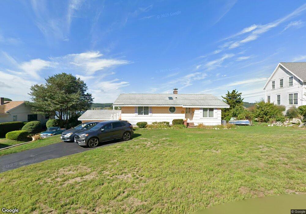
12 Juniper Rd Gloucester, MA 01930
Riverview NeighborhoodEstimated Value: $734,000 - $1,426,000
2
Beds
2
Baths
1,136
Sq Ft
$1,040/Sq Ft
Est. Value
About This Home
This home is located at 12 Juniper Rd, Gloucester, MA 01930 and is currently estimated at $1,181,946, approximately $1,040 per square foot. 12 Juniper Rd is a home located in Essex County with nearby schools including Beeman Memorial, Ralph B O'maley Middle School, and Gloucester High School.
Ownership History
Date
Name
Owned For
Owner Type
Purchase Details
Closed on
Oct 19, 2011
Sold by
Giamatteo William B and Giammatteo Saleen M
Bought by
Giammatteo William B
Current Estimated Value
Home Financials for this Owner
Home Financials are based on the most recent Mortgage that was taken out on this home.
Original Mortgage
$246,000
Outstanding Balance
$158,638
Interest Rate
3%
Estimated Equity
$1,023,308
Purchase Details
Closed on
Aug 27, 1999
Sold by
Cividal Bruno E Est
Bought by
Giammateo William B and Giammeteo Saleen M
Home Financials for this Owner
Home Financials are based on the most recent Mortgage that was taken out on this home.
Original Mortgage
$297,500
Interest Rate
7.53%
Mortgage Type
Purchase Money Mortgage
Create a Home Valuation Report for This Property
The Home Valuation Report is an in-depth analysis detailing your home's value as well as a comparison with similar homes in the area
Home Values in the Area
Average Home Value in this Area
Purchase History
| Date | Buyer | Sale Price | Title Company |
|---|---|---|---|
| Giammatteo William B | -- | -- | |
| Giammateo William B | $425,000 | -- |
Source: Public Records
Mortgage History
| Date | Status | Borrower | Loan Amount |
|---|---|---|---|
| Open | Giammateo William B | $246,000 | |
| Previous Owner | Giammateo William B | $297,500 |
Source: Public Records
Tax History
| Year | Tax Paid | Tax Assessment Tax Assessment Total Assessment is a certain percentage of the fair market value that is determined by local assessors to be the total taxable value of land and additions on the property. | Land | Improvement |
|---|---|---|---|---|
| 2025 | $12,437 | $1,279,500 | $903,900 | $375,600 |
| 2024 | $11,974 | $1,230,600 | $860,800 | $369,800 |
| 2023 | $11,468 | $1,082,900 | $734,800 | $348,100 |
| 2022 | $10,950 | $933,500 | $638,900 | $294,600 |
| 2021 | $10,865 | $873,400 | $580,700 | $292,700 |
| 2020 | $10,457 | $848,100 | $580,700 | $267,400 |
| 2019 | $10,222 | $805,500 | $553,700 | $251,800 |
| 2018 | $10,082 | $779,700 | $540,200 | $239,500 |
| 2017 | $9,811 | $743,800 | $514,600 | $229,200 |
| 2016 | $10,284 | $755,600 | $576,000 | $179,600 |
| 2015 | $10,063 | $737,200 | $562,900 | $174,300 |
Source: Public Records
Map
Nearby Homes
- 13 Honeysuckle Rd
- 31 Echo Ave
- 2 Breezy Point Rd
- 2 Finch Ln
- 167 Atlantic St
- 6 Monroe Ct
- 13 Mystic Ave
- 8 Mystic Ave
- 98 Maplewood Ave
- 672 Washington St
- 145 Essex Ave Unit 402
- 5 Samoset Rd Unit B
- 226 Atlantic St
- 15 Harvard St
- 5 Lepage Ln
- 40 Sargent St
- 33 Maplewood Ave Unit 310
- 33 Maplewood Ave Unit 16
- 20 Beacon St
- 20 Beacon St Unit 2
- 10 Juniper Rd
- 14 Juniper Rd
- 14 Juniper Rd Unit 2
- 14 Juniper Rd Unit WINTER
- 14 Juniper Rd Unit 1
- 11 Juniper Rd
- 9 Juniper Rd
- 13 Juniper Rd
- 8 Juniper Rd
- 16 Juniper Rd
- 8 Blueberry Ln
- 7 Juniper Rd
- 6 Blueberry Ln
- 10 Blueberry Ln
- 15 Juniper Rd
- 6 Juniper Rd
- 4 Blueberry Ln
- 12 Blueberry Ln
- 5 Juniper Rd
- 18 Juniper Rd
Your Personal Tour Guide
Ask me questions while you tour the home.