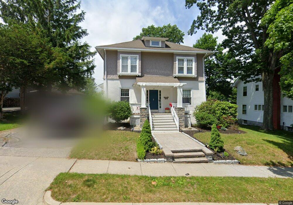
12 Kenilworth Rd Unit 1 Worcester, MA 01602
Newton Square NeighborhoodEstimated Value: $542,357 - $621,000
3
Beds
2
Baths
2,372
Sq Ft
$242/Sq Ft
Est. Value
About This Home
This home is located at 12 Kenilworth Rd Unit 1, Worcester, MA 01602 and is currently estimated at $574,589, approximately $242 per square foot. 12 Kenilworth Rd Unit 1 is a home located in Worcester County with nearby schools including Chandler Magnet, Jacob Hiatt Magnet School, and Midland Street.
Ownership History
Date
Name
Owned For
Owner Type
Purchase Details
Closed on
Dec 3, 2012
Sold by
Guiney John C and Guiney Debbie C
Bought by
Denning Amy M
Current Estimated Value
Home Financials for this Owner
Home Financials are based on the most recent Mortgage that was taken out on this home.
Original Mortgage
$216,000
Outstanding Balance
$148,796
Interest Rate
3.4%
Mortgage Type
New Conventional
Estimated Equity
$425,793
Create a Home Valuation Report for This Property
The Home Valuation Report is an in-depth analysis detailing your home's value as well as a comparison with similar homes in the area
Home Values in the Area
Average Home Value in this Area
Purchase History
| Date | Buyer | Sale Price | Title Company |
|---|---|---|---|
| Denning Amy M | $230,000 | -- |
Source: Public Records
Mortgage History
| Date | Status | Borrower | Loan Amount |
|---|---|---|---|
| Open | Denning Amy M | $216,000 |
Source: Public Records
Tax History Compared to Growth
Tax History
| Year | Tax Paid | Tax Assessment Tax Assessment Total Assessment is a certain percentage of the fair market value that is determined by local assessors to be the total taxable value of land and additions on the property. | Land | Improvement |
|---|---|---|---|---|
| 2025 | $5,874 | $445,300 | $118,400 | $326,900 |
| 2024 | $5,742 | $417,600 | $118,400 | $299,200 |
| 2023 | $5,521 | $385,000 | $103,000 | $282,000 |
| 2022 | $5,097 | $335,100 | $82,400 | $252,700 |
| 2021 | $5,053 | $310,400 | $65,900 | $244,500 |
| 2020 | $4,884 | $287,300 | $65,900 | $221,400 |
| 2019 | $4,880 | $271,100 | $59,300 | $211,800 |
| 2018 | $4,820 | $254,900 | $59,300 | $195,600 |
| 2017 | $4,622 | $240,500 | $59,300 | $181,200 |
| 2016 | $4,619 | $224,100 | $43,400 | $180,700 |
| 2015 | $4,498 | $224,100 | $43,400 | $180,700 |
| 2014 | $4,373 | $223,800 | $43,400 | $180,400 |
Source: Public Records
Map
Nearby Homes
- 12 Kenilworth Rd
- 10 Kenilworth Rd
- 14 Kenilworth Rd
- 21 Iowa St
- 16 Kenilworth Rd
- 11 Kenilworth Rd
- 6 Kenilworth Rd
- 7 Kenilworth Rd
- 19 Iowa St
- 15 Kenilworth Rd
- 4 Kenilworth Rd
- 5 Kenilworth Rd
- 15 Iowa St
- 18 Kenilworth Rd
- 31 Iowa St
- 26 Iowa St Unit 2
- 26 Iowa St Unit 1
- 26 Iowa St
- 26 Iowa St Unit B
- 26 Iowa St Unit A