12 Laurel Ln Norwalk, OH 44857
Estimated Value: $266,000 - $289,153
3
Beds
2
Baths
1,470
Sq Ft
$193/Sq Ft
Est. Value
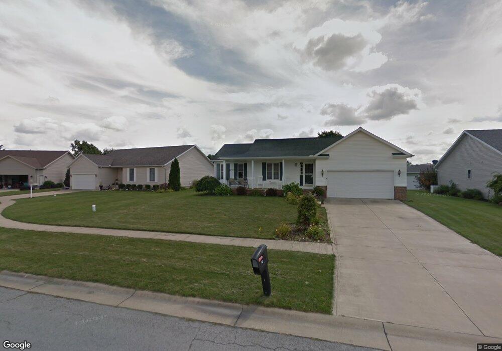
About This Home
This home is located at 12 Laurel Ln, Norwalk, OH 44857 and is currently estimated at $283,288, approximately $192 per square foot. 12 Laurel Ln is a home located in Huron County with nearby schools including Maplehurst Elementary School, Pleasant Elementary School, and League Elementary School.
Ownership History
Date
Name
Owned For
Owner Type
Purchase Details
Closed on
Nov 23, 2015
Sold by
Hanna Stephen M and Hanna Stephanie L
Bought by
Hanna Stephen M and Hanna Stephanie L
Current Estimated Value
Purchase Details
Closed on
Jun 24, 2004
Bought by
Hanna Stephen M and Hanna Stephanie L
Purchase Details
Closed on
Feb 4, 2004
Bought by
Fannie Mae Aka Federal
Purchase Details
Closed on
Feb 27, 2002
Sold by
Perry Oliver B
Bought by
Krupp Benjamin J
Purchase Details
Closed on
May 11, 2001
Sold by
Barman David A
Bought by
Perry Oliver B and Perry Marilyn K
Purchase Details
Closed on
Mar 27, 1998
Bought by
Barman Construction Inc
Create a Home Valuation Report for This Property
The Home Valuation Report is an in-depth analysis detailing your home's value as well as a comparison with similar homes in the area
Home Values in the Area
Average Home Value in this Area
Purchase History
| Date | Buyer | Sale Price | Title Company |
|---|---|---|---|
| Hanna Stephen M | -- | Attorney | |
| Hanna Stephen M | $147,500 | -- | |
| Fannie Mae Aka Federal | $96,000 | -- | |
| Krupp Benjamin J | $140,000 | -- | |
| Perry Oliver B | $21,900 | -- | |
| Barman Construction Inc | -- | -- |
Source: Public Records
Tax History Compared to Growth
Tax History
| Year | Tax Paid | Tax Assessment Tax Assessment Total Assessment is a certain percentage of the fair market value that is determined by local assessors to be the total taxable value of land and additions on the property. | Land | Improvement |
|---|---|---|---|---|
| 2024 | $3,542 | $86,790 | $9,430 | $77,360 |
| 2023 | $3,542 | $66,690 | $7,880 | $58,810 |
| 2022 | $2,688 | $66,690 | $7,880 | $58,810 |
| 2021 | $2,689 | $66,690 | $7,880 | $58,810 |
| 2020 | $2,598 | $61,290 | $7,880 | $53,410 |
| 2019 | $2,541 | $61,290 | $7,880 | $53,410 |
| 2018 | $2,496 | $61,290 | $7,880 | $53,410 |
| 2017 | $2,247 | $54,990 | $7,880 | $47,110 |
| 2016 | $2,205 | $54,990 | $7,880 | $47,110 |
| 2015 | $2,205 | $54,990 | $7,880 | $47,110 |
| 2014 | $2,253 | $55,730 | $6,690 | $49,040 |
| 2013 | $1,958 | $55,730 | $6,690 | $49,040 |
Source: Public Records
Map
Nearby Homes
- 6 N West St
- 144 Sycamore Dr
- 280 W Main St
- 161 W Main St
- 157 W Main St
- 102 N Pleasant St
- 12 Minard Place
- 29 W Seminary St
- 15 E Washington St
- 21 Maple St
- 40 W Elm St
- 40 Norwood Ave
- 27 Norwood Ave
- 3170 Brown Rd
- 230 Whittlesey Ave Unit 59
- 230 Whittlesey Ave Unit 72
- 4 Deer Track Trail Unit A
- 57 Milan Ave
- 15 W Chestnut St
- 123 E Main St