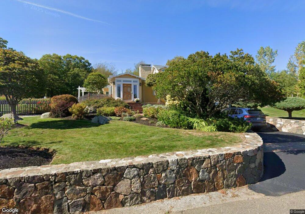
12 Links Rd Gloucester, MA 01930
East Gloucester NeighborhoodEstimated Value: $1,594,000 - $1,997,000
4
Beds
4
Baths
3,465
Sq Ft
$509/Sq Ft
Est. Value
About This Home
This home is located at 12 Links Rd, Gloucester, MA 01930 and is currently estimated at $1,763,634, approximately $508 per square foot. 12 Links Rd is a home located in Essex County with nearby schools including East Gloucester Elementary School, Ralph B O'maley Middle School, and Gloucester High School.
Ownership History
Date
Name
Owned For
Owner Type
Purchase Details
Closed on
Jun 23, 2008
Sold by
Harrison David E and Holovak-Harrison Michele
Bought by
Towne 3Rd James T
Current Estimated Value
Home Financials for this Owner
Home Financials are based on the most recent Mortgage that was taken out on this home.
Original Mortgage
$523,750
Outstanding Balance
$336,946
Interest Rate
6.1%
Mortgage Type
Purchase Money Mortgage
Estimated Equity
$1,426,688
Create a Home Valuation Report for This Property
The Home Valuation Report is an in-depth analysis detailing your home's value as well as a comparison with similar homes in the area
Home Values in the Area
Average Home Value in this Area
Purchase History
| Date | Buyer | Sale Price | Title Company |
|---|---|---|---|
| Towne 3Rd James T | $778,000 | -- | |
| Towne 3Rd James T | $778,000 | -- |
Source: Public Records
Mortgage History
| Date | Status | Borrower | Loan Amount |
|---|---|---|---|
| Open | Towne 3Rd James T | $523,750 |
Source: Public Records
Tax History
| Year | Tax Paid | Tax Assessment Tax Assessment Total Assessment is a certain percentage of the fair market value that is determined by local assessors to be the total taxable value of land and additions on the property. | Land | Improvement |
|---|---|---|---|---|
| 2025 | $14,487 | $1,490,400 | $495,100 | $995,300 |
| 2024 | $13,435 | $1,380,800 | $471,500 | $909,300 |
| 2023 | $12,360 | $1,167,100 | $402,200 | $764,900 |
| 2022 | $11,958 | $1,019,400 | $349,700 | $669,700 |
| 2021 | $11,560 | $929,300 | $318,000 | $611,300 |
| 2020 | $12,002 | $973,400 | $318,000 | $655,400 |
| 2019 | $13,255 | $1,044,500 | $349,000 | $695,500 |
| 2018 | $11,974 | $926,100 | $340,500 | $585,600 |
| 2017 | $11,991 | $909,100 | $323,500 | $585,600 |
| 2016 | $11,607 | $852,800 | $310,200 | $542,600 |
| 2015 | $11,065 | $810,600 | $303,100 | $507,500 |
Source: Public Records
Map
Nearby Homes
- 10 Seaview Rd
- 11 Ocean View Dr
- 197 E Main St Unit 1
- 15 Raven Ln Unit 15
- 73 Rocky Neck Ave Unit 2
- 1 Wonson St
- 60 Rocky Neck Ave Unit 202
- 70 Bass Ave
- 3 Mondello Square
- 36 Eastern Ave
- 139A Prospect St
- 14R Spring St Unit 3
- 26 Marina Dr
- 191 Main St Unit 3
- 191 Main St Unit 2A
- 78 Thatcher Rd Unit 6
- 25 Salt Island Rd
- 70 Old Nugent Farm Rd
- 35 Middle St Unit 4
- 33 Middle St
- 2 Links Rd
- 3 Links Rd Unit A
- 3 Links Rd Unit B
- 3 Links Rd
- 16 Links Rd
- 68 High Popples Rd
- 68 High Popples Rd Unit A
- 30 Links Rd
- 2 Mayflower Ln
- 20 Links Rd
- 161 Atlantic Rd Unit 171
- 1 & 1A Mayflower Ln
- 1 Mayflower Ln
- 163 Atlantic Rd Unit 11
- 163 Atlantic Rd Unit 9
- 163 Atlantic Rd Unit 7
- 163 Atlantic Rd Unit 8
- 163 Atlantic Rd Unit 10
- 163 Atlantic Rd Unit 6
- 163 Atlantic Rd
Your Personal Tour Guide
Ask me questions while you tour the home.