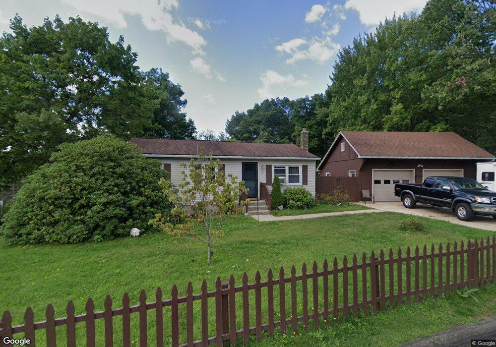
12 Longview Dr Florence, MA 01062
Florence NeighborhoodEstimated Value: $345,123 - $385,000
3
Beds
2
Baths
864
Sq Ft
$420/Sq Ft
Est. Value
About This Home
This home is located at 12 Longview Dr, Florence, MA 01062 and is currently estimated at $363,281, approximately $420 per square foot. 12 Longview Dr is a home located in Hampshire County with nearby schools including Northampton High School.
Ownership History
Date
Name
Owned For
Owner Type
Purchase Details
Closed on
Aug 31, 2007
Sold by
Robator James J and Robator James W
Bought by
Maldonado Carmen and Maldonado Miguel
Current Estimated Value
Home Financials for this Owner
Home Financials are based on the most recent Mortgage that was taken out on this home.
Original Mortgage
$110,000
Outstanding Balance
$70,143
Interest Rate
6.71%
Mortgage Type
Purchase Money Mortgage
Estimated Equity
$293,138
Purchase Details
Closed on
Jul 1, 1988
Sold by
Mald Roger J
Bought by
Foley John A
Create a Home Valuation Report for This Property
The Home Valuation Report is an in-depth analysis detailing your home's value as well as a comparison with similar homes in the area
Home Values in the Area
Average Home Value in this Area
Purchase History
| Date | Buyer | Sale Price | Title Company |
|---|---|---|---|
| Maldonado Carmen | $220,000 | -- | |
| Foley John A | $109,000 | -- |
Source: Public Records
Mortgage History
| Date | Status | Borrower | Loan Amount |
|---|---|---|---|
| Open | Maldonado Carmen | $110,000 | |
| Previous Owner | Foley John A | $40,000 | |
| Previous Owner | Foley John A | $91,500 | |
| Previous Owner | Foley John A | $5,000 | |
| Previous Owner | Foley John A | $86,500 |
Source: Public Records
Tax History
| Year | Tax Paid | Tax Assessment Tax Assessment Total Assessment is a certain percentage of the fair market value that is determined by local assessors to be the total taxable value of land and additions on the property. | Land | Improvement |
|---|---|---|---|---|
| 2025 | $4,008 | $287,700 | $131,700 | $156,000 |
| 2024 | $4,350 | $286,400 | $125,500 | $160,900 |
| 2023 | $4,000 | $252,500 | $114,100 | $138,400 |
| 2022 | $3,667 | $205,000 | $106,800 | $98,200 |
| 2021 | $3,603 | $207,400 | $101,800 | $105,600 |
| 2020 | $3,484 | $207,400 | $101,800 | $105,600 |
| 2019 | $3,269 | $188,200 | $86,800 | $101,400 |
| 2018 | $3,224 | $189,200 | $86,800 | $102,400 |
| 2017 | $3,158 | $189,200 | $86,800 | $102,400 |
| 2016 | $3,057 | $189,200 | $86,800 | $102,400 |
| 2015 | $3,045 | $192,700 | $86,800 | $105,900 |
| 2014 | $2,966 | $192,700 | $86,800 | $105,900 |
Source: Public Records
Map
Nearby Homes
- 815 Burts Pit Rd
- 723 Lot B Ryan Rd
- 72 Emerson Way
- 296 Ryan Rd Unit A
- 296 Ryan Rd
- 296 Ryan Rd Unit B
- 635 Florence Rd
- 697 Florence Rd
- 589 Florence Rd
- 42 Clark St
- 967 Florence Rd
- 832 Westhampton Rd
- 0 W Farms Rd
- 892 Westhampton Rd
- 296 Old Wilson Rd
- 404 Sylvester Rd
- 37 Landy Ave
- 20-11 Sylvester Rd
- 98 Park Hill Rd
- 67 Park St Unit A
- 20 Longview Dr
- 20 Longview Dr Unit 1
- 256 Brookside Cir
- 264 Brookside Cir
- 248 Brookside Cir
- 28 Longview Dr
- 21 Longview Dr
- 240 Brookside Cir
- 286 Brookside Cir
- 263 Brookside Cir
- 271 Brookside Cir
- 232 Brookside Cir
- 11 Overlook Dr
- 29 Longview Dr
- 255 Brookside Cir
- 279 Brookside Cir
- 36 Longview Dr
- 37 Longview Dr
- 23 Overlook Dr
- 300 Brookside Cir
Your Personal Tour Guide
Ask me questions while you tour the home.