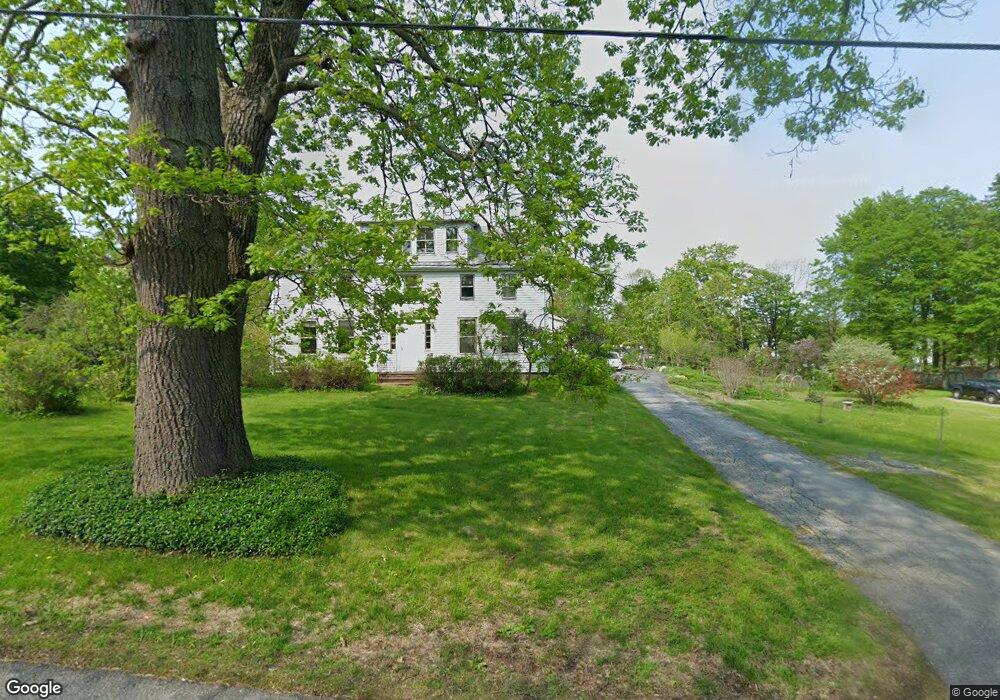
12 Maple Ave Freeport, ME 04032
Estimated Value: $550,213 - $679,000
2
Beds
2
Baths
2,080
Sq Ft
$300/Sq Ft
Est. Value
About This Home
This home is located at 12 Maple Ave, Freeport, ME 04032 and is currently estimated at $623,053, approximately $299 per square foot. 12 Maple Ave is a home with nearby schools including Morse Street School, Mast Landing School, and Freeport Middle School.
Create a Home Valuation Report for This Property
The Home Valuation Report is an in-depth analysis detailing your home's value as well as a comparison with similar homes in the area
Home Values in the Area
Average Home Value in this Area
Tax History
| Year | Tax Paid | Tax Assessment Tax Assessment Total Assessment is a certain percentage of the fair market value that is determined by local assessors to be the total taxable value of land and additions on the property. | Land | Improvement |
|---|---|---|---|---|
| 2025 | $5,692 | $411,000 | $215,400 | $195,600 |
| 2024 | $5,349 | $400,700 | $205,100 | $195,600 |
| 2023 | $4,924 | $358,100 | $186,400 | $171,700 |
| 2022 | $4,432 | $324,700 | $167,000 | $157,700 |
| 2021 | $4,335 | $324,700 | $167,000 | $157,700 |
| 2020 | $4,208 | $300,600 | $154,600 | $146,000 |
| 2019 | $4,030 | $281,800 | $145,900 | $135,900 |
| 2018 | $4,130 | $274,400 | $137,500 | $136,900 |
| 2017 | $3,960 | $264,900 | $134,300 | $130,600 |
| 2016 | $3,832 | $242,500 | $121,300 | $121,200 |
Source: Public Records
Map
Nearby Homes
- 212 Main St
- 10 Durham Rd
- 5 Holbrook St
- 42 Durham Rd
- 11 Orchard Hill Rd
- 67 Farmview Ln
- 15 Linwood Rd Unit 15
- 39 Hunter Rd
- 1 Wardtown Rd
- 8 Statler Ln
- 1260 Us Route 1
- 10 Prout Rd
- 15 Tinkers Way
- 26 Harvest Ridge Rd Unit 24
- 20 Harvest Ridge Rd Unit 23
- 52 Birch Point Rd
- 143 Bragdon Rd
- 0 Prout Rd
- 21 Renee Rd
- 4 Harper's Trail
Your Personal Tour Guide
Ask me questions while you tour the home.