C
Seller's Agent in 2014
Cheryl Friend
Glenda Williamson Realty
(217) 875-8081
53 Total Sales

Estimated Value: $82,159 - $102,000
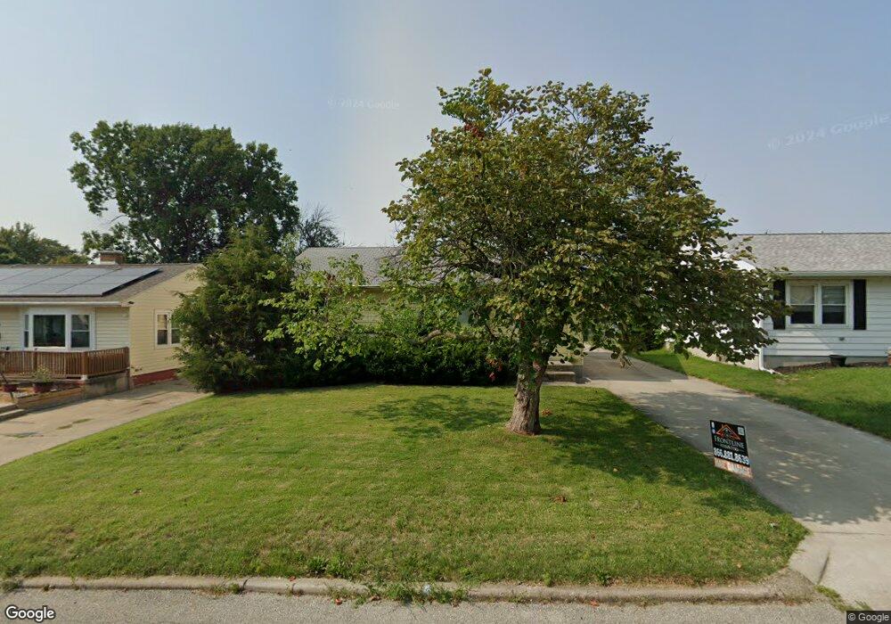
Nice 3 bedroom ranch, all appliances stay. 2 car detached garage with new concrete driveway, partially finished lower level with 3/4 bath. Immediate possession.Furnace 2007, air conditioner 2013,newer driveway 2011, washer, dryer, and refrigerator 2005.Interior painted 2013.
Last Agent to Sell the Property
Glenda Williamson Realty License #471002049 Listed on: 05/29/2013
Last Buyer's Agent
Michelle Nurnberger
Bagley & Assoc. License #475154208
| Date | Buyer | Sale Price | Title Company |
|---|---|---|---|
| Runion Grantee Caitlin | $56,000 | None Available | |
| Kwacz Ronald J | $72,000 | None Available | |
| -- | $67,000 | -- |
| Date | Status | Borrower | Loan Amount |
|---|---|---|---|
| Open | Runion Grantee Caitlin | $41,200 |
| Date | Event | Price | List to Sale | Price per Sq Ft |
|---|---|---|---|---|
| 07/30/2014 07/30/14 | Sold | $56,000 | -13.8% | $38 / Sq Ft |
| 06/01/2014 06/01/14 | Pending | -- | -- | -- |
| 05/29/2013 05/29/13 | For Sale | $65,000 | -- | $45 / Sq Ft |
| Year | Tax Paid | Tax Assessment Tax Assessment Total Assessment is a certain percentage of the fair market value that is determined by local assessors to be the total taxable value of land and additions on the property. | Land | Improvement |
|---|---|---|---|---|
| 2024 | $1,867 | $25,286 | $3,296 | $21,990 |
| 2023 | $1,830 | $24,391 | $3,179 | $21,212 |
| 2022 | $1,695 | $22,571 | $2,942 | $19,629 |
| 2021 | $1,551 | $21,078 | $2,747 | $18,331 |
| 2020 | $1,499 | $20,100 | $2,620 | $17,480 |
| 2019 | $1,499 | $20,100 | $2,620 | $17,480 |
| 2018 | $1,488 | $20,167 | $2,629 | $17,538 |
| 2017 | $1,540 | $20,705 | $2,699 | $18,006 |
| 2016 | $1,576 | $20,917 | $2,727 | $18,190 |
| 2015 | $1,487 | $20,547 | $2,679 | $17,868 |
| 2014 | $1,375 | $20,343 | $2,652 | $17,691 |
| 2013 | $2,015 | $21,107 | $2,752 | $18,355 |
C
Seller's Agent in 2014
Cheryl Friend
Glenda Williamson Realty
(217) 875-8081
53 Total Sales
M
Buyer's Agent in 2014
Michelle Nurnberger
Bagley & Assoc.
Source: Central Illinois Board of REALTORS®
MLS Number: 5191377
APN: 04-12-03-333-011
Ask me questions while you tour the home.
