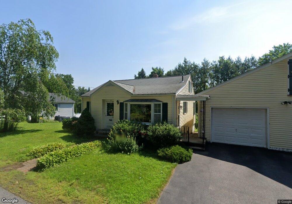
12 Marble Rd Sutton, MA 01590
Estimated Value: $400,748 - $459,000
2
Beds
1
Bath
885
Sq Ft
$470/Sq Ft
Est. Value
About This Home
This home is located at 12 Marble Rd, Sutton, MA 01590 and is currently estimated at $415,937, approximately $469 per square foot. 12 Marble Rd is a home located in Worcester County with nearby schools including Sutton Elementary School, Sutton Middle School, and Sutton High School.
Ownership History
Date
Name
Owned For
Owner Type
Purchase Details
Closed on
Oct 27, 2023
Sold by
Chizy Yvette D Est and Chizy
Bought by
Chizy Michael P
Current Estimated Value
Purchase Details
Closed on
Nov 9, 2017
Sold by
Hill Jeffrey C and Hill Christine A
Bought by
Hill James H and Hill Sharol J
Home Financials for this Owner
Home Financials are based on the most recent Mortgage that was taken out on this home.
Original Mortgage
$195,700
Interest Rate
3.63%
Mortgage Type
Adjustable Rate Mortgage/ARM
Create a Home Valuation Report for This Property
The Home Valuation Report is an in-depth analysis detailing your home's value as well as a comparison with similar homes in the area
Home Values in the Area
Average Home Value in this Area
Purchase History
| Date | Buyer | Sale Price | Title Company |
|---|---|---|---|
| Chizy Michael P | -- | None Available | |
| Hill James H | $50,000 | -- |
Source: Public Records
Mortgage History
| Date | Status | Borrower | Loan Amount |
|---|---|---|---|
| Previous Owner | Hill James H | $195,700 |
Source: Public Records
Tax History
| Year | Tax Paid | Tax Assessment Tax Assessment Total Assessment is a certain percentage of the fair market value that is determined by local assessors to be the total taxable value of land and additions on the property. | Land | Improvement |
|---|---|---|---|---|
| 2025 | $4,340 | $348,300 | $149,000 | $199,300 |
| 2024 | $4,278 | $331,900 | $142,500 | $189,400 |
| 2023 | $3,627 | $257,600 | $128,800 | $128,800 |
| 2022 | $3,706 | $238,800 | $103,100 | $135,700 |
| 2021 | $3,477 | $212,900 | $103,100 | $109,800 |
| 2020 | $3,481 | $212,900 | $103,100 | $109,800 |
| 2019 | $3,334 | $196,600 | $99,200 | $97,400 |
| 2018 | $2,999 | $176,300 | $84,300 | $92,000 |
| 2017 | $2,839 | $167,400 | $73,300 | $94,100 |
| 2016 | $2,816 | $164,200 | $73,300 | $90,900 |
| 2015 | $2,733 | $159,800 | $73,300 | $86,500 |
| 2014 | $2,700 | $154,800 | $71,200 | $83,600 |
Source: Public Records
Map
Nearby Homes
- 1 Burbank Rd
- 99 Burbank Rd
- 99 Burbank Road Lot 182
- 20 Millers Way Unit C
- 229 Worcester-Providence Turnpike
- 175 Armsby Rd
- 66 Buttonwood Ave
- 168 Burbank Rd
- 5 Mogren Dr
- 4 Jessica j Dr
- 2 Jessica j Dr
- 5 Wildflower Dr
- 128 Worcester Providence Turnpike
- 150 Ariel Cir
- 124 Worcester Providence Turnpike
- 82 Central Turnpike
- 5 Putnam Hill Rd
- 31 Central Turnpike
- 51 Central Turnpike
- 11 Laurel Dr
- 14 Marble Rd
- 15 Marble Rd
- 154 Boston Rd
- 9 Marble Rd
- 13 Marble Rd
- 150 Boston Rd
- 18 Marble Rd
- 0 Worc Prov Tpk (146) Unit 30527733
- Rt 146 Worcester Providence Turnpike
- 148 Boston Rd
- 19 Marble Rd
- 157 Boston Rd
- 140 Worcester-Providence Turnpike Unit 3
- 140 Worcester-Providence Turnpike
- 140 Worcester Providence Turnpike
- 159 Boston Rd
- 166 Boston Rd
- 21 Marble Rd
- 170 Boston Rd
- 165 Boston Rd
Your Personal Tour Guide
Ask me questions while you tour the home.