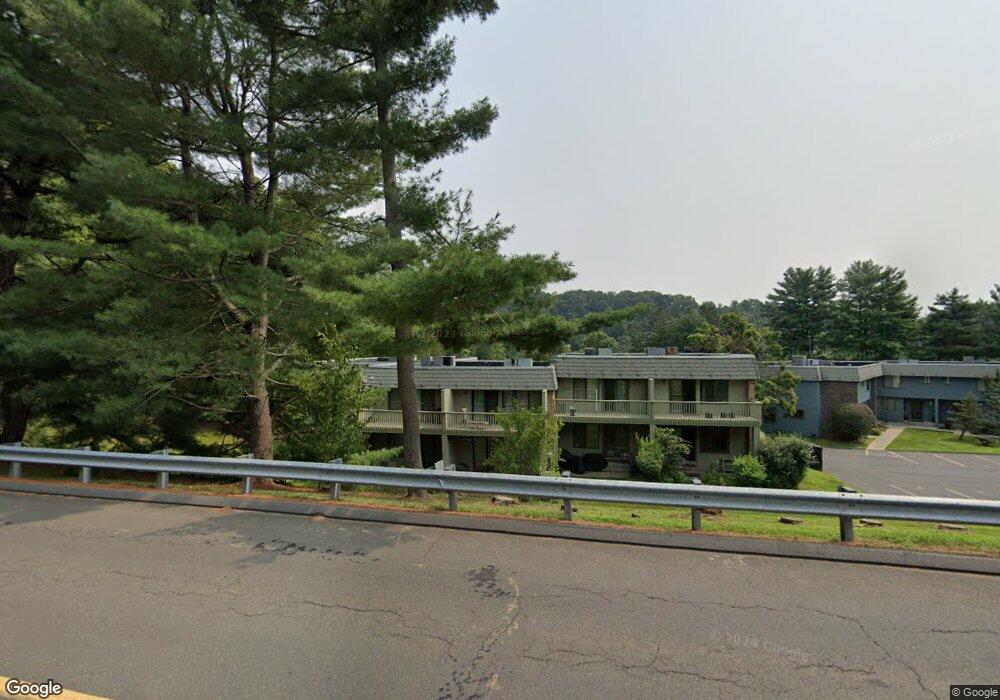
12 Margo Ct Cromwell, CT 06416
Estimated Value: $203,000 - $250,049
2
Beds
2
Baths
1,453
Sq Ft
$161/Sq Ft
Est. Value
About This Home
This home is located at 12 Margo Ct, Cromwell, CT 06416 and is currently estimated at $233,262, approximately $160 per square foot. 12 Margo Ct is a home located in Middlesex County with nearby schools including Edna C. Stevens School, Woodside Intermediate School, and Cromwell Middle School.
Ownership History
Date
Name
Owned For
Owner Type
Purchase Details
Closed on
Apr 1, 2016
Sold by
Department Of Housing & Urban Dev
Bought by
Wahatalo Wendy and Faucher Donald
Current Estimated Value
Home Financials for this Owner
Home Financials are based on the most recent Mortgage that was taken out on this home.
Original Mortgage
$71,200
Outstanding Balance
$56,508
Interest Rate
3.65%
Mortgage Type
Purchase Money Mortgage
Estimated Equity
$176,754
Purchase Details
Closed on
Jan 19, 2016
Sold by
Us Bank Na
Bought by
Department Of Housing & Urban Dev
Purchase Details
Closed on
Oct 15, 2014
Sold by
Eisenberg Jaime E
Bought by
Us Bank Na
Purchase Details
Closed on
Jul 31, 2007
Sold by
Truszkowski Becky A
Bought by
Vinick Jesse and Eisenberg Jaime Ellen
Home Financials for this Owner
Home Financials are based on the most recent Mortgage that was taken out on this home.
Original Mortgage
$161,466
Interest Rate
6.78%
Purchase Details
Closed on
Oct 16, 1998
Sold by
Azia Gail R
Bought by
Canfield Becky A
Home Financials for this Owner
Home Financials are based on the most recent Mortgage that was taken out on this home.
Original Mortgage
$54,000
Interest Rate
6.8%
Create a Home Valuation Report for This Property
The Home Valuation Report is an in-depth analysis detailing your home's value as well as a comparison with similar homes in the area
Home Values in the Area
Average Home Value in this Area
Purchase History
| Date | Buyer | Sale Price | Title Company |
|---|---|---|---|
| Wahatalo Wendy | $89,000 | -- | |
| Department Of Housing & Urban Dev | -- | -- | |
| Us Bank Na | -- | -- | |
| Vinick Jesse | $164,000 | -- | |
| Canfield Becky A | $60,000 | -- |
Source: Public Records
Mortgage History
| Date | Status | Borrower | Loan Amount |
|---|---|---|---|
| Open | Canfield Becky A | $71,200 | |
| Previous Owner | Canfield Becky A | $163,719 | |
| Previous Owner | Canfield Becky A | $161,466 | |
| Previous Owner | Canfield Becky A | $54,000 |
Source: Public Records
Tax History
| Year | Tax Paid | Tax Assessment Tax Assessment Total Assessment is a certain percentage of the fair market value that is determined by local assessors to be the total taxable value of land and additions on the property. | Land | Improvement |
|---|---|---|---|---|
| 2025 | $3,854 | $125,160 | $0 | $125,160 |
| 2024 | $3,764 | $125,160 | $0 | $125,160 |
| 2023 | $3,681 | $125,160 | $0 | $125,160 |
| 2022 | $3,238 | $97,160 | $0 | $97,160 |
| 2021 | $3,238 | $97,160 | $0 | $97,160 |
| 2020 | $3,190 | $97,160 | $0 | $97,160 |
| 2019 | $3,190 | $97,160 | $0 | $97,160 |
| 2018 | $3,190 | $97,160 | $0 | $97,160 |
| 2017 | $2,792 | $82,300 | $0 | $82,300 |
| 2016 | $2,768 | $82,300 | $0 | $82,300 |
| 2015 | $2,583 | $82,300 | $0 | $82,300 |
| 2014 | $2,739 | $82,300 | $0 | $82,300 |
Source: Public Records
Map
Nearby Homes
- 21 Hawthorn Ct Unit 21
- 7 Willow Ct Unit 7
- 11 Valley Run Dr Unit 11
- 9 Willow Ct
- 22 Linda Ct Unit 22
- 14 Redwood Ct Unit 14
- 9 Bayberry Ct
- 10 Dogwood Ct Unit 10
- 1 Great Oak Ct
- 3 Avon Dale Rd Unit 3
- 234 Skyview Dr Unit 234
- 3 Sunridge Ln Unit 3
- 43 Sunridge Ln
- 34 Woodsboro Cir Unit 34
- 180 Skyview Dr Unit 180
- 159 Evergreen Rd
- 37 Coles Rd
- 58 Morning Glory Dr
- 3 E Lake Place
- 59 Trolley Crossing Ln Unit 59
Your Personal Tour Guide
Ask me questions while you tour the home.