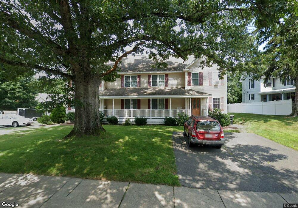
12 Merrimac St Unit B Woburn, MA 01801
North Woburn NeighborhoodEstimated Value: $711,944 - $784,000
3
Beds
3
Baths
1,594
Sq Ft
$469/Sq Ft
Est. Value
About This Home
This home is located at 12 Merrimac St Unit B, Woburn, MA 01801 and is currently estimated at $747,486, approximately $468 per square foot. 12 Merrimac St Unit B is a home located in Middlesex County with nearby schools including Linscott-Rumford Elementary School, John F. Kennedy Middle School, and Woburn High School.
Ownership History
Date
Name
Owned For
Owner Type
Purchase Details
Closed on
Nov 2, 2004
Sold by
Canal Condo Constr Llc
Bought by
Karp Ari N
Current Estimated Value
Home Financials for this Owner
Home Financials are based on the most recent Mortgage that was taken out on this home.
Original Mortgage
$319,920
Outstanding Balance
$159,225
Interest Rate
5.74%
Mortgage Type
Purchase Money Mortgage
Estimated Equity
$588,261
Create a Home Valuation Report for This Property
The Home Valuation Report is an in-depth analysis detailing your home's value as well as a comparison with similar homes in the area
Home Values in the Area
Average Home Value in this Area
Purchase History
| Date | Buyer | Sale Price | Title Company |
|---|---|---|---|
| Karp Ari N | $399,900 | -- |
Source: Public Records
Mortgage History
| Date | Status | Borrower | Loan Amount |
|---|---|---|---|
| Open | Karp Ari N | $319,920 |
Source: Public Records
Tax History Compared to Growth
Tax History
| Year | Tax Paid | Tax Assessment Tax Assessment Total Assessment is a certain percentage of the fair market value that is determined by local assessors to be the total taxable value of land and additions on the property. | Land | Improvement |
|---|---|---|---|---|
| 2025 | $4,954 | $580,100 | $0 | $580,100 |
| 2024 | $4,497 | $558,000 | $0 | $558,000 |
| 2023 | $4,649 | $534,400 | $0 | $534,400 |
| 2022 | $4,703 | $503,500 | $0 | $503,500 |
| 2021 | $4,658 | $499,200 | $0 | $499,200 |
| 2020 | $4,512 | $484,100 | $0 | $484,100 |
| 2019 | $4,314 | $454,100 | $0 | $454,100 |
| 2018 | $4,254 | $430,100 | $0 | $430,100 |
| 2017 | $3,976 | $400,000 | $0 | $400,000 |
| 2016 | $3,802 | $378,300 | $0 | $378,300 |
| 2015 | $3,847 | $378,300 | $0 | $378,300 |
| 2014 | $3,901 | $373,700 | $0 | $373,700 |
Source: Public Records
Map
Nearby Homes
- 12 Merrimac St Unit A
- 14 Merrimac St
- 4 Unit 4
- 15 Merrimac St
- 13 Merrimac St
- 17 Merrimac St
- 28 School St
- 16 Corpl Charles Oneill Dr
- 14 Corpl Charles Oneill Dr
- 26 School St
- 2 Corpl Charles Oneill Dr
- 2 Corpl Charles Oneill Dr Unit 1-1
- 4 Corpl Charles Oneill Dr
- 30 Merrimac St Unit 2
- 4 Charles O'Neill Dr Unit 1
- 19 Merrimac St
- 32 School St
- 36 School St
- 36 School St Unit 2
- 36 School St Unit 3