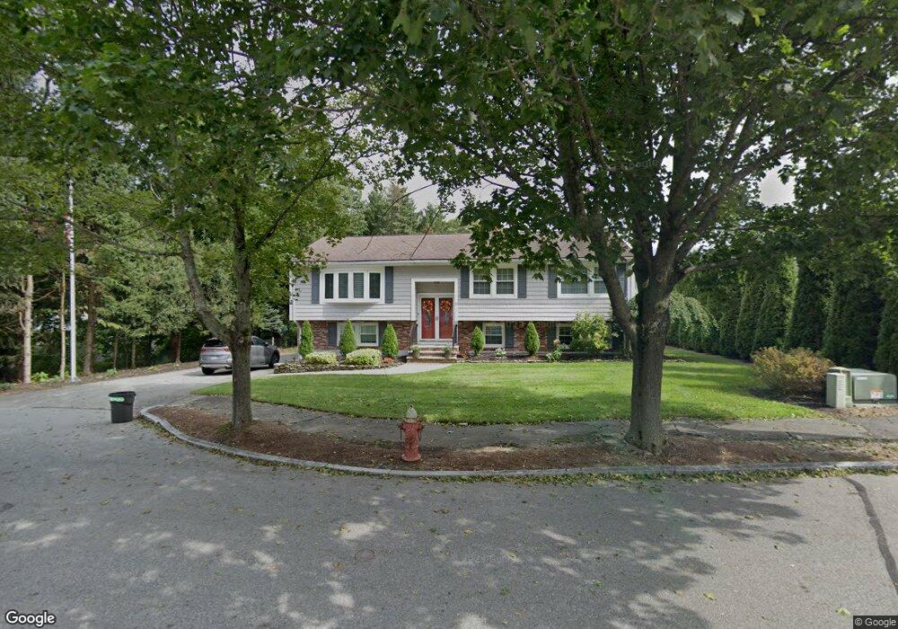
12 Murdoch Rd Stoneham, MA 02180
Haywardville NeighborhoodEstimated Value: $936,306 - $969,000
3
Beds
2
Baths
2,119
Sq Ft
$448/Sq Ft
Est. Value
About This Home
This home is located at 12 Murdoch Rd, Stoneham, MA 02180 and is currently estimated at $948,827, approximately $447 per square foot. 12 Murdoch Rd is a home located in Middlesex County with nearby schools including Stoneham High School, Greater Boston Academy, and St. Patrick Elementary School.
Ownership History
Date
Name
Owned For
Owner Type
Purchase Details
Closed on
Jul 21, 2016
Sold by
Casarano Joseph J and Casarano Barbara J
Bought by
12 Murdock Road Nt
Current Estimated Value
Purchase Details
Closed on
Jun 3, 1998
Sold by
Bruno Paul and Bruno Marjan
Bought by
Casarano Joseph J and Casarano Barbara J
Purchase Details
Closed on
Mar 26, 1997
Sold by
Louise Tempone T and Tempone Louise
Bought by
Bruno Paul and Bruno Marjan
Create a Home Valuation Report for This Property
The Home Valuation Report is an in-depth analysis detailing your home's value as well as a comparison with similar homes in the area
Home Values in the Area
Average Home Value in this Area
Purchase History
| Date | Buyer | Sale Price | Title Company |
|---|---|---|---|
| 12 Murdock Road Nt | $589,000 | -- | |
| Casarano Joseph J | $265,000 | -- | |
| Casarano Joseph J | $265,000 | -- | |
| Bruno Paul | $237,000 | -- | |
| Bruno Paul | $237,000 | -- |
Source: Public Records
Mortgage History
| Date | Status | Borrower | Loan Amount |
|---|---|---|---|
| Previous Owner | Bruno Paul | $293,300 | |
| Previous Owner | Bruno Paul | $304,500 |
Source: Public Records
Tax History
| Year | Tax Paid | Tax Assessment Tax Assessment Total Assessment is a certain percentage of the fair market value that is determined by local assessors to be the total taxable value of land and additions on the property. | Land | Improvement |
|---|---|---|---|---|
| 2025 | $8,701 | $850,500 | $440,500 | $410,000 |
| 2024 | $8,274 | $781,300 | $400,500 | $380,800 |
| 2023 | $7,942 | $715,500 | $360,500 | $355,000 |
| 2022 | $7,096 | $681,700 | $350,500 | $331,200 |
| 2021 | $6,711 | $620,200 | $310,500 | $309,700 |
| 2020 | $8,097 | $624,600 | $310,500 | $314,100 |
| 2019 | $7,097 | $632,500 | $310,500 | $322,000 |
| 2018 | $6,800 | $580,700 | $290,500 | $290,200 |
| 2017 | $6,225 | $502,400 | $253,200 | $249,200 |
| 2016 | $6,095 | $479,900 | $253,200 | $226,700 |
| 2015 | $6,120 | $472,200 | $244,200 | $228,000 |
| 2014 | $5,731 | $424,800 | $212,600 | $212,200 |
Source: Public Records
Map
Nearby Homes
- 137 Franklin St Unit 102
- 17 Franklin St
- 6 Everett St
- 159 Franklin St Unit D2
- 159 Franklin St Unit C2
- 159 Franklin St Unit E6
- 35 Wright St
- 57 Park St
- 8 Common St Unit 3
- 33 Lake Ave
- 51 Spring St
- 10 Pomeworth St Unit A
- 53 Perkins St
- 4 Garfield Ave
- 35 Tremont St
- 21 Tremont St Unit B
- 21 Tremont St Unit A
- 200 Ledgewood Dr Unit 601
- 132 Walton Park
- 58 Washington St
Your Personal Tour Guide
Ask me questions while you tour the home.