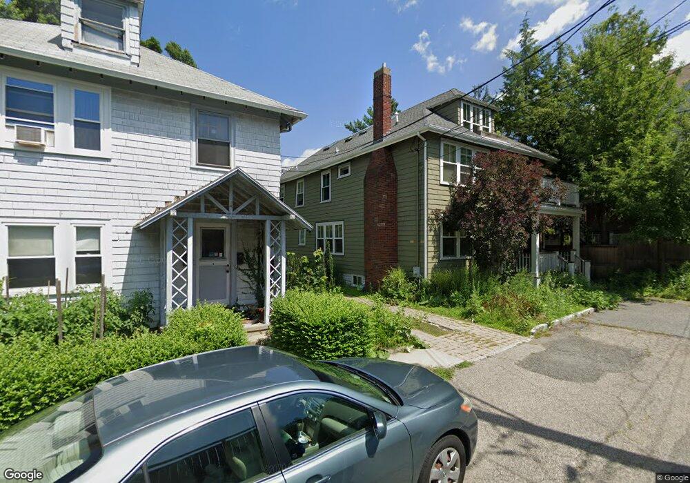
12 Newell Terrace Cambridge, MA 02140
Neighborhood Nine NeighborhoodEstimated Value: $3,288,380 - $4,059,000
4
Beds
4
Baths
2,691
Sq Ft
$1,330/Sq Ft
Est. Value
About This Home
This home is located at 12 Newell Terrace, Cambridge, MA 02140 and is currently estimated at $3,579,095, approximately $1,330 per square foot. 12 Newell Terrace is a home located in Middlesex County with nearby schools including Benjamin Banneker Charter Public School, Cambridge Montessori School, and St Peter School.
Ownership History
Date
Name
Owned For
Owner Type
Purchase Details
Closed on
Dec 13, 2018
Sold by
Stokes Elizabeth A
Bought by
Elizabeth Anne Stokes T and Elizabeth Stokes
Current Estimated Value
Purchase Details
Closed on
May 24, 2013
Sold by
Stokes Richard C
Bought by
Stokes Elizabeth A
Purchase Details
Closed on
Apr 10, 2013
Sold by
Sbn Llc
Bought by
Stokes Richard C
Purchase Details
Closed on
May 16, 2012
Sold by
Clinton Dorothea R Est and Fantini
Bought by
Sbn Llc
Create a Home Valuation Report for This Property
The Home Valuation Report is an in-depth analysis detailing your home's value as well as a comparison with similar homes in the area
Home Values in the Area
Average Home Value in this Area
Purchase History
| Date | Buyer | Sale Price | Title Company |
|---|---|---|---|
| Elizabeth Anne Stokes T | -- | -- | |
| Stokes Elizabeth A | -- | -- | |
| Stokes Elizabeth A | -- | -- | |
| Stokes Richard C | $1,870,000 | -- | |
| Stokes Richard C | $1,870,000 | -- | |
| Sbn Llc | $965,000 | -- | |
| Sbn Llc | $965,000 | -- |
Source: Public Records
Mortgage History
| Date | Status | Borrower | Loan Amount |
|---|---|---|---|
| Previous Owner | Sbn Llc | $150,000 |
Source: Public Records
Tax History Compared to Growth
Tax History
| Year | Tax Paid | Tax Assessment Tax Assessment Total Assessment is a certain percentage of the fair market value that is determined by local assessors to be the total taxable value of land and additions on the property. | Land | Improvement |
|---|---|---|---|---|
| 2025 | $19,989 | $3,147,800 | $1,106,800 | $2,041,000 |
| 2024 | $18,384 | $3,105,400 | $1,151,500 | $1,953,900 |
| 2023 | $16,989 | $2,899,200 | $1,173,900 | $1,725,300 |
| 2022 | $15,718 | $2,655,000 | $1,126,900 | $1,528,100 |
| 2021 | $14,951 | $2,555,800 | $1,105,300 | $1,450,500 |
| 2020 | $13,922 | $2,421,300 | $1,047,400 | $1,373,900 |
| 2019 | $13,634 | $2,295,300 | $1,025,700 | $1,269,600 |
| 2018 | $11,951 | $2,186,500 | $975,200 | $1,211,300 |
| 2017 | $13,380 | $2,061,600 | $928,200 | $1,133,400 |
| 2016 | $12,842 | $1,837,200 | $801,800 | $1,035,400 |
| 2015 | $12,715 | $1,626,000 | $700,700 | $925,300 |
| 2014 | $12,022 | $1,434,600 | $595,900 | $838,700 |
Source: Public Records
Map
Nearby Homes
- 12-14 Gray Gardens W
- 84 Garden St
- 273 Walden St Unit 2
- 86 Avon Hill St
- 18 Donnell St
- 148 Huron Ave
- 43 Linnaean St Unit 42
- 202 Garden St
- 70 Walden St Unit 1
- 70 Walden St Unit 7
- 70 Walden St Unit 11
- 24 Cambridge Terrace Unit 2
- 32 Copley St Unit 2
- 22 Agassiz St
- 5 Field St
- 52 Garden St Unit B2
- 156 Fayerweather St Unit 156
- 234 Huron Ave
- 14-16 Field St
- 422-424 Walden St
- 8 Newell Terrace
- 9 Bellevue Ave
- 10 Bellevue Ave
- 10 Bellevue Ave Unit 10
- 10 Bellevue Ave Unit 2
- 10 W Bellevue Ave Unit B
- 10 W Bellevue Ave Unit 3
- 5 W Bellevue Ave
- 226 Upland Rd
- 268 Upland Rd
- 272 Upland Rd
- 230 Upland Rd
- 230 Upland Rd
- 230 Upland Rd Unit 2
- 25 Huron Ave
- 262 Upland Rd
- 262 Upland Rd Unit 3
- 262 Upland Rd Unit 2
- 5 Bellevue Ave
- 224 Upland Rd Unit 2