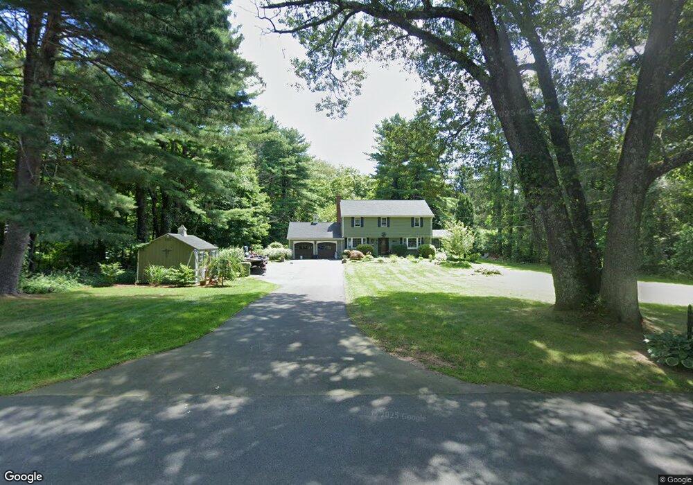
12 Notch Rd West Simsbury, CT 06092
Estimated Value: $518,000 - $561,000
4
Beds
3
Baths
1,888
Sq Ft
$282/Sq Ft
Est. Value
About This Home
This home is located at 12 Notch Rd, West Simsbury, CT 06092 and is currently estimated at $531,806, approximately $281 per square foot. 12 Notch Rd is a home located in Hartford County with nearby schools including Tootin' Hills School, Henry James Memorial School, and Simsbury High School.
Ownership History
Date
Name
Owned For
Owner Type
Purchase Details
Closed on
Oct 24, 2005
Sold by
Chase Weldow A and Chase Clarice O
Bought by
Punty Jason E and Punty Mary Dean S
Current Estimated Value
Home Financials for this Owner
Home Financials are based on the most recent Mortgage that was taken out on this home.
Original Mortgage
$232,500
Interest Rate
5.72%
Purchase Details
Closed on
Jan 19, 1996
Sold by
Marchion Olga and Laraia Vera
Bought by
Szwez Walter
Create a Home Valuation Report for This Property
The Home Valuation Report is an in-depth analysis detailing your home's value as well as a comparison with similar homes in the area
Home Values in the Area
Average Home Value in this Area
Purchase History
| Date | Buyer | Sale Price | Title Company |
|---|---|---|---|
| Punty Jason E | $310,000 | -- | |
| Szwez Walter | $60,000 | -- |
Source: Public Records
Mortgage History
| Date | Status | Borrower | Loan Amount |
|---|---|---|---|
| Open | Szwez Walter | $245,000 | |
| Closed | Szwez Walter | $232,500 |
Source: Public Records
Tax History Compared to Growth
Tax History
| Year | Tax Paid | Tax Assessment Tax Assessment Total Assessment is a certain percentage of the fair market value that is determined by local assessors to be the total taxable value of land and additions on the property. | Land | Improvement |
|---|---|---|---|---|
| 2025 | $8,231 | $240,940 | $74,970 | $165,970 |
| 2024 | $8,026 | $240,940 | $74,970 | $165,970 |
| 2023 | $7,667 | $240,940 | $74,970 | $165,970 |
| 2022 | $7,568 | $195,900 | $79,470 | $116,430 |
| 2021 | $7,568 | $195,900 | $79,470 | $116,430 |
| 2020 | $7,266 | $195,900 | $79,470 | $116,430 |
| 2019 | $7,311 | $195,900 | $79,470 | $116,430 |
| 2018 | $7,364 | $195,900 | $79,470 | $116,430 |
| 2017 | $7,033 | $181,450 | $79,460 | $101,990 |
| 2016 | $6,735 | $181,450 | $79,460 | $101,990 |
| 2015 | $6,735 | $181,450 | $79,460 | $101,990 |
| 2014 | $6,739 | $181,450 | $79,460 | $101,990 |
Source: Public Records
Map
Nearby Homes
- 19 Glenbrook Dr
- 121 Gracey Rd
- 24 Drumlin Rd
- 395 Bushy Hill Rd
- 10 Sachems Trail
- 6 Highwood Rd
- 15 Red Fox Run
- 23 Red Fox Run
- 370A W Mountain Rd
- 301 Bushy Hill Rd
- 302 Bushy Hill Rd
- 41 Applegate Ln
- 3 Applegate Ln Unit 3
- 31 Applegate Ln Unit 31
- 49 Applegate Ln Unit 49
- 42 Garrett Rd
- 8 Crane Place
- 265 E Hill Rd
- 70 Trailsend Dr
- 14 Nod Brook Dr