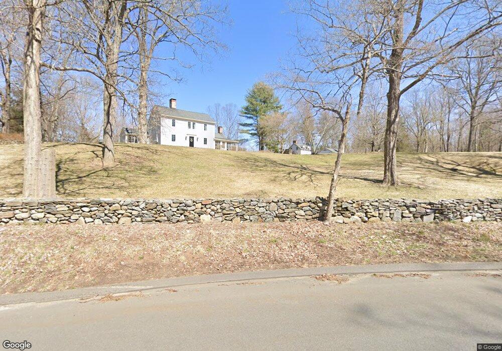
12 Obtuse Rd N Brookfield, CT 06804
Estimated Value: $748,000 - $1,597,000
4
Beds
3
Baths
2,908
Sq Ft
$376/Sq Ft
Est. Value
About This Home
This home is located at 12 Obtuse Rd N, Brookfield, CT 06804 and is currently estimated at $1,092,930, approximately $375 per square foot. 12 Obtuse Rd N is a home located in Fairfield County with nearby schools including Center Elementary School, Whisconier Middle School, and Rio Mesa High School.
Ownership History
Date
Name
Owned For
Owner Type
Purchase Details
Closed on
Jun 1, 2010
Sold by
Jg Prop
Bought by
Denis Jean
Current Estimated Value
Purchase Details
Closed on
Sep 11, 2008
Sold by
Emc Mortgage Corp
Bought by
Mcgorty Gavin
Create a Home Valuation Report for This Property
The Home Valuation Report is an in-depth analysis detailing your home's value as well as a comparison with similar homes in the area
Home Values in the Area
Average Home Value in this Area
Purchase History
| Date | Buyer | Sale Price | Title Company |
|---|---|---|---|
| Denis Jean | $660,000 | -- | |
| Denis Jean | $660,000 | -- | |
| Mcgorty Gavin | $385,000 | -- | |
| Washington Mutual Bank | -- | -- | |
| Washington Mutual Bank | -- | -- |
Source: Public Records
Mortgage History
| Date | Status | Borrower | Loan Amount |
|---|---|---|---|
| Open | Washington Mutual Bank | $510,000 |
Source: Public Records
Tax History Compared to Growth
Tax History
| Year | Tax Paid | Tax Assessment Tax Assessment Total Assessment is a certain percentage of the fair market value that is determined by local assessors to be the total taxable value of land and additions on the property. | Land | Improvement |
|---|---|---|---|---|
| 2025 | $19,792 | $684,150 | $110,310 | $573,840 |
| 2024 | $19,088 | $684,150 | $110,310 | $573,840 |
| 2023 | $18,376 | $684,150 | $110,310 | $573,840 |
| 2022 | $17,706 | $684,150 | $110,310 | $573,840 |
| 2021 | $8,997 | $552,380 | $122,700 | $429,680 |
| 2020 | $16,378 | $552,380 | $122,700 | $429,680 |
| 2019 | $16,096 | $552,380 | $122,700 | $429,680 |
| 2018 | $15,654 | $552,380 | $122,700 | $429,680 |
| 2017 | $15,074 | $552,380 | $122,700 | $429,680 |
| 2016 | $15,023 | $569,060 | $131,110 | $437,950 |
| 2015 | $14,625 | $569,060 | $131,110 | $437,950 |
| 2014 | $14,915 | $580,350 | $131,110 | $449,240 |
Source: Public Records
Map
Nearby Homes
- 6 Lyndenwood Dr
- 44 Obtuse Rd N
- 70 Obtuse Hill Rd
- 19 A Apache Dr
- 99 Obtuse Hill Rd
- 409 Northrop St
- 7 Hearthstone Dr
- 8 Cherokee Dr
- 98A Tower Rd
- 370 Northrop St
- 5 Hidden Brook Dr
- 11 Winding Rd
- 48 High Ridge Rd
- 89 Iron Ore Hill Rd
- 5 Rabbit Ln
- 140 Whisconier Rd
- 21 Lillinonah Dr
- 26 Cove Rd
- 9A Obtuse Rocks Rd
- 27 Obtuse Rd S
- 1 Lyndenwood Dr
- 3 Lyndenwood Dr
- 9 Lyndenwood Dr
- 2 Lyndenwood Dr
- 28 Lyndenwood Dr
- 17 Obtuse Rd N
- 5 Lyndenwood Dr
- 4 Lyndenwood Dr
- 22 Lyndenwood Dr
- 26 Lyndenwood Dr
- 23 Obtuse Rd N
- 15 Obtuse Rd N
- 7 Lyndenwood Dr
- 10 Obtuse Rd N
- 16 Ashwood Ln
- 24 Lyndenwood Dr
- 11 Obtuse Rd N
- 18 Lyndenwood Dr
- 14 Ashwood Ln
- 6 Dorset Ln