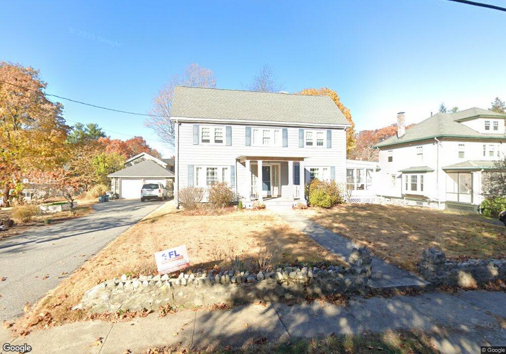
12 Overlook Rd Wakefield, MA 01880
Greenwood NeighborhoodEstimated Value: $859,000 - $1,015,000
4
Beds
3
Baths
2,128
Sq Ft
$446/Sq Ft
Est. Value
About This Home
This home is located at 12 Overlook Rd, Wakefield, MA 01880 and is currently estimated at $949,258, approximately $446 per square foot. 12 Overlook Rd is a home located in Middlesex County with nearby schools including Wakefield Memorial High School, Melrose Montessori School, and St Mary's School.
Ownership History
Date
Name
Owned For
Owner Type
Purchase Details
Closed on
Dec 9, 2024
Sold by
White Paul A and White Joanne
Bought by
White Matthew and White Megan
Current Estimated Value
Purchase Details
Closed on
Feb 7, 1992
Sold by
Grieve George and Grieve Patricia
Bought by
White Paul A and White Joanne
Purchase Details
Closed on
Mar 24, 1988
Sold by
Northeast Equities
Bought by
Grieve George
Purchase Details
Closed on
Aug 18, 1987
Sold by
Brownson Phyllis N
Bought by
Northeast Equities Inc
Create a Home Valuation Report for This Property
The Home Valuation Report is an in-depth analysis detailing your home's value as well as a comparison with similar homes in the area
Home Values in the Area
Average Home Value in this Area
Purchase History
| Date | Buyer | Sale Price | Title Company |
|---|---|---|---|
| White Matthew | -- | None Available | |
| White Matthew | -- | None Available | |
| White Paul A | $216,000 | -- | |
| Grieve George | $275,000 | -- | |
| Northeast Equities Inc | $229,000 | -- |
Source: Public Records
Mortgage History
| Date | Status | Borrower | Loan Amount |
|---|---|---|---|
| Previous Owner | Northeast Equities Inc | $152,000 | |
| Previous Owner | Northeast Equities Inc | $177,000 | |
| Previous Owner | Northeast Equities Inc | $178,000 |
Source: Public Records
Tax History
| Year | Tax Paid | Tax Assessment Tax Assessment Total Assessment is a certain percentage of the fair market value that is determined by local assessors to be the total taxable value of land and additions on the property. | Land | Improvement |
|---|---|---|---|---|
| 2025 | $9,611 | $846,800 | $374,900 | $471,900 |
| 2024 | $8,868 | $788,300 | $348,800 | $439,500 |
| 2023 | $8,634 | $736,100 | $325,500 | $410,600 |
| 2022 | $8,105 | $657,900 | $290,600 | $367,300 |
| 2021 | $8,408 | $660,500 | $265,700 | $394,800 |
| 2020 | $7,908 | $619,300 | $249,100 | $370,200 |
| 2019 | $7,414 | $577,900 | $232,500 | $345,400 |
| 2018 | $7,152 | $552,300 | $222,100 | $330,200 |
| 2017 | $6,726 | $516,200 | $207,600 | $308,600 |
| 2016 | $6,506 | $482,300 | $205,000 | $277,300 |
| 2015 | $6,079 | $451,000 | $191,500 | $259,500 |
| 2014 | $5,624 | $440,100 | $186,800 | $253,300 |
Source: Public Records
Map
Nearby Homes
- 34-36 W Highland Ave
- 23 Ellsworth Ave
- 24 Ellsworth Ave
- 601 Franklin St Unit 2
- 60 Franklin St Unit 60
- 58 Franklin St Unit 58
- 98 Boardman Ave
- 43-51 Albion St Unit C9
- 7 West St
- 51 Melrose St Unit 1C
- 51 Melrose St Unit 1A
- 49 Melrose St Unit 1F
- 9 Ledge St
- 176 Bay State Rd
- 24 Mount Zion Rd
- 11 Ludlow Ave
- 35 Maple Rd
- 8 Crystal St Unit 2
- 8 Crystal St Unit 3
- 12 Lovis Ave
Your Personal Tour Guide
Ask me questions while you tour the home.