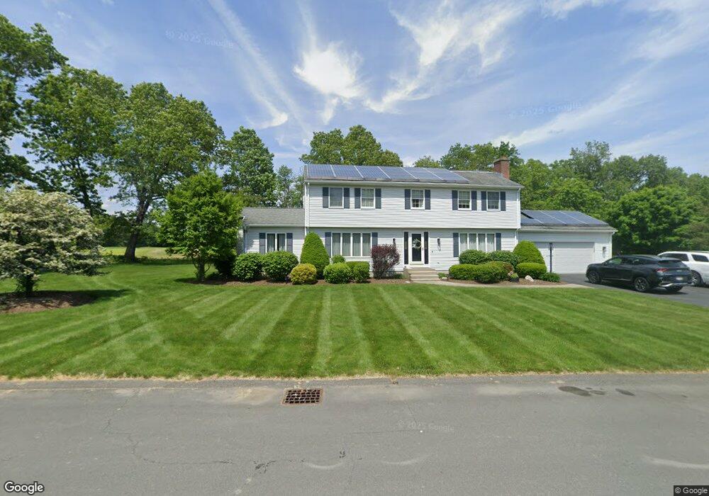
12 Parsons Way Southampton, MA 01073
Estimated Value: $535,000 - $633,000
4
Beds
3
Baths
2,244
Sq Ft
$263/Sq Ft
Est. Value
About This Home
This home is located at 12 Parsons Way, Southampton, MA 01073 and is currently estimated at $590,034, approximately $262 per square foot. 12 Parsons Way is a home located in Hampshire County with nearby schools including William E Norris School, Calvary Baptist Christian School, and White Oak School.
Ownership History
Date
Name
Owned For
Owner Type
Purchase Details
Closed on
May 1, 1997
Sold by
Fortier John C and Fortier Michelle L
Bought by
Batchelder Edward D and Batchelder Ellen L
Current Estimated Value
Create a Home Valuation Report for This Property
The Home Valuation Report is an in-depth analysis detailing your home's value as well as a comparison with similar homes in the area
Home Values in the Area
Average Home Value in this Area
Purchase History
| Date | Buyer | Sale Price | Title Company |
|---|---|---|---|
| Batchelder Edward D | $192,500 | -- |
Source: Public Records
Mortgage History
| Date | Status | Borrower | Loan Amount |
|---|---|---|---|
| Open | Batchelder Edward D | $200,000 | |
| Closed | Batchelder Edward D | $50,000 | |
| Closed | Batchelder Edward D | $35,000 |
Source: Public Records
Tax History Compared to Growth
Tax History
| Year | Tax Paid | Tax Assessment Tax Assessment Total Assessment is a certain percentage of the fair market value that is determined by local assessors to be the total taxable value of land and additions on the property. | Land | Improvement |
|---|---|---|---|---|
| 2025 | $6,891 | $486,300 | $116,300 | $370,000 |
| 2024 | $6,692 | $469,600 | $116,300 | $353,300 |
| 2023 | $6,013 | $419,600 | $116,300 | $303,300 |
| 2022 | $5,913 | $392,400 | $116,600 | $275,800 |
| 2021 | $5,551 | $347,600 | $106,700 | $240,900 |
| 2020 | $5,588 | $353,200 | $106,700 | $246,500 |
| 2019 | $5,434 | $333,200 | $106,700 | $226,500 |
| 2018 | $5,247 | $307,600 | $95,900 | $211,700 |
| 2017 | $5,020 | $307,600 | $95,900 | $211,700 |
| 2015 | $4,748 | $302,200 | $87,200 | $215,000 |
Source: Public Records
Map
Nearby Homes
- 43 Pomeroy Meadow Rd
- 23 Wolcott Rd
- 216 College Hwy
- 17 Glendale Rd
- 68 College Hwy
- Lot 6 Gil Farm Rd
- Lot 5 Gil Farm Rd
- 12 Golden Cir
- 38 College Hwy
- 77 Crooked Ledge Rd
- 7 Quigley Rd
- 0 Glendale Rd
- 40 Strong Rd
- 19 Lead Mine Rd
- 26 Eastwood Ln
- 119 Brickyard Rd
- Lot 5 Brickyard Rd
- LOT 3 Brickyard Rd
- 23 John St
- 16 Pomeroy Meadow Rd