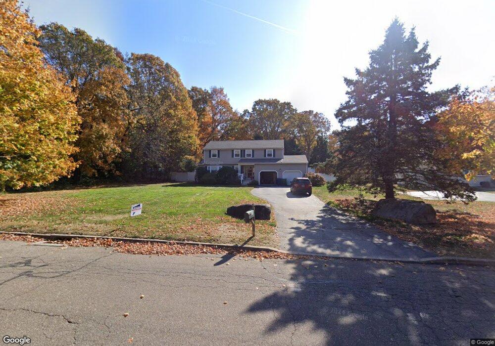
12 Paula Ln Waterford, CT 06385
Estimated Value: $536,000 - $689,000
4
Beds
3
Baths
2,384
Sq Ft
$247/Sq Ft
Est. Value
About This Home
This home is located at 12 Paula Ln, Waterford, CT 06385 and is currently estimated at $589,902, approximately $247 per square foot. 12 Paula Ln is a home located in New London County with nearby schools including Clark Lane Middle School, Waterford High School, and New London High School Multi-Magnet Campus.
Ownership History
Date
Name
Owned For
Owner Type
Purchase Details
Closed on
Oct 12, 1993
Sold by
Anhalt Patrick W
Bought by
Beason William L and Beason Margreet M
Current Estimated Value
Purchase Details
Closed on
Jan 15, 1993
Sold by
Clark Robert E and Clark Cheryl A
Bought by
Anhalt Patrick W
Create a Home Valuation Report for This Property
The Home Valuation Report is an in-depth analysis detailing your home's value as well as a comparison with similar homes in the area
Home Values in the Area
Average Home Value in this Area
Purchase History
| Date | Buyer | Sale Price | Title Company |
|---|---|---|---|
| Beason William L | $195,000 | -- | |
| Anhalt Patrick W | $180,000 | -- |
Source: Public Records
Mortgage History
| Date | Status | Borrower | Loan Amount |
|---|---|---|---|
| Closed | Anhalt Patrick W | $123,200 | |
| Closed | Anhalt Patrick W | $152,400 | |
| Closed | Anhalt Patrick W | $21,900 |
Source: Public Records
Tax History Compared to Growth
Tax History
| Year | Tax Paid | Tax Assessment Tax Assessment Total Assessment is a certain percentage of the fair market value that is determined by local assessors to be the total taxable value of land and additions on the property. | Land | Improvement |
|---|---|---|---|---|
| 2025 | $6,161 | $263,750 | $82,390 | $181,360 |
| 2024 | $5,882 | $263,750 | $82,390 | $181,360 |
| 2023 | $5,592 | $263,750 | $82,390 | $181,360 |
| 2022 | $5,828 | $211,460 | $56,200 | $155,260 |
| 2021 | $5,845 | $211,460 | $56,200 | $155,260 |
| 2020 | $5,893 | $211,460 | $56,200 | $155,260 |
| 2019 | $5,917 | $211,460 | $56,200 | $155,260 |
| 2018 | $5,798 | $211,460 | $56,200 | $155,260 |
| 2017 | $5,860 | $216,800 | $56,200 | $160,600 |
| 2016 | $5,806 | $216,800 | $56,200 | $160,600 |
| 2015 | $5,600 | $216,800 | $56,200 | $160,600 |
| 2014 | $5,377 | $216,800 | $56,200 | $160,600 |
Source: Public Records
Map
Nearby Homes
- 127 Spithead Rd
- 26 Fulmore Dr
- 32 Stoneheights Dr Unit 32
- 24 Stoneheights Dr
- 164 Stoneheights Dr Unit 164
- 9 Arrowhead Trail
- 398 & 402 Boston Post Rd
- 6 Fulmore Dr
- 398 Boston Post Rd
- 9 Rock Ridge Rd
- 310 Boston Post Rd Unit 86
- 27 Mullen Hill Rd
- 182 Oswegatchie Rd
- 5 Wilcox Ct
- 37 Spithead Rd
- 270 Boston Post Rd Unit 22
- 267 Boston Post Rd
- 20 North Rd
- 37 South St
- 163 Oswegatchie Rd