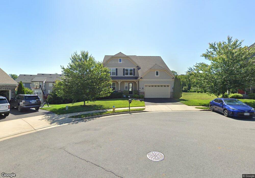
12 Plowshare Ct Stafford, VA 22554
Estimated Value: $723,000 - $823,000
5
Beds
5
Baths
3,366
Sq Ft
$231/Sq Ft
Est. Value
About This Home
This home is located at 12 Plowshare Ct, Stafford, VA 22554 and is currently estimated at $779,102, approximately $231 per square foot. 12 Plowshare Ct is a home located in Stafford County with nearby schools including Winding Creek Elementary School, Rodney E. Thompson Middle School, and Colonial Forge High School.
Ownership History
Date
Name
Owned For
Owner Type
Purchase Details
Closed on
Mar 25, 2022
Sold by
Casey Rogers Barrett
Bought by
Rogers Barrett Casey and Rogers Crystal
Current Estimated Value
Home Financials for this Owner
Home Financials are based on the most recent Mortgage that was taken out on this home.
Original Mortgage
$609,500
Outstanding Balance
$572,583
Interest Rate
4.42%
Mortgage Type
VA
Estimated Equity
$206,519
Purchase Details
Closed on
Mar 16, 2015
Sold by
The Drees Company
Bought by
Rogers Barrett C
Home Financials for this Owner
Home Financials are based on the most recent Mortgage that was taken out on this home.
Original Mortgage
$502,450
Interest Rate
3.67%
Mortgage Type
VA
Create a Home Valuation Report for This Property
The Home Valuation Report is an in-depth analysis detailing your home's value as well as a comparison with similar homes in the area
Home Values in the Area
Average Home Value in this Area
Purchase History
| Date | Buyer | Sale Price | Title Company |
|---|---|---|---|
| Rogers Barrett Casey | -- | Stewart Title Company | |
| Rogers Barrett C | $536,150 | -- |
Source: Public Records
Mortgage History
| Date | Status | Borrower | Loan Amount |
|---|---|---|---|
| Open | Rogers Barrett Casey | $609,500 | |
| Previous Owner | Rogers Barrett C | $502,450 |
Source: Public Records
Tax History Compared to Growth
Tax History
| Year | Tax Paid | Tax Assessment Tax Assessment Total Assessment is a certain percentage of the fair market value that is determined by local assessors to be the total taxable value of land and additions on the property. | Land | Improvement |
|---|---|---|---|---|
| 2025 | -- | $679,700 | $190,000 | $489,700 |
| 2024 | $0 | $679,700 | $190,000 | $489,700 |
| 2023 | $0 | $676,900 | $165,000 | $511,900 |
| 2022 | $2,500 | $676,900 | $165,000 | $511,900 |
| 2021 | $0 | $515,600 | $150,000 | $365,600 |
| 2020 | $0 | $515,600 | $150,000 | $365,600 |
| 2019 | $2,399 | $520,000 | $150,000 | $370,000 |
| 2018 | $0 | $520,000 | $150,000 | $370,000 |
| 2017 | $5,000 | $505,000 | $135,000 | $370,000 |
| 2016 | $5,000 | $505,000 | $135,000 | $370,000 |
| 2015 | -- | $485,300 | $135,000 | $350,300 |
| 2014 | -- | $0 | $0 | $0 |
Source: Public Records
Map
Nearby Homes
- 9 Plowshare Ct
- 103 Thresher Ln Unit 43
- 18 Smelters Trace Rd
- 18 Farmview Dr
- 49 Dog Patch Ln
- 600 Ramoth Church Rd
- 9 Brannigan Dr
- 3 Hemming Dr
- 1 Lakewind Ln
- 175 Infinity Ln
- 185 Infinity Ln
- 1092 Aspen Rd
- 54 Lightfoot Dr
- 1032 Coastal Ave
- 1585 Mountain View Rd
- 8 Winter Wheat Ln
- 991 Coastal Ave
- 138 Courthouse Rd
- 990 Forsythia Ln
- 4 Monument Dr
- 10 Plowshare Ct
- 15 Plowshare Ct
- 52 Shepherds Hook Way
- 50 Shepherds Hook Way
- 48 Shepherds Hook Way
- 48 Shepherds Hook Way
- 46 Shepherds Hook Way
- 8 Plowshare Ct
- 11 Plowshare Ct
- 44 Shepherds Hook Way
- 46 Shepherds Hook Way
- 6 Plowshare Ct
- 7 Plowshare Ct
- 40 Shepherds Hook Way
- 38 Shepherds Hook Way
- 50 Shepherds Hook Way
- 38 Shepherds Hook Way
- 43 Shepherds Hook Way
- 4 Plowshare Ct
- 36 Shepherds Hook Way