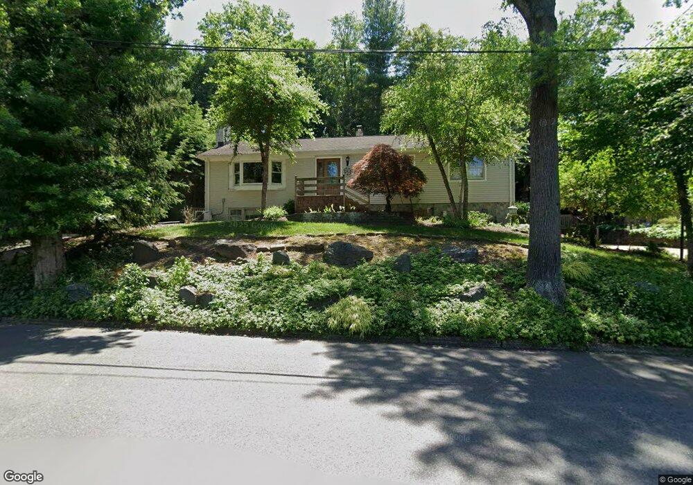
12 Poplar Rd Demarest, NJ 07627
Estimated Value: $1,033,405 - $1,458,000
Studio
--
Bath
1,796
Sq Ft
$673/Sq Ft
Est. Value
About This Home
This home is located at 12 Poplar Rd, Demarest, NJ 07627 and is currently estimated at $1,208,601, approximately $672 per square foot. 12 Poplar Rd is a home located in Bergen County with nearby schools including County Road Elementary School, Demarest Middle School, and Luther Lee Emerson Elementary School.
Ownership History
Date
Name
Owned For
Owner Type
Purchase Details
Closed on
Feb 28, 2013
Sold by
Yiengpruksawan Anusak and Yiengpruksawan Mimi H
Bought by
Abehssera Daniel and Abehssera Diana
Current Estimated Value
Home Financials for this Owner
Home Financials are based on the most recent Mortgage that was taken out on this home.
Original Mortgage
$400,000
Interest Rate
3.54%
Mortgage Type
New Conventional
Purchase Details
Closed on
May 31, 1995
Sold by
Mcdonald Elfrizde Mc
Bought by
Yiengpruksawan Anusak and Yiengprusawan Mimi
Home Financials for this Owner
Home Financials are based on the most recent Mortgage that was taken out on this home.
Original Mortgage
$288,000
Interest Rate
8.21%
Create a Home Valuation Report for This Property
The Home Valuation Report is an in-depth analysis detailing your home's value as well as a comparison with similar homes in the area
Home Values in the Area
Average Home Value in this Area
Purchase History
We collect this data history from publicly available records. To have your information removed, we recommend requesting removal directly through your county’s website.
| Date | Buyer | Sale Price | Title Company |
|---|---|---|---|
| Abehssera Daniel | $500,000 | -- | |
| Yiengpruksawan Anusak | $320,000 | -- |
Source: Public Records
Mortgage History
We collect this data history from publicly available records. To have your information removed, we recommend requesting removal directly through your county’s website.
| Date | Status | Borrower | Loan Amount |
|---|---|---|---|
| Previous Owner | Abehssera Daniel | $400,000 | |
| Previous Owner | Yiengpruksawan Anusak | $288,000 |
Source: Public Records
Tax History
| Year | Tax Paid | Tax Assessment Tax Assessment Total Assessment is a certain percentage of the fair market value that is determined by local assessors to be the total taxable value of land and additions on the property. | Land | Improvement |
|---|---|---|---|---|
| 2025 | $14,643 | $978,300 | $669,700 | $308,600 |
| 2024 | $13,977 | $479,000 | $400,000 | $79,000 |
| 2023 | $13,599 | $479,000 | $400,000 | $79,000 |
| 2022 | $13,599 | $479,000 | $400,000 | $79,000 |
| 2021 | $13,264 | $479,000 | $400,000 | $79,000 |
| 2020 | $12,952 | $479,000 | $400,000 | $79,000 |
| 2019 | $12,579 | $479,000 | $400,000 | $79,000 |
| 2018 | $12,191 | $479,000 | $400,000 | $79,000 |
| 2017 | $11,898 | $479,000 | $400,000 | $79,000 |
| 2016 | $11,712 | $479,000 | $400,000 | $79,000 |
| 2015 | $11,553 | $479,000 | $400,000 | $79,000 |
| 2014 | $13,537 | $573,600 | $421,000 | $152,600 |
Source: Public Records
Map
Nearby Homes
- 16 Poplar Rd
- 55 Forest Rd
- 114 Bellaire Dr
- 311 Bellaire Dr
- 22 Maplewood Rd
- 414 Bellaire Dr
- 85 Orchard Rd
- 11 Stone Bridge Ct
- 24 Stone Bridge Ct
- 2 Stone Bridge Ct
- 56 Northwood Ave
- 713 Bellaire Dr
- 19 Central Ave
- 8 Ranch Ln
- 24 Country Club Way
- 7 Central Ave
- 1 Stone Bridge Ct
- 22 Northwood Ave
- 41 Orchard Rd
- 14 O Shaughnessy Ln
- 296 Hardenburgh Ave
- 304 Hardenburgh Ave
- 292 Hardenburgh Ave
- 8 Poplar Rd
- 297 Hardenburgh Ave
- 293 Hardenburgh Ave
- 284 Hardenburgh Ave
- 291 Hardenburgh Ave
- 7 Poplar Rd
- 303 Hardenburgh Ave
- 306 Hardenburgh Ave
- 289 Hardenburgh Ave
- 15 Poplar Rd
- 285 Hardenburgh Ave
- 102 Lake Rd
- 108 Lake Rd
- 311 Hardenburgh Ave
- 90 Lake Rd
- 19 Poplar Rd
- 112 Lake Rd
Your Personal Tour Guide
Ask me questions while you tour the home.