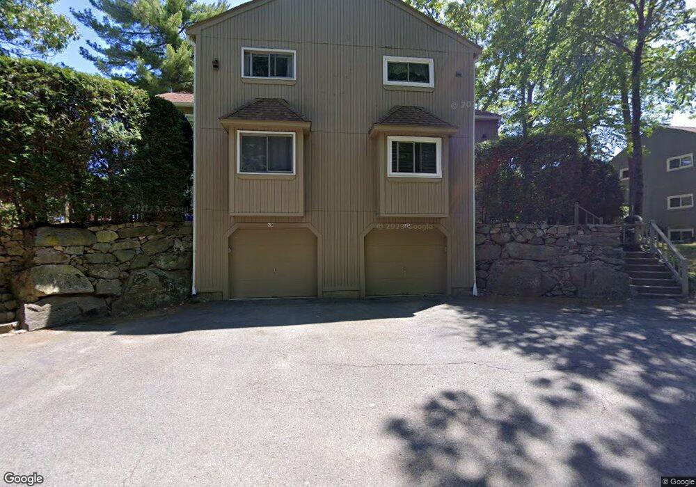
12 Princess Path Uxbridge, MA 01569
Estimated Value: $344,517 - $378,000
2
Beds
2
Baths
1,410
Sq Ft
$255/Sq Ft
Est. Value
About This Home
This home is located at 12 Princess Path, Uxbridge, MA 01569 and is currently estimated at $359,879, approximately $255 per square foot. 12 Princess Path is a home located in Worcester County with nearby schools including Uxbridge High School and Our Lady of the Valley Regional School.
Ownership History
Date
Name
Owned For
Owner Type
Purchase Details
Closed on
Dec 30, 2016
Sold by
Velez Freddie and Velez Delmy J
Bought by
Dodd Christine L
Current Estimated Value
Home Financials for this Owner
Home Financials are based on the most recent Mortgage that was taken out on this home.
Original Mortgage
$181,818
Outstanding Balance
$149,059
Interest Rate
3.94%
Mortgage Type
New Conventional
Estimated Equity
$210,820
Purchase Details
Closed on
Dec 5, 1995
Sold by
White Wendy
Bought by
Velez Freddie and Velez Delmy
Purchase Details
Closed on
Jun 28, 1993
Sold by
Fdic
Bought by
White Wendy
Create a Home Valuation Report for This Property
The Home Valuation Report is an in-depth analysis detailing your home's value as well as a comparison with similar homes in the area
Home Values in the Area
Average Home Value in this Area
Purchase History
| Date | Buyer | Sale Price | Title Company |
|---|---|---|---|
| Dodd Christine L | $180,000 | -- | |
| Velez Freddie | $87,500 | -- | |
| White Wendy | $63,500 | -- |
Source: Public Records
Mortgage History
| Date | Status | Borrower | Loan Amount |
|---|---|---|---|
| Open | Dodd Christine L | $181,818 | |
| Previous Owner | White Wendy | $150,000 | |
| Previous Owner | White Wendy | $126,000 | |
| Previous Owner | White Wendy | $19,000 |
Source: Public Records
Tax History
| Year | Tax Paid | Tax Assessment Tax Assessment Total Assessment is a certain percentage of the fair market value that is determined by local assessors to be the total taxable value of land and additions on the property. | Land | Improvement |
|---|---|---|---|---|
| 2025 | $36 | $274,700 | $0 | $274,700 |
| 2024 | $3,543 | $274,200 | $0 | $274,200 |
| 2023 | $3,178 | $227,800 | $0 | $227,800 |
| 2022 | $3,064 | $202,100 | $0 | $202,100 |
| 2021 | $3,227 | $204,000 | $0 | $204,000 |
| 2020 | $3,259 | $194,700 | $0 | $194,700 |
| 2019 | $3,074 | $177,200 | $0 | $177,200 |
| 2018 | $2,993 | $174,300 | $0 | $174,300 |
| 2017 | $3,034 | $178,900 | $0 | $178,900 |
| 2016 | $3,022 | $172,000 | $0 | $172,000 |
| 2015 | $2,993 | $172,000 | $0 | $172,000 |
Source: Public Records
Map
Nearby Homes
- 197 Crownshield Ave Unit 16B
- 197 Crownshield Ave Unit 16A
- 197 Crownshield Ave Unit 16C
- 79 High St
- 5 Peter St Unit D
- 314 Richardson St
- 16 Farnum St
- 86 Hunter Rd
- 395 High St
- 61 Spring Hill Dr Unit 61
- 376 Douglas St
- 11 Summerfield Dr Unit 11
- 70 Chocolog Rd
- 223 Mendon St
- 24 Olde Canal Way Unit 24
- 145 Mantell Rd
- 169 Mantell Rd
- 137 Mantell Rd
- 127 Old Millville Rd
- 45 Turner Farm Rd
- 10 Princess Path
- 11 Manor House Ln
- 9 Manor House Ln
- 9 Manor House Ln
- 9 Manor House Ln Unit 9
- 12 Princess Path Unit 12
- 9 Manor House Ln Unit 27A
- 9 Manor House Ln Unit 9 21
- 14 Princess Path
- 16 Princess Path
- 15 Manor House Ln
- 13 Manor House Ln
- 13 Manor House Ln Unit 13
- 16 Princess Path Unit 16
- 15 Manor House Ln Unit 15
- 16 Princess Path Unit 28C
- 13 Manor House Ln Unit 28A
- 14 Princess Path Unit 28
- 15 Manor House Ln Unit 28B
- 14 Princess Path Unit 14
Your Personal Tour Guide
Ask me questions while you tour the home.