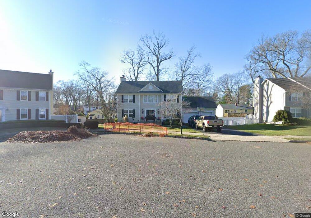
12 Robby Dr Oakhurst, NJ 07755
Estimated Value: $1,033,000 - $1,212,000
3
Beds
2
Baths
2,028
Sq Ft
$547/Sq Ft
Est. Value
About This Home
This home is located at 12 Robby Dr, Oakhurst, NJ 07755 and is currently estimated at $1,108,883, approximately $546 per square foot. 12 Robby Dr is a home located in Monmouth County with nearby schools including Ocean Township High School, Bet Yaakov of the Jersey Shore, and Bnot Shirah of Deal.
Ownership History
Date
Name
Owned For
Owner Type
Purchase Details
Closed on
Dec 6, 2000
Sold by
Hayes Paul
Bought by
Giannotti Michael and Giannotti Cindee
Current Estimated Value
Home Financials for this Owner
Home Financials are based on the most recent Mortgage that was taken out on this home.
Original Mortgage
$200,000
Outstanding Balance
$73,702
Interest Rate
7.7%
Estimated Equity
$1,035,181
Purchase Details
Closed on
Jul 16, 1999
Sold by
S & K Inc
Bought by
Hayes Paul and Hayes Melissa
Home Financials for this Owner
Home Financials are based on the most recent Mortgage that was taken out on this home.
Original Mortgage
$185,000
Interest Rate
7.91%
Create a Home Valuation Report for This Property
The Home Valuation Report is an in-depth analysis detailing your home's value as well as a comparison with similar homes in the area
Home Values in the Area
Average Home Value in this Area
Purchase History
| Date | Buyer | Sale Price | Title Company |
|---|---|---|---|
| Giannotti Michael | $285,000 | -- | |
| Hayes Paul | $252,900 | -- |
Source: Public Records
Mortgage History
| Date | Status | Borrower | Loan Amount |
|---|---|---|---|
| Open | Giannotti Michael | $200,000 | |
| Previous Owner | Hayes Paul | $185,000 |
Source: Public Records
Tax History
| Year | Tax Paid | Tax Assessment Tax Assessment Total Assessment is a certain percentage of the fair market value that is determined by local assessors to be the total taxable value of land and additions on the property. | Land | Improvement |
|---|---|---|---|---|
| 2025 | $13,042 | $1,024,800 | $574,200 | $450,600 |
| 2024 | $11,018 | $914,600 | $536,900 | $377,700 |
Source: Public Records
Map
Nearby Homes
- 453 Harnell Ave
- 197 Delaware Ave
- 185 Pinecrest Rd
- 187 Pinecrest Rd
- 201 Freehold St
- 443 Harnell Ave
- 450 Wells Ave
- 8 Corey Dr
- 489 Freehold St
- 185 Elmwood Rd
- 409 Wells Ave
- 227 Chatham Ave
- 232 Woodcrest Rd
- 186 Whalepond Rd
- 421 W Lincoln Ave
- 243 Woodcrest Rd
- 221 Harrison Ave
- 120 Whalepond Rd
- 35 Shadow Lawn Dr
- 104 Pear St
- 163 Delaware Ave
- 14 Robby Dr
- 10 Robby Dr
- 173 Delaware Ave
- 161 Delaware Ave
- 15 Robby Dr
- 175 Delaware Ave
- 157 Delaware Ave
- 8 Robby Dr
- 188 Highwood Rd
- 473 Garwood St
- 160 Delaware Ave
- 9 Robby Dr
- 179 Delaware Ave
- 179 Delaware Ave Unit WINTER
- 457 Harnell Ave
- 457 Harnell Ave Unit 5
- 11 Chris Place
- 158 Delaware Ave
- 155 Delaware Ave
Your Personal Tour Guide
Ask me questions while you tour the home.