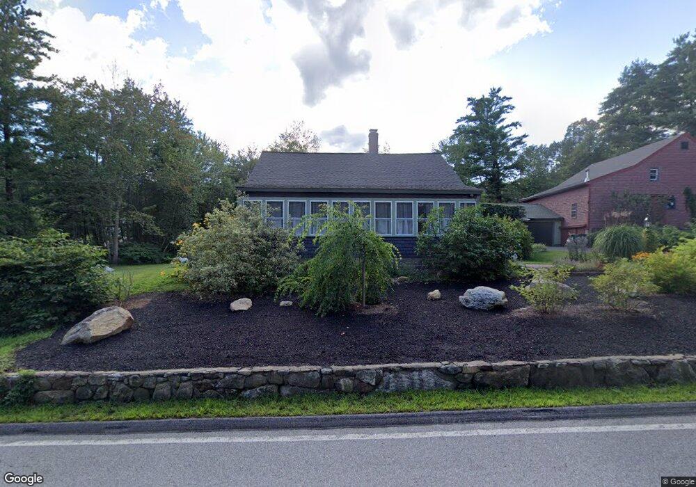
12 S Bow Rd Hooksett, NH 03106
Estimated Value: $488,112 - $569,000
3
Beds
3
Baths
1,407
Sq Ft
$380/Sq Ft
Est. Value
About This Home
This home is located at 12 S Bow Rd, Hooksett, NH 03106 and is currently estimated at $535,278, approximately $380 per square foot. 12 S Bow Rd is a home located in Merrimack County with nearby schools including Fred C. Underhill School, Hooksett Memorial School, and David R. Cawley Middle School.
Ownership History
Date
Name
Owned For
Owner Type
Purchase Details
Closed on
Mar 10, 2016
Sold by
Moszer Barbara L
Bought by
Barbara Tardie Ft and Tardie Barbara L
Current Estimated Value
Purchase Details
Closed on
Jun 19, 2006
Sold by
Koeltzow Timothy E and Koeltzow Dawn W
Bought by
Moszer Barbara L
Home Financials for this Owner
Home Financials are based on the most recent Mortgage that was taken out on this home.
Original Mortgage
$212,800
Interest Rate
6.62%
Purchase Details
Closed on
Jul 10, 2003
Sold by
Cady Thomas R and Cady Suzanne T
Bought by
Koeltzow Timothy E and Koeltzow Dawn W
Home Financials for this Owner
Home Financials are based on the most recent Mortgage that was taken out on this home.
Original Mortgage
$198,000
Interest Rate
5.45%
Create a Home Valuation Report for This Property
The Home Valuation Report is an in-depth analysis detailing your home's value as well as a comparison with similar homes in the area
Home Values in the Area
Average Home Value in this Area
Purchase History
| Date | Buyer | Sale Price | Title Company |
|---|---|---|---|
| Barbara Tardie Ft | -- | -- | |
| Moszer Barbara L | $266,000 | -- | |
| Moszer Barbara L | $266,000 | -- | |
| Koeltzow Timothy E | $220,000 | -- |
Source: Public Records
Mortgage History
| Date | Status | Borrower | Loan Amount |
|---|---|---|---|
| Previous Owner | Koeltzow Timothy E | $166,400 | |
| Previous Owner | Koeltzow Timothy E | $190,412 | |
| Previous Owner | Moszer Barbara L | $212,800 | |
| Previous Owner | Koeltzow Timothy E | $198,000 |
Source: Public Records
Tax History
| Year | Tax Paid | Tax Assessment Tax Assessment Total Assessment is a certain percentage of the fair market value that is determined by local assessors to be the total taxable value of land and additions on the property. | Land | Improvement |
|---|---|---|---|---|
| 2024 | $7,549 | $445,100 | $119,700 | $325,400 |
| 2023 | $7,113 | $445,100 | $119,600 | $325,500 |
| 2022 | $6,441 | $267,800 | $81,800 | $186,000 |
| 2021 | $5,948 | $267,700 | $81,700 | $186,000 |
| 2020 | $7,069 | $267,700 | $81,700 | $186,000 |
| 2019 | $106 | $267,800 | $81,800 | $186,000 |
| 2018 | $6,588 | $267,800 | $81,800 | $186,000 |
| 2017 | $5,476 | $204,800 | $79,600 | $125,200 |
| 2016 | $4,612 | $204,800 | $79,600 | $125,200 |
| 2015 | $5,063 | $204,800 | $79,600 | $125,200 |
| 2014 | $5,085 | $204,800 | $79,600 | $125,200 |
| 2013 | $4,809 | $204,800 | $79,600 | $125,200 |
Source: Public Records
Map
Nearby Homes
- 5 Cross Rd
- 245 W River Rd
- 315 Hackett Hill Rd
- 500 E Dunbarton Rd
- 29 S Bow Dunbarton Rd
- 1601 Hooksett Rd
- 8 Short Ave
- 63 Woodview Way
- 163 Woodview Way Unit 2
- 30 Ledgewood Dr
- 1465 Hooksett Rd Unit 418
- 1465 Hooksett Rd Unit 183
- 1465 Hooksett Rd Unit 390
- 1465 Hooksett Rd Unit 41
- 78 Woodview Way
- 237 Woodview Way
- 2 Brandywine Dr
- 264 Woodview Way
- 25 Forestedge Way Unit 25
- 55 Forestedge Way
Your Personal Tour Guide
Ask me questions while you tour the home.