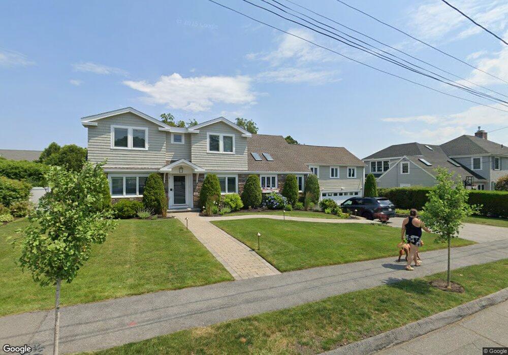
12 Shepard Ave Unit 1 Swampscott, MA 01907
Estimated Value: $1,215,000 - $1,391,000
3
Beds
2
Baths
2,000
Sq Ft
$663/Sq Ft
Est. Value
About This Home
This home is located at 12 Shepard Ave Unit 1, Swampscott, MA 01907 and is currently estimated at $1,326,583, approximately $663 per square foot. 12 Shepard Ave Unit 1 is a home located in Essex County with nearby schools including Swampscott Middle School, Swampscott High School, and Devereux School.
Ownership History
Date
Name
Owned For
Owner Type
Purchase Details
Closed on
Sep 25, 2020
Sold by
Puzzo Stephen R and Puzzo Nicole
Bought by
Nellhaus Daniel B and Nellhaus Marie L
Current Estimated Value
Home Financials for this Owner
Home Financials are based on the most recent Mortgage that was taken out on this home.
Original Mortgage
$684,000
Outstanding Balance
$605,625
Interest Rate
2.9%
Mortgage Type
New Conventional
Estimated Equity
$720,958
Purchase Details
Closed on
Sep 19, 2017
Sold by
Villanueva Rhonda
Bought by
Puzzo Stephen R and Puzzo Nicole
Home Financials for this Owner
Home Financials are based on the most recent Mortgage that was taken out on this home.
Original Mortgage
$50,000
Interest Rate
3.93%
Mortgage Type
New Conventional
Purchase Details
Closed on
Sep 14, 2012
Sold by
Damore Federico and Damore Nancy A
Bought by
Villanueva Rhonda
Purchase Details
Closed on
Oct 7, 2008
Sold by
Zelda C Glott T C and Zelda Glott
Bought by
Damore Federico and Dallalis-Damore Nancy A
Purchase Details
Closed on
Dec 22, 2006
Sold by
Glott Zelda C
Bought by
Glott Tr Cynthia S and Cowan Judith R
Purchase Details
Closed on
May 24, 2005
Sold by
Glott Michael M and Glott Zelda C
Bought by
Glott Zelda C
Create a Home Valuation Report for This Property
The Home Valuation Report is an in-depth analysis detailing your home's value as well as a comparison with similar homes in the area
Home Values in the Area
Average Home Value in this Area
Purchase History
| Date | Buyer | Sale Price | Title Company |
|---|---|---|---|
| Nellhaus Daniel B | $855,000 | None Available | |
| Puzzo Stephen R | $686,000 | -- | |
| Villanueva Rhonda | $550,000 | -- | |
| Villanueva Rhonda | $550,000 | -- | |
| Damore Federico | $460,000 | -- | |
| Damore Federico | $460,000 | -- | |
| Glott Tr Cynthia S | -- | -- | |
| Glott Tr Cynthia S | -- | -- | |
| Glott Zelda C | -- | -- | |
| Glott Zelda C | -- | -- |
Source: Public Records
Mortgage History
| Date | Status | Borrower | Loan Amount |
|---|---|---|---|
| Open | Nellhaus Daniel B | $684,000 | |
| Previous Owner | Puzzo Stephen R | $50,000 | |
| Previous Owner | Glott Zelda C | $376,000 |
Source: Public Records
Tax History Compared to Growth
Tax History
| Year | Tax Paid | Tax Assessment Tax Assessment Total Assessment is a certain percentage of the fair market value that is determined by local assessors to be the total taxable value of land and additions on the property. | Land | Improvement |
|---|---|---|---|---|
| 2025 | $13,352 | $1,164,100 | $473,300 | $690,800 |
| 2024 | $12,097 | $1,052,800 | $453,600 | $599,200 |
| 2023 | $11,351 | $966,900 | $414,100 | $552,800 |
| 2022 | $10,471 | $816,100 | $355,000 | $461,100 |
| 2021 | $10,089 | $731,100 | $295,800 | $435,300 |
| 2020 | $10,049 | $702,700 | $295,800 | $406,900 |
| 2019 | $9,723 | $639,700 | $266,200 | $373,500 |
| 2018 | $10,136 | $633,500 | $266,200 | $367,300 |
| 2017 | $10,362 | $593,800 | $251,400 | $342,400 |
| 2016 | $9,914 | $572,100 | $251,400 | $320,700 |
| 2015 | $9,812 | $572,100 | $251,400 | $320,700 |
| 2014 | $9,288 | $496,700 | $229,200 | $267,500 |
Source: Public Records
Map
Nearby Homes
- 179 Beach Bluff Ave
- 25 Manton Rd
- 48 Bellevue Rd
- 37 Stanley Rd
- 24 Orchard Cir
- 35 Alden Rd
- 212 Humphrey St Unit 205
- 35 Littles Point Rd Unit S201
- 201 Humphrey St Unit 2
- 5 Elmwood Rd
- 19 Elmwood Rd
- 110 Galloupes Point Rd
- 25 Tedesco St
- 9 Tedesco Pond Place Unit 9
- 71 Walnut Rd
- 2 Wilfred Terrace
- 8 Ocean View Rd
- 1006 Paradise Rd Unit 3R
- 1004 Paradise Rd Unit PHJ
- 21 Bay View Dr
- 12 Shepard Ave
- 18 Shepard Ave
- 6 Shepard Ave
- 37 Blodgett Ave
- 7 Blodgett Ave
- 45 Blodgett Ave
- 261 Atlantic Ave
- 27 Blodgett Ave
- 26 Shepard Ave
- 53 Blodgett Ave
- 281 Atlantic Ave
- 272 Atlantic Ave
- 10 Blodgett Ave
- 25 Shepard Ave
- 257 Atlantic Ave
- 42 Blodgett Ave
- 34 Blodgett Ave
- 34 Shepard Ave
- 16 Blodgett Ave
- 48 Blodgett Ave