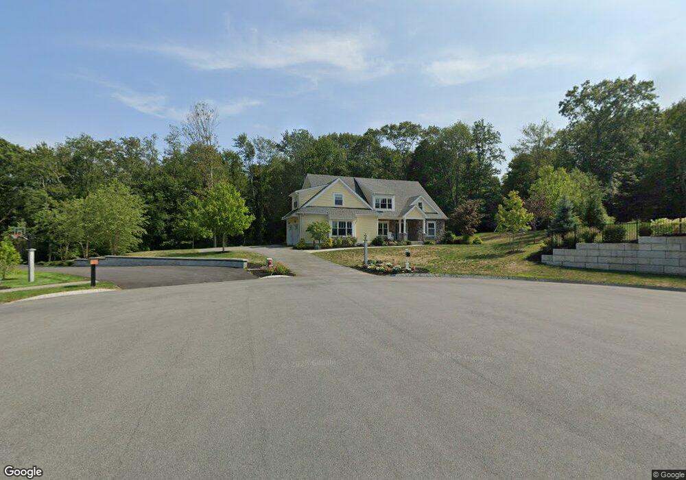
12 Spring Hill Farm Rd Wenham, MA 01984
Estimated Value: $1,657,000 - $2,016,000
4
Beds
3
Baths
4,600
Sq Ft
$395/Sq Ft
Est. Value
About This Home
This home is located at 12 Spring Hill Farm Rd, Wenham, MA 01984 and is currently estimated at $1,816,738, approximately $394 per square foot. 12 Spring Hill Farm Rd is a home located in Essex County with nearby schools including Winthrop School, Cutler Elementary School, and Miles River Middle School.
Ownership History
Date
Name
Owned For
Owner Type
Purchase Details
Closed on
Jun 27, 2019
Sold by
Roell Margaret and Theriault Paul
Bought by
P & P Joint Ret
Current Estimated Value
Purchase Details
Closed on
Apr 24, 2019
Sold by
Spring Hill Ventures Llc
Bought by
Roell Margaret and Roizner Ricardo
Create a Home Valuation Report for This Property
The Home Valuation Report is an in-depth analysis detailing your home's value as well as a comparison with similar homes in the area
Home Values in the Area
Average Home Value in this Area
Purchase History
| Date | Buyer | Sale Price | Title Company |
|---|---|---|---|
| P & P Joint Ret | -- | -- | |
| Roell Margaret | $400,000 | -- |
Source: Public Records
Tax History Compared to Growth
Tax History
| Year | Tax Paid | Tax Assessment Tax Assessment Total Assessment is a certain percentage of the fair market value that is determined by local assessors to be the total taxable value of land and additions on the property. | Land | Improvement |
|---|---|---|---|---|
| 2025 | $24,444 | $1,573,000 | $605,400 | $967,600 |
| 2024 | $23,792 | $1,519,300 | $605,400 | $913,900 |
| 2023 | $20,227 | $1,165,800 | $429,900 | $735,900 |
| 2022 | $23,253 | $1,187,600 | $429,900 | $757,700 |
| 2021 | $23,423 | $1,190,200 | $432,500 | $757,700 |
| 2020 | $8,305 | $438,500 | $438,500 | $0 |
| 2019 | $4,271 | $237,000 | $237,000 | $0 |
Source: Public Records
Map
Nearby Homes
- 10 Spring Hill Farm Rd
- 8 Thaxton Rd
- 13 Spring Hill Farm Rd
- 1 Angus Cir
- 11 Spring Hill Farm Rd
- 11 Spring Hill Farm Rd
- 10 Thaxton Rd
- 15 Spring Hill Farm Rd
- 8 Spring Hill Farm Rd
- 41 Old Planters Rd
- 11 Thaxton Rd
- 9 Spring Hill Farm Rd
- 2 Angus Cir
- 5 Thaxton Rd
- 39 Old Planters Rd
- 6 Thaxton Rd
- 1 Windham Ln
- 2 Windham Ln
- 63 Dodges Row
- 65 Dodges Row