Estimated Value: $636,000 - $782,000
3
Beds
1
Bath
1,170
Sq Ft
$619/Sq Ft
Est. Value
About This Home
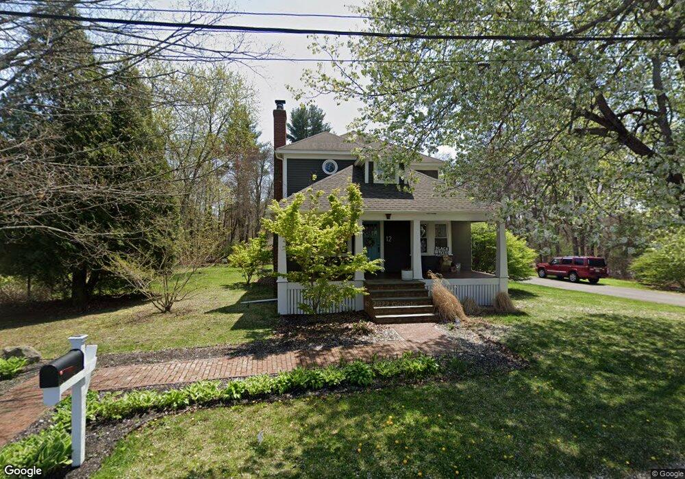
This home is located at 12 Sylvia St, Acton, MA 01720 and is currently estimated at $724,486, approximately $619 per square foot. 12 Sylvia St is a home located in Middlesex County with nearby schools including Acton-Boxborough Regional High School, Maynard Knowledge Beginnings, and The Imago School.
Ownership History
Date
Name
Owned For
Owner Type
Purchase Details
Closed on
May 1, 2008
Sold by
Gaebel Georgina R
Bought by
Vancleef Elizabeth and Quinn Peter S
Current Estimated Value
Home Financials for this Owner
Home Financials are based on the most recent Mortgage that was taken out on this home.
Original Mortgage
$392,400
Outstanding Balance
$249,931
Interest Rate
5.99%
Mortgage Type
Purchase Money Mortgage
Estimated Equity
$474,555
Create a Home Valuation Report for This Property
The Home Valuation Report is an in-depth analysis detailing your home's value as well as a comparison with similar homes in the area
Home Values in the Area
Average Home Value in this Area
Purchase History
| Date | Buyer | Sale Price | Title Company |
|---|---|---|---|
| Vancleef Elizabeth | $310,000 | -- |
Source: Public Records
Mortgage History
| Date | Status | Borrower | Loan Amount |
|---|---|---|---|
| Open | Vancleef Elizabeth | $392,400 |
Source: Public Records
Tax History Compared to Growth
Tax History
| Year | Tax Paid | Tax Assessment Tax Assessment Total Assessment is a certain percentage of the fair market value that is determined by local assessors to be the total taxable value of land and additions on the property. | Land | Improvement |
|---|---|---|---|---|
| 2025 | $10,295 | $600,300 | $273,800 | $326,500 |
| 2024 | $9,492 | $569,400 | $273,800 | $295,600 |
| 2023 | $9,560 | $544,400 | $248,800 | $295,600 |
| 2022 | $9,861 | $507,000 | $216,300 | $290,700 |
| 2021 | $8,942 | $442,000 | $200,100 | $241,900 |
| 2020 | $8,504 | $442,000 | $200,100 | $241,900 |
| 2019 | $8,161 | $421,300 | $200,100 | $221,200 |
| 2018 | $7,368 | $380,200 | $200,100 | $180,100 |
| 2017 | $7,247 | $380,200 | $200,100 | $180,100 |
| 2016 | $7,311 | $380,200 | $200,100 | $180,100 |
| 2015 | $7,028 | $368,900 | $200,100 | $168,800 |
| 2014 | $6,860 | $352,700 | $200,100 | $152,600 |
Source: Public Records
Map
Nearby Homes
- 40 High St
- 12 Brewster Ln
- 19 Railroad St Unit C2
- 131 Main St
- 129 Main St Unit 129
- 129 Main St
- 128 Audubon Dr
- 86 School St
- 169 Main St
- 70 River St
- 20 Tremont St
- 7 King St
- 8 Laurel Ct
- 220 Red Acre Rd
- 118 Parker St Unit 16
- 128 Parker St Unit 3B
- 12 Nick Ln
- 132 Parker St Unit G5
- 12 Walcott St
- 1 Maillet Dr