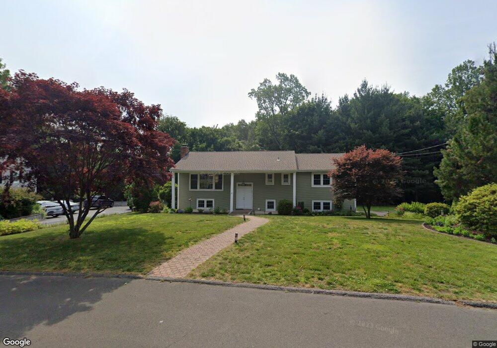
12 Tally Dr Norwalk, CT 06851
East Norwalk NeighborhoodEstimated Value: $764,000 - $827,758
4
Beds
2
Baths
1,563
Sq Ft
$502/Sq Ft
Est. Value
About This Home
This home is located at 12 Tally Dr, Norwalk, CT 06851 and is currently estimated at $784,690, approximately $502 per square foot. 12 Tally Dr is a home located in Fairfield County with nearby schools including King's Highway Elementary School, Coleytown Middle School, and Staples High School.
Ownership History
Date
Name
Owned For
Owner Type
Purchase Details
Closed on
Apr 17, 2024
Sold by
Vallejo Camille
Bought by
Camille Vallejo T and Camille Vallejo
Current Estimated Value
Purchase Details
Closed on
Jul 1, 1998
Sold by
Ivanko Richard D and Ivanko Jacqueline
Bought by
Vallejo Camille
Create a Home Valuation Report for This Property
The Home Valuation Report is an in-depth analysis detailing your home's value as well as a comparison with similar homes in the area
Home Values in the Area
Average Home Value in this Area
Purchase History
| Date | Buyer | Sale Price | Title Company |
|---|---|---|---|
| Camille Vallejo T | -- | None Available | |
| Camille Vallejo T | -- | None Available | |
| Camille Vallejo T | -- | None Available | |
| Vallejo Camille | $279,000 | -- | |
| Vallejo Camille | $279,000 | -- |
Source: Public Records
Mortgage History
| Date | Status | Borrower | Loan Amount |
|---|---|---|---|
| Previous Owner | Vallejo Camille | $324,000 | |
| Previous Owner | Vallejo Camille | $338,700 | |
| Previous Owner | Vallejo Camille | $350,000 |
Source: Public Records
Tax History Compared to Growth
Tax History
| Year | Tax Paid | Tax Assessment Tax Assessment Total Assessment is a certain percentage of the fair market value that is determined by local assessors to be the total taxable value of land and additions on the property. | Land | Improvement |
|---|---|---|---|---|
| 2025 | $9,820 | $410,110 | $178,420 | $231,690 |
| 2024 | $9,675 | $410,110 | $178,420 | $231,690 |
| 2023 | $8,007 | $318,220 | $133,820 | $184,400 |
| 2022 | $7,857 | $318,220 | $133,820 | $184,400 |
| 2021 | $7,653 | $318,220 | $133,820 | $184,400 |
| 2020 | $7,649 | $318,220 | $133,820 | $184,400 |
| 2019 | $7,435 | $318,220 | $133,820 | $184,400 |
| 2018 | $7,634 | $286,320 | $146,450 | $139,870 |
| 2017 | $7,372 | $286,320 | $146,450 | $139,870 |
| 2016 | $7,301 | $286,320 | $146,450 | $139,870 |
| 2015 | $7,281 | $286,320 | $146,450 | $139,870 |
| 2014 | $7,187 | $286,320 | $146,450 | $139,870 |
Source: Public Records
Map
Nearby Homes
- 44 King St
- 14 Strathmore Ln
- 26 Treadwell Ave
- 80 County St Unit 9K
- 80 County St Unit 1U
- 80 County St Unit 11K
- 31 Franklin St
- 42 Kings Hwy S
- 324 Strawberry Hill Ave Unit B104
- 100 Wolfpit Ave Unit 2
- 11 Manitou Ct
- 16 Katy Ln
- 32 Heather Ln
- 142 Wolfpit Ave
- 13 Orchard Hill Rd
- 33 Assisi Way
- 71 Saddle Rd
- 5 Franklin Ave
- 3 Laurel Ln
- 11 Margaret St