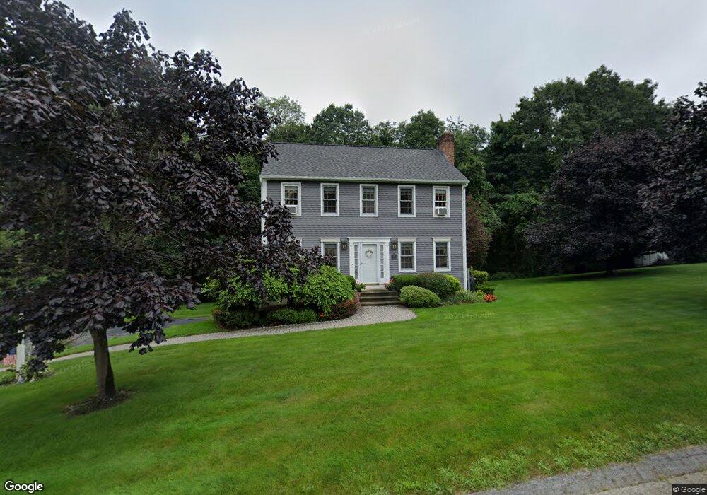
12 Ten Rod Rd Rutland, MA 01543
Estimated Value: $529,521 - $602,000
3
Beds
2
Baths
1,608
Sq Ft
$349/Sq Ft
Est. Value
About This Home
This home is located at 12 Ten Rod Rd, Rutland, MA 01543 and is currently estimated at $561,630, approximately $349 per square foot. 12 Ten Rod Rd is a home located in Worcester County with nearby schools including Wachusett Regional High School.
Create a Home Valuation Report for This Property
The Home Valuation Report is an in-depth analysis detailing your home's value as well as a comparison with similar homes in the area
Home Values in the Area
Average Home Value in this Area
Tax History Compared to Growth
Tax History
| Year | Tax Paid | Tax Assessment Tax Assessment Total Assessment is a certain percentage of the fair market value that is determined by local assessors to be the total taxable value of land and additions on the property. | Land | Improvement |
|---|---|---|---|---|
| 2025 | $6,375 | $447,700 | $121,600 | $326,100 |
| 2024 | $5,873 | $396,000 | $113,700 | $282,300 |
| 2023 | $5,371 | $391,500 | $107,200 | $284,300 |
| 2022 | $5,026 | $318,300 | $89,000 | $229,300 |
| 2021 | $5,058 | $302,900 | $96,500 | $206,400 |
| 2020 | $4,943 | $280,700 | $86,300 | $194,400 |
| 2019 | $4,775 | $266,900 | $74,600 | $192,300 |
| 2018 | $4,610 | $254,300 | $74,600 | $179,700 |
| 2017 | $4,659 | $254,300 | $74,600 | $179,700 |
| 2016 | $4,379 | $252,100 | $75,100 | $177,000 |
| 2015 | $4,335 | $245,600 | $75,100 | $170,500 |
| 2014 | $4,202 | $245,600 | $75,100 | $170,500 |
Source: Public Records
Map
Nearby Homes
- 6 Ten Rod Rd
- 32 Pommogussett Rd Unit 1
- 11 Valley View Cir
- 35 Laurelwood Rd
- 21 Lewis St
- 11 Lewis St
- 23 Miles Rd
- 289 Main St
- 27 Lewis St
- 12 Lewis St
- 6 Lewis St
- 10 Soucy Dr
- 3 Forest Hill Dr
- 2 Forest Hill Dr
- 6 Hickory Dr
- 8 Fidelity Dr Unit 4
- 130 Fidelity Dr Unit 65
- 132 Fidelity Dr Unit 61
- 15 Summer Hill Dr
- 17 Clealand Cir