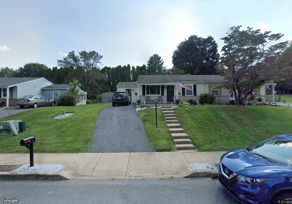
12 Turnbridge Dr Lancaster, PA 17603
Meadia Heights NeighborhoodEstimated Value: $217,000 - $261,000
2
Beds
1
Bath
750
Sq Ft
$314/Sq Ft
Est. Value
About This Home
This home is located at 12 Turnbridge Dr, Lancaster, PA 17603 and is currently estimated at $235,854, approximately $314 per square foot. 12 Turnbridge Dr is a home located in Lancaster County with nearby schools including Elizabeth R Martin Elementary School, Wheatland Middle School, and McCaskey High School.
Ownership History
Date
Name
Owned For
Owner Type
Purchase Details
Closed on
Jul 2, 2016
Sold by
Gantz Cassius S
Bought by
Grantz Cassius S and Grantz Candee L
Current Estimated Value
Purchase Details
Closed on
Nov 29, 2007
Sold by
Erb Adam and Erb Janelle
Bought by
Gantz Cassius S
Home Financials for this Owner
Home Financials are based on the most recent Mortgage that was taken out on this home.
Original Mortgage
$126,900
Interest Rate
6.48%
Mortgage Type
Purchase Money Mortgage
Create a Home Valuation Report for This Property
The Home Valuation Report is an in-depth analysis detailing your home's value as well as a comparison with similar homes in the area
Home Values in the Area
Average Home Value in this Area
Purchase History
| Date | Buyer | Sale Price | Title Company |
|---|---|---|---|
| Grantz Cassius S | -- | None Available | |
| Gantz Cassius S | $126,900 | None Available |
Source: Public Records
Mortgage History
| Date | Status | Borrower | Loan Amount |
|---|---|---|---|
| Previous Owner | Gantz Cassius S | $126,900 |
Source: Public Records
Tax History
| Year | Tax Paid | Tax Assessment Tax Assessment Total Assessment is a certain percentage of the fair market value that is determined by local assessors to be the total taxable value of land and additions on the property. | Land | Improvement |
|---|---|---|---|---|
| 2025 | $2,743 | $95,100 | $30,500 | $64,600 |
| 2024 | $2,743 | $95,100 | $30,500 | $64,600 |
| 2023 | $2,679 | $95,100 | $30,500 | $64,600 |
| 2022 | $2,520 | $95,100 | $30,500 | $64,600 |
| 2021 | $2,444 | $95,100 | $30,500 | $64,600 |
| 2020 | $2,444 | $95,100 | $30,500 | $64,600 |
| 2019 | $2,392 | $95,100 | $30,500 | $64,600 |
| 2018 | $1,591 | $95,100 | $30,500 | $64,600 |
| 2017 | $2,426 | $74,200 | $26,300 | $47,900 |
| 2016 | $2,381 | $74,200 | $26,300 | $47,900 |
| 2015 | $322 | $74,200 | $26,300 | $47,900 |
| 2014 | $1,552 | $74,200 | $26,300 | $47,900 |
Source: Public Records
Map
Nearby Homes
- 17 Pickford Dr
- 1596 New Danville Pike
- 371 Dickens Dr
- 270 Kentshire Dr
- 268 Kentshire Dr
- 337 Eckman Rd
- 6 Myrtlewood Ct
- 1827 Divot Ct
- 1953 Willow Street Pike
- 206 Meadia Ave
- 825 S Pearl St
- 217 Weatherfield Place
- 121 Hillard
- 118 Hillard
- 110 Hillard
- 636 Bean Hill Rd
- 706 Fairview Ave
- 846 Marjory Terrace
- 870 Hilton Dr
- 449 Hershey Ave
- 14 Turnbridge Dr
- 10 Turnbridge Dr
- 16 Turnbridge Dr
- 8 Turnbridge Dr
- 18 Turnbridge Dr
- 15 Hoover Rd
- 17 Hoover Rd
- 15 Turnbridge Dr
- 13 Turnbridge Dr
- 6 Turnbridge Dr
- 20 Turnbridge Dr
- 13 Hoover Rd
- 19 Turnbridge Dr
- 21 Hoover Rd
- 11 Turnbridge Dr
- 22 Turnbridge Dr
- 4 Turnbridge Dr
- 6 Stockbridge Cir
- 1 Grafton Cir
- 9 Hoover Rd
Your Personal Tour Guide
Ask me questions while you tour the home.