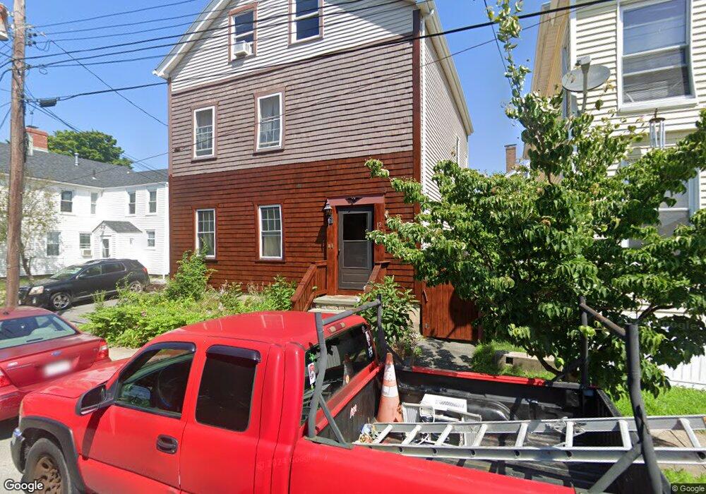
12 Union St Fairhaven, MA 02719
Estimated Value: $410,000 - $551,411
4
Beds
2
Baths
2,564
Sq Ft
$188/Sq Ft
Est. Value
About This Home
This home is located at 12 Union St, Fairhaven, MA 02719 and is currently estimated at $481,353, approximately $187 per square foot. 12 Union St is a home located in Bristol County with nearby schools including Fairhaven High School, City On A Hill Charter Public School New Bedford, and St. Joseph School.
Ownership History
Date
Name
Owned For
Owner Type
Purchase Details
Closed on
Jun 11, 2002
Sold by
Lengo Rlty Corp
Bought by
Surprenant Roger E and Surprenant Mary E
Current Estimated Value
Home Financials for this Owner
Home Financials are based on the most recent Mortgage that was taken out on this home.
Original Mortgage
$108,000
Outstanding Balance
$45,955
Interest Rate
6.9%
Mortgage Type
Purchase Money Mortgage
Estimated Equity
$435,398
Create a Home Valuation Report for This Property
The Home Valuation Report is an in-depth analysis detailing your home's value as well as a comparison with similar homes in the area
Home Values in the Area
Average Home Value in this Area
Purchase History
| Date | Buyer | Sale Price | Title Company |
|---|---|---|---|
| Surprenant Roger E | $145,000 | -- |
Source: Public Records
Mortgage History
| Date | Status | Borrower | Loan Amount |
|---|---|---|---|
| Open | Surprenant Roger E | $56,373 | |
| Open | Surprenant Roger E | $108,000 |
Source: Public Records
Tax History
| Year | Tax Paid | Tax Assessment Tax Assessment Total Assessment is a certain percentage of the fair market value that is determined by local assessors to be the total taxable value of land and additions on the property. | Land | Improvement |
|---|---|---|---|---|
| 2025 | $42 | $453,500 | $235,300 | $218,200 |
| 2024 | $4,117 | $446,000 | $235,300 | $210,700 |
| 2023 | $3,963 | $398,300 | $203,000 | $195,300 |
| 2022 | $3,744 | $366,300 | $184,900 | $181,400 |
| 2021 | $3,673 | $325,300 | $168,100 | $157,200 |
| 2020 | $3,598 | $325,300 | $168,100 | $157,200 |
| 2019 | $3,577 | $306,500 | $144,000 | $162,500 |
| 2018 | $3,402 | $289,500 | $137,000 | $152,500 |
| 2017 | $3,262 | $270,900 | $131,900 | $139,000 |
| 2016 | $3,116 | $255,800 | $129,300 | $126,500 |
| 2015 | $3,070 | $252,700 | $129,300 | $123,400 |
Source: Public Records
Map
Nearby Homes
Your Personal Tour Guide
Ask me questions while you tour the home.