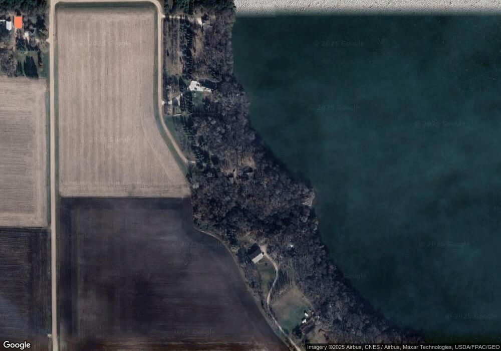
12 W Wilmert Lake Dr Fairmont, MN 56031
Estimated Value: $475,000 - $664,010
4
Beds
3
Baths
2,486
Sq Ft
$242/Sq Ft
Est. Value
About This Home
This home is located at 12 W Wilmert Lake Dr, Fairmont, MN 56031 and is currently estimated at $600,753, approximately $241 per square foot. 12 W Wilmert Lake Dr is a home located in Martin County with nearby schools including Fairmont Elementary School and Fairmont Junior/Senior High School.
Ownership History
Date
Name
Owned For
Owner Type
Purchase Details
Closed on
Dec 1, 2006
Sold by
Pirie Robert S and Pirie Heidi J
Bought by
Jespen Michel R and Jespen Karen K
Current Estimated Value
Home Financials for this Owner
Home Financials are based on the most recent Mortgage that was taken out on this home.
Original Mortgage
$368,323
Interest Rate
6.4%
Mortgage Type
Purchase Money Mortgage
Create a Home Valuation Report for This Property
The Home Valuation Report is an in-depth analysis detailing your home's value as well as a comparison with similar homes in the area
Home Values in the Area
Average Home Value in this Area
Purchase History
| Date | Buyer | Sale Price | Title Company |
|---|---|---|---|
| Jespen Michel R | $365,000 | None Available |
Source: Public Records
Mortgage History
| Date | Status | Borrower | Loan Amount |
|---|---|---|---|
| Closed | Jespen Michel R | $368,323 |
Source: Public Records
Tax History Compared to Growth
Tax History
| Year | Tax Paid | Tax Assessment Tax Assessment Total Assessment is a certain percentage of the fair market value that is determined by local assessors to be the total taxable value of land and additions on the property. | Land | Improvement |
|---|---|---|---|---|
| 2025 | $5,130 | $627,000 | $169,600 | $457,400 |
| 2024 | $4,548 | $637,900 | $159,600 | $478,300 |
| 2023 | $4,436 | $601,500 | $159,600 | $441,900 |
| 2022 | $3,746 | $518,400 | $159,600 | $358,800 |
| 2021 | $3,532 | $407,600 | $141,400 | $266,200 |
| 2020 | $3,746 | $404,900 | $141,400 | $263,500 |
| 2019 | $3,804 | $398,900 | $135,400 | $263,500 |
| 2018 | $3,326 | $338,700 | $75,100 | $263,600 |
| 2017 | $3,134 | $328,500 | $73,533 | $254,967 |
| 2016 | $3,002 | $328,700 | $73,534 | $255,166 |
| 2015 | $2,657 | $328,700 | $73,534 | $255,166 |
| 2013 | $2,919 | $289,500 | $46,061 | $243,439 |
Source: Public Records
Map
Nearby Homes
- 775 200th Ave
- 276 180th Ave
- Lot 5 200th Ave
- Lot 1 200th Ave
- Lot 2 200th Ave
- Lot 3 200th Ave
- Lot 4 200th Ave
- Lot 6 200th Ave
- 1910 Knollwood Dr
- 2413 Albion Ave
- 2224 Red Bird Ln
- 2218 Red Bird Ln
- 2214 Red Bird Ln
- 2109 95th St
- 0 Co Rd 39 190th Ave
- 190th Ave
- 1011 Iowa 15
- 1600 S Prairie Ave
- 625 625 Heritage Ct
- 954 Liberty Ln
- 6 W Wilmert Lake Dr
- 8 W Wilmert Lake Dr
- 14 W Wilmert Lake Dr
- 18 W Wilmert Lake Dr
- 4 W Wilmert Lake Dr
- 8 Miedtke Ln
- 2 W Wilmert Lake Dr
- 568 190th Ave
- 545 190th Ave
- 549 190th Ave
- 2 Forgotten Lake Rd
- 1966 50th St
- 464 Cottonwood Rd
- 6 Forgotten Lake Rd
- 8 Forgotten Lake Rd
- 1835 50th St
- 10 Forgotten Lake Rd
- 439 Cottonwood Rd
- 1936 60th St
