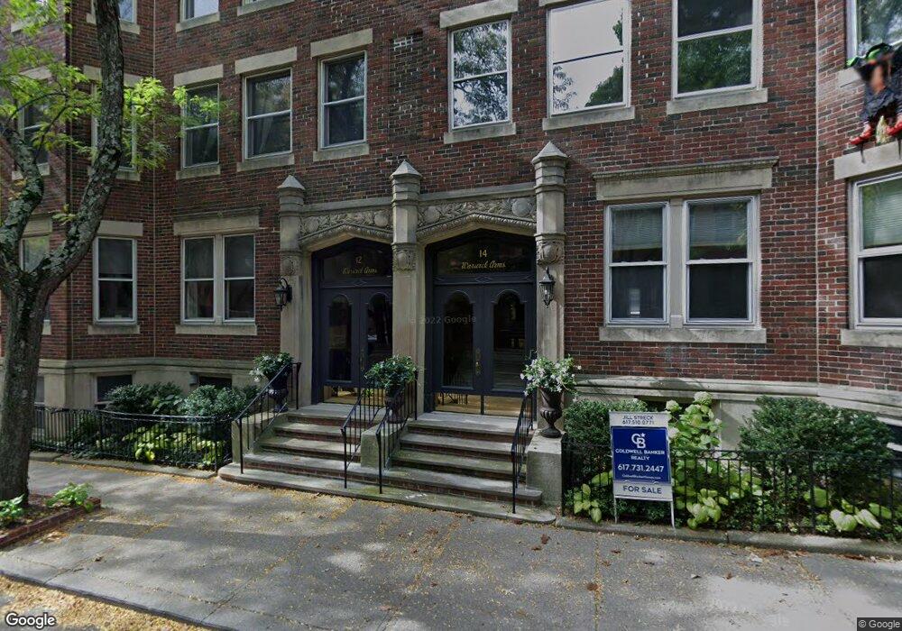
12 Warwick Rd Unit 3 12 Brookline, MA 02445
Washington Square NeighborhoodEstimated Value: $1,479,302 - $1,588,000
3
Beds
2
Baths
2,105
Sq Ft
$723/Sq Ft
Est. Value
About This Home
This home is located at 12 Warwick Rd Unit 3 12, Brookline, MA 02445 and is currently estimated at $1,521,576, approximately $722 per square foot. 12 Warwick Rd Unit 3 12 is a home located in Norfolk County with nearby schools including John D. Runkle School, Torah Academy, and Bais Yaakov Of Boston High School.
Ownership History
Date
Name
Owned For
Owner Type
Purchase Details
Closed on
Mar 18, 2005
Sold by
Spivack Carla
Bought by
Migpaie Rt
Current Estimated Value
Purchase Details
Closed on
Oct 15, 1998
Sold by
Kostick Walda N
Bought by
Spivack Charlotte K
Home Financials for this Owner
Home Financials are based on the most recent Mortgage that was taken out on this home.
Original Mortgage
$268,000
Interest Rate
6.8%
Mortgage Type
Purchase Money Mortgage
Create a Home Valuation Report for This Property
The Home Valuation Report is an in-depth analysis detailing your home's value as well as a comparison with similar homes in the area
Home Values in the Area
Average Home Value in this Area
Purchase History
| Date | Buyer | Sale Price | Title Company |
|---|---|---|---|
| Migpaie Rt | $712,500 | -- | |
| Spivack Charlotte K | $335,000 | -- |
Source: Public Records
Mortgage History
| Date | Status | Borrower | Loan Amount |
|---|---|---|---|
| Previous Owner | Spivack Charlotte K | $268,000 | |
| Previous Owner | Spivack Charlotte K | $60,000 |
Source: Public Records
Tax History Compared to Growth
Tax History
| Year | Tax Paid | Tax Assessment Tax Assessment Total Assessment is a certain percentage of the fair market value that is determined by local assessors to be the total taxable value of land and additions on the property. | Land | Improvement |
|---|---|---|---|---|
| 2025 | $13,420 | $1,359,700 | $0 | $1,359,700 |
| 2024 | $12,260 | $1,254,900 | $0 | $1,254,900 |
| 2023 | $12,845 | $1,288,400 | $0 | $1,288,400 |
| 2022 | $12,872 | $1,263,200 | $0 | $1,263,200 |
| 2021 | $12,257 | $1,250,700 | $0 | $1,250,700 |
| 2020 | $11,703 | $1,238,400 | $0 | $1,238,400 |
| 2019 | $11,051 | $1,179,400 | $0 | $1,179,400 |
| 2018 | $9,782 | $1,034,000 | $0 | $1,034,000 |
| 2017 | $9,459 | $957,400 | $0 | $957,400 |
| 2016 | $9,070 | $870,400 | $0 | $870,400 |
| 2015 | $8,329 | $779,900 | $0 | $779,900 |
| 2014 | $8,056 | $707,300 | $0 | $707,300 |
Source: Public Records
Map
Nearby Homes
- 3 Englewood Ave Unit 9
- 1856 Beacon St Unit 2C
- 1778 Beacon St Unit 302
- 37 Englewood Ave Unit 3
- 8 Strathmore Rd Unit G
- 1880 Beacon St Unit 6
- 47 Englewood Ave
- 17 Strathmore Rd Unit 2
- 1763 Beacon St Unit A
- 140 Kilsyth Rd Unit 8
- 141 Beaconsfield Rd Unit 6
- 65 Strathmore Rd Unit 49
- 135 Beaconsfield Rd Unit 1
- 24 Selkirk Rd Unit 24-4
- 1731 Beacon St Unit 717
- 1731 Beacon St Unit 1502
- 333 Clark Rd
- 31 Orkney Rd Unit 54
- 41 Orkney Rd
- 1666 Commonwealth Ave Unit 24
- 12 Warwick Rd Unit 3
- 12 Warwick Rd Unit 2
- 12 Warwick Rd Unit 1
- 14 Warwick Rd Unit 3
- 14 Warwick Rd Unit 2
- 14 Warwick Rd Unit 1
- 14 Warwick Rd Unit 14-2
- 16 Warwick Rd Unit B
- 16 Warwick Rd Unit 3
- 16 Warwick Rd Unit 2
- 16 Warwick Rd Unit 1
- 1796 Beacon St Unit 2
- 1796 Beacon St
- 1796 Beacon St Unit 1
- 1800 Beacon St
- 1800 Beacon St Unit 2
- 1800 Beacon St Unit 3
- 1800 Beacon St Unit 1
- 1798 Beacon St
- 1798 Beacon St Unit B4