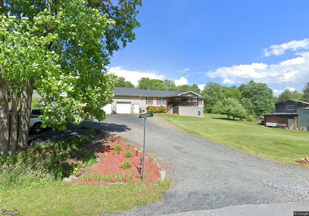
12 Whippoorwill Dr Burnsville, NC 28714
Estimated Value: $323,000 - $463,381
3
Beds
2
Baths
2,025
Sq Ft
$210/Sq Ft
Est. Value
About This Home
This home is located at 12 Whippoorwill Dr, Burnsville, NC 28714 and is currently estimated at $424,595, approximately $209 per square foot. 12 Whippoorwill Dr is a home located in Yancey County with nearby schools including Mountain Heritage High School and Genesis Academy.
Ownership History
Date
Name
Owned For
Owner Type
Purchase Details
Closed on
Sep 18, 2024
Sold by
Queen Shawn Michael
Bought by
Queen Heather
Current Estimated Value
Purchase Details
Closed on
Mar 5, 2015
Sold by
Young Geraldine S
Bought by
Young David D
Purchase Details
Closed on
Apr 24, 2003
Bought by
Young David D and Young Geraldine S
Create a Home Valuation Report for This Property
The Home Valuation Report is an in-depth analysis detailing your home's value as well as a comparison with similar homes in the area
Home Values in the Area
Average Home Value in this Area
Purchase History
| Date | Buyer | Sale Price | Title Company |
|---|---|---|---|
| Queen Heather | -- | None Listed On Document | |
| Young David D | -- | None Available | |
| Young David D | $2,000 | -- |
Source: Public Records
Tax History Compared to Growth
Tax History
| Year | Tax Paid | Tax Assessment Tax Assessment Total Assessment is a certain percentage of the fair market value that is determined by local assessors to be the total taxable value of land and additions on the property. | Land | Improvement |
|---|---|---|---|---|
| 2025 | $2,071 | $351,000 | $115,000 | $236,000 |
| 2024 | $2,071 | $351,000 | $115,000 | $236,000 |
| 2023 | $1,393 | $207,890 | $41,500 | $166,390 |
| 2022 | $1,365 | $207,890 | $41,500 | $166,390 |
| 2021 | $1,393 | $207,890 | $41,500 | $166,390 |
| 2020 | $1,364 | $207,890 | $41,500 | $166,390 |
| 2019 | $1,393 | $207,890 | $41,500 | $166,390 |
| 2018 | $1,393 | $207,890 | $41,500 | $166,390 |
| 2017 | $1,372 | $207,890 | $41,500 | $166,390 |
| 2016 | $1,372 | $207,890 | $41,500 | $166,390 |
| 2015 | $1,240 | $221,490 | $43,600 | $177,890 |
| 2014 | $1,240 | $221,490 | $43,600 | $177,890 |
Source: Public Records
Map
Nearby Homes
- Lot 4 Rosewood Ln
- 514 Mine Branch Rd
- 355 Rosewood Ln
- Lot 6 Rosewood Ln
- 179 Cabin Hill Rd
- 433 Deneen Rd
- 1050 Wyatt Town Rd
- 161 Blue Rock Rd
- 000 Trinity Place
- 00 High Peak Dr Unit 61
- 00 High Peak Dr Unit 45
- 97 Gordon Ln
- 40 Double Island Rd
- 20 Frosted Ln
- 00 Falling Water Dr Unit 15
- 00 High Peak Ridge Unit 10
- 00 High Peak Ridge Unit 7
- 126 Juniper Dr
- 830 Windy River Ridge
- Lot 5 High Peak Dr
- 80 Champ Ray Rd
- 169 Champ Ray Rd
- 81 Champ Ray Rd
- 23 Partner Ln
- 264 Champ Ray Rd
- 7 Billy Goat Ln
- 70 Partner Ln
- 143 Billy Goat Ln
- 471 State Highway 80 N
- 299 Champ Ray Rd
- 12 Winter Haven Dr
- 12 Winterberry Rd
- 35 Little Mountain Rd
- 19 Partner Ln
- 321 Billy Goat Ln
- 462 Champ Ray Rd
- 796 State Highway 80 N
- 44 River Rock Rd
- 140 River Rock Rd
- 44 Burning Bush Dr