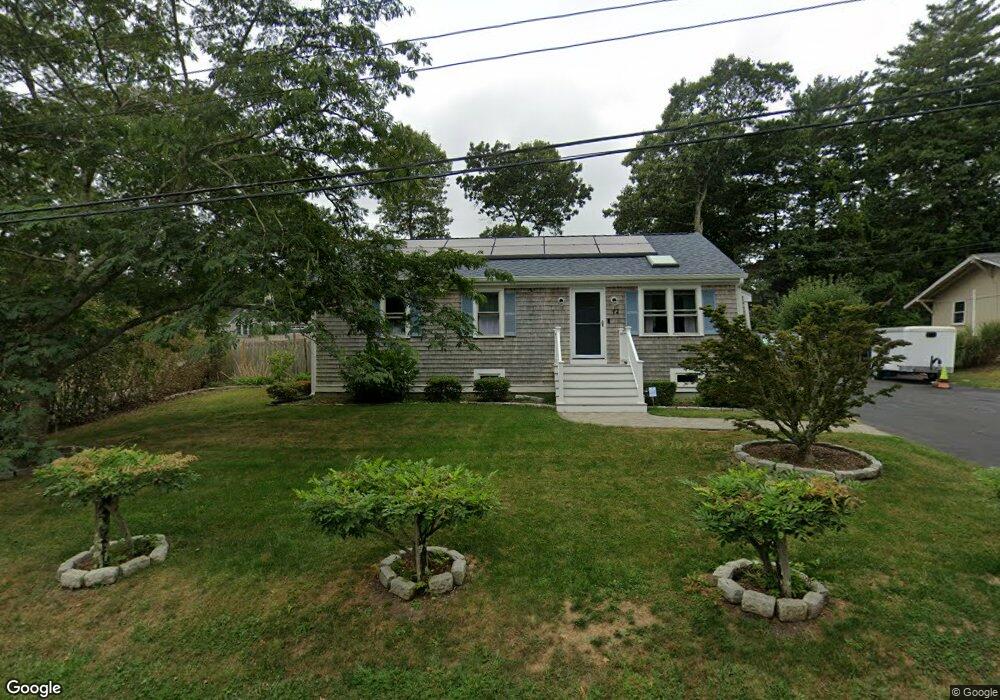
12 White Pine Ln East Falmouth, MA 02536
Hatchville NeighborhoodEstimated Value: $506,000 - $644,000
3
Beds
2
Baths
1,001
Sq Ft
$558/Sq Ft
Est. Value
About This Home
This home is located at 12 White Pine Ln, East Falmouth, MA 02536 and is currently estimated at $558,154, approximately $557 per square foot. 12 White Pine Ln is a home located in Barnstable County with nearby schools including Mullen-Hall School, Morse Pond School, and Lawrence School.
Ownership History
Date
Name
Owned For
Owner Type
Purchase Details
Closed on
Sep 18, 2002
Sold by
Dejay Rt and Kinchla
Bought by
Odonnell Brendan M and Thompson Deborah A
Current Estimated Value
Home Financials for this Owner
Home Financials are based on the most recent Mortgage that was taken out on this home.
Original Mortgage
$219,900
Outstanding Balance
$92,664
Interest Rate
6.36%
Mortgage Type
Purchase Money Mortgage
Estimated Equity
$465,490
Purchase Details
Closed on
May 9, 2001
Sold by
Costa Rt and Costa
Bought by
Dejay Rt and Kinchla
Home Financials for this Owner
Home Financials are based on the most recent Mortgage that was taken out on this home.
Original Mortgage
$105,000
Interest Rate
6.88%
Mortgage Type
Purchase Money Mortgage
Create a Home Valuation Report for This Property
The Home Valuation Report is an in-depth analysis detailing your home's value as well as a comparison with similar homes in the area
Home Values in the Area
Average Home Value in this Area
Purchase History
| Date | Buyer | Sale Price | Title Company |
|---|---|---|---|
| Odonnell Brendan M | $239,900 | -- | |
| Odonnell Brendan M | $239,900 | -- | |
| Dejay Rt | $45,100 | -- | |
| Dejay Rt | $45,100 | -- |
Source: Public Records
Mortgage History
| Date | Status | Borrower | Loan Amount |
|---|---|---|---|
| Open | Dejay Rt | $219,900 | |
| Closed | Dejay Rt | $219,900 | |
| Previous Owner | Dejay Rt | $105,000 |
Source: Public Records
Tax History Compared to Growth
Tax History
| Year | Tax Paid | Tax Assessment Tax Assessment Total Assessment is a certain percentage of the fair market value that is determined by local assessors to be the total taxable value of land and additions on the property. | Land | Improvement |
|---|---|---|---|---|
| 2025 | $2,852 | $485,900 | $140,100 | $345,800 |
| 2024 | $2,807 | $447,000 | $132,800 | $314,200 |
| 2023 | $2,778 | $401,500 | $132,800 | $268,700 |
| 2022 | $2,530 | $314,300 | $100,100 | $214,200 |
| 2021 | $2,449 | $288,100 | $95,700 | $192,400 |
| 2020 | $2,400 | $279,400 | $87,000 | $192,400 |
| 2019 | $2,126 | $248,400 | $87,000 | $161,400 |
| 2018 | $2,055 | $239,000 | $87,000 | $152,000 |
| 2017 | $1,988 | $233,100 | $87,000 | $146,100 |
| 2016 | $1,951 | $233,100 | $87,000 | $146,100 |
| 2015 | $1,909 | $233,100 | $87,000 | $146,100 |
| 2014 | $1,923 | $236,000 | $91,600 | $144,400 |
Source: Public Records
Map
Nearby Homes
- 590 Sandwich Rd
- 25 Harris Hill Rd
- 68 Deepwood Dr
- 17 Pinewood Dr
- 59 Whitecaps Dr
- 70 Meredith Dr
- 100 Tanglewood Dr
- 66 Braxton Rd
- 12 Rock Hollow Dr
- 3 Viber Ln
- 32 Jamie Ln
- 130 Old Barnstable Rd
- 273 Sandwich Rd
- 809 Sandwich Rd
- 149 Brick Kiln Rd
- 23 Little John Rd
- 33 John Parker Rd
- 35 Old Barnstable Rd
- 24 Little John Rd
- 18 White Pine Ln
- 8 White Pine Ln
- 19 Corrine Dr
- 15 Corrine Dr
- 11 White Pine Ln
- 17 White Pine Ln
- 9 Corrine Dr
- 22 White Pine Ln
- 7 White Pine Ln
- 23 Corrine Dr
- 2 White Pine Ln
- 19 White Pine Ln
- 3 White Pine Ln
- 3 Corrine Dr
- 82 Lake Shore Dr
- 10 Corrine Dr
- 26 Corrine Dr
- 25 Corrine Dr
- 74 Lake Shore Dr
- 88 Lake Shore Dr