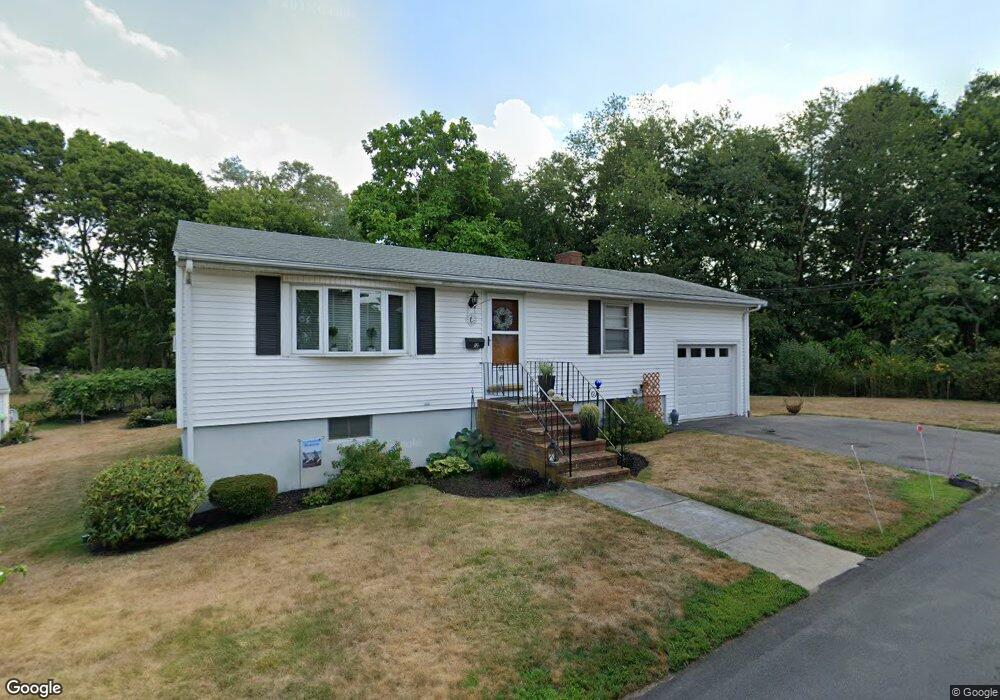
12 Whitman Rd Milton, MA 02186
Montclair NeighborhoodEstimated Value: $667,000 - $722,000
2
Beds
1
Bath
864
Sq Ft
$800/Sq Ft
Est. Value
About This Home
This home is located at 12 Whitman Rd, Milton, MA 02186 and is currently estimated at $690,871, approximately $799 per square foot. 12 Whitman Rd is a home located in Norfolk County with nearby schools including Milton High School, Conservatory Lab Upper School, and St Brendan School.
Ownership History
Date
Name
Owned For
Owner Type
Purchase Details
Closed on
Mar 21, 2025
Sold by
Falcione Chiarina Est and Falcione
Bought by
Langthorne Michael E
Current Estimated Value
Home Financials for this Owner
Home Financials are based on the most recent Mortgage that was taken out on this home.
Original Mortgage
$313,750
Outstanding Balance
$312,150
Interest Rate
6.89%
Mortgage Type
Purchase Money Mortgage
Estimated Equity
$378,721
Create a Home Valuation Report for This Property
The Home Valuation Report is an in-depth analysis detailing your home's value as well as a comparison with similar homes in the area
Home Values in the Area
Average Home Value in this Area
Purchase History
| Date | Buyer | Sale Price | Title Company |
|---|---|---|---|
| Langthorne Michael E | $663,750 | None Available | |
| Langthorne Michael E | $663,750 | None Available |
Source: Public Records
Mortgage History
| Date | Status | Borrower | Loan Amount |
|---|---|---|---|
| Open | Langthorne Michael E | $313,750 | |
| Closed | Langthorne Michael E | $313,750 |
Source: Public Records
Tax History Compared to Growth
Tax History
| Year | Tax Paid | Tax Assessment Tax Assessment Total Assessment is a certain percentage of the fair market value that is determined by local assessors to be the total taxable value of land and additions on the property. | Land | Improvement |
|---|---|---|---|---|
| 2025 | $6,080 | $548,200 | $361,000 | $187,200 |
| 2024 | $5,864 | $537,000 | $361,000 | $176,000 |
| 2023 | $5,942 | $521,200 | $359,700 | $161,500 |
| 2022 | $6,052 | $485,300 | $359,700 | $125,600 |
| 2021 | $5,709 | $434,800 | $315,200 | $119,600 |
| 2020 | $5,440 | $414,600 | $291,400 | $123,200 |
| 2019 | $5,305 | $402,500 | $282,900 | $119,600 |
| 2018 | $4,806 | $348,000 | $241,400 | $106,600 |
| 2017 | $4,498 | $331,700 | $229,900 | $101,800 |
| 2016 | $4,451 | $329,700 | $229,900 | $99,800 |
| 2015 | $4,388 | $314,800 | $211,700 | $103,100 |
Source: Public Records
Map
Nearby Homes
- 43 Hilma St
- 61 Hill Top St
- 253 W Squantum St
- 65 Barham Ave
- 118-120 Granite Ave Unit 2
- 60 Newbury St Unit 10
- 13 Ash St
- 23 Myrtle St
- 45 Hancock St Unit 203
- 559 Gallivan Blvd
- 52 Hamilton Ave
- 197 Hobart St
- 39 Fayette St Unit 403
- 1076 Adams St
- 400 Adams St Unit A
- 140 Minot St
- 885-887 Adams St Unit 1
- 397 Adams St
- 107 Minot St
- 17 Holmes St Unit 2
- 21 Riverside Ave
- 11 Whitman Rd
- 27 Riverside Ave
- 15 Whitman Rd
- 3 Whitman Rd
- 11 Riverside Ave
- 33 Riverside Ave
- 18 Riverside Ave
- 29 Thistle Ave
- 37 Thistle Ave
- 33 Thistle Ave
- 10 Riverside Ave
- 41 Thistle Ave
- 37 Riverside Ave
- 25 Thistle Ave
- 25 Thistle Ave Unit 1
- 25 Thistle Ave Unit 2
- 2 Riverside Ave
- 44 Thistle Ave
- 45 Riverside Ave