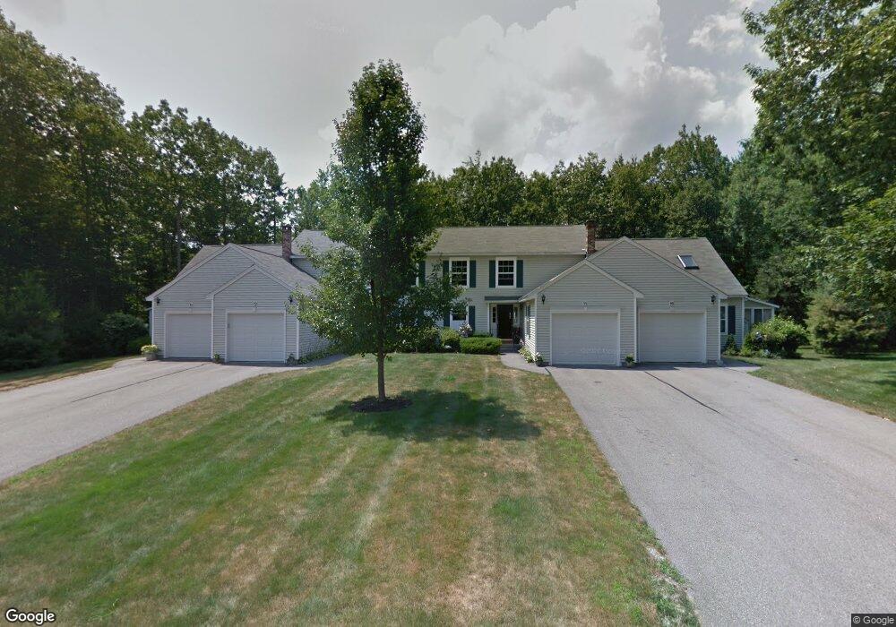
12 Windsor Commons Dr Kennebunk, ME 04043
Estimated Value: $285,000 - $543,000
2
Beds
2
Baths
1,455
Sq Ft
$288/Sq Ft
Est. Value
About This Home
This home is located at 12 Windsor Commons Dr, Kennebunk, ME 04043 and is currently estimated at $418,665, approximately $287 per square foot. 12 Windsor Commons Dr is a home located in York County with nearby schools including Kennebunk High School and The New School.
Ownership History
Date
Name
Owned For
Owner Type
Purchase Details
Closed on
Mar 15, 2025
Sold by
Leouzon Stephanie
Bought by
Ob-Ok Rt and Obrien
Current Estimated Value
Purchase Details
Closed on
Oct 9, 2009
Sold by
Lasprzak Condominiums Inc
Bought by
Stephanie Summers Maureen and Stephanie Leouzon
Create a Home Valuation Report for This Property
The Home Valuation Report is an in-depth analysis detailing your home's value as well as a comparison with similar homes in the area
Home Values in the Area
Average Home Value in this Area
Purchase History
| Date | Buyer | Sale Price | Title Company |
|---|---|---|---|
| Ob-Ok Rt | $260,000 | None Available | |
| Ob-Ok Rt | $260,000 | None Available | |
| Ob-Ok Rt | $260,000 | None Available | |
| Ob-Ok Rt | $260,000 | None Available | |
| Ob-Ok Rt | $260,000 | None Available | |
| Ob-Ok Rt | $260,000 | None Available | |
| Stephanie Summers Maureen | -- | -- | |
| Summers Maureen | -- | -- |
Source: Public Records
Mortgage History
| Date | Status | Borrower | Loan Amount |
|---|---|---|---|
| Previous Owner | Summers Maureen | $100,000 |
Source: Public Records
Tax History
| Year | Tax Paid | Tax Assessment Tax Assessment Total Assessment is a certain percentage of the fair market value that is determined by local assessors to be the total taxable value of land and additions on the property. | Land | Improvement |
|---|---|---|---|---|
| 2024 | $5,027 | $296,600 | $74,700 | $221,900 |
| 2023 | $4,760 | $296,600 | $74,700 | $221,900 |
| 2022 | $4,330 | $296,600 | $74,700 | $221,900 |
| 2021 | $4,227 | $296,600 | $74,700 | $221,900 |
| 2020 | $4,197 | $296,600 | $74,700 | $221,900 |
| 2019 | $4,078 | $296,600 | $74,700 | $221,900 |
| 2018 | $3,892 | $222,400 | $56,000 | $166,400 |
| 2017 | $3,681 | $222,400 | $56,000 | $166,400 |
| 2016 | $3,536 | $222,400 | $56,000 | $166,400 |
| 2015 | $3,257 | $222,400 | $56,000 | $166,400 |
| 2014 | $3,172 | $222,400 | $56,000 | $166,400 |
Source: Public Records
Map
Nearby Homes
- 22 Winchester Ct
- 59 Plymouth Grove Unit 11
- 9 Hampton Glen Dr Unit 3
- 6 Dunnhill Dr Unit 28
- 17 Hampton Glen Dr Unit 5
- 056 Cat Mousam Rd
- 23 Lilac Ln
- 15 Casey Ln
- 19 Old Alewive Rd
- 23 Cascade Cir Unit 22
- 61 Fletcher St
- 16 Oakwood Ln Unit 16
- 22 Oakwood Ln
- 17 Legacy Ln
- 30 York St Unit 1
- 30 Twine Mill Rd
- 10 Chickadee Ln
- 18 Longwood Dr
- 0 Potvin Rd
- 60 Brown St Unit 2
- 12 Windsor Commons Dr Unit 58
- 10 Windsor Commons Dr
- 14 Windsor Commons Dr
- 14 Windsor Commons Dr Unit 18
- 16 Windsor Commons Dr
- 8 Windsor Commons Dr
- 6 Windsor Commons Dr
- 18 Windsor Commons Dr
- 20 Windsor Commons Dr
- 20 Windsor Commons Dr Unit 15
- 4 Windsor Commons Dr
- 22 Windsor Commons Dr
- 2 Windsor Commons Dr
- 24 Windsor Commons Dr
- 24 Windsor Commons Dr Unit 24
- 24 Windsor Commons Dr Unit 13
- 0 Windsor Commons Dr
- 8 Stratford Place
- 8 Stratford Place Unit 56
- 26 Coventry Woods Dr Unit 26
Your Personal Tour Guide
Ask me questions while you tour the home.