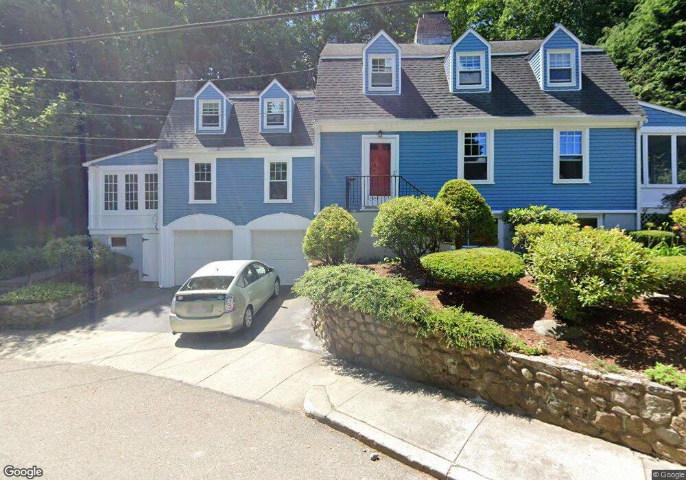
120 Atwood Ave Unit A Newtonville, MA 02460
Newtonville NeighborhoodEstimated Value: $1,527,000 - $1,845,634
1
Bed
1
Bath
--
Sq Ft
0.26
Acres
About This Home
This home is located at 120 Atwood Ave Unit A, Newtonville, MA 02460 and is currently estimated at $1,667,159. 120 Atwood Ave Unit A is a home located in Middlesex County with nearby schools including Cabot Elementary School, F.A. Day Middle School, and Newton North High School.
Ownership History
Date
Name
Owned For
Owner Type
Purchase Details
Closed on
Jun 17, 2013
Sold by
E H Nurczynski Ret
Bought by
Case David J and Case Elizabeth B
Current Estimated Value
Home Financials for this Owner
Home Financials are based on the most recent Mortgage that was taken out on this home.
Original Mortgage
$752,560
Outstanding Balance
$532,936
Interest Rate
3.39%
Mortgage Type
Purchase Money Mortgage
Estimated Equity
$1,134,223
Purchase Details
Closed on
Apr 18, 2007
Sold by
Nurczynski Elizabeth H
Bought by
Elizabeth Nurczynski R
Create a Home Valuation Report for This Property
The Home Valuation Report is an in-depth analysis detailing your home's value as well as a comparison with similar homes in the area
Home Values in the Area
Average Home Value in this Area
Purchase History
| Date | Buyer | Sale Price | Title Company |
|---|---|---|---|
| Case David J | $940,700 | -- | |
| Elizabeth Nurczynski R | -- | -- | |
| Elizabeth Nurczynski R | -- | -- |
Source: Public Records
Mortgage History
| Date | Status | Borrower | Loan Amount |
|---|---|---|---|
| Open | Case David J | $752,560 |
Source: Public Records
Tax History Compared to Growth
Tax History
| Year | Tax Paid | Tax Assessment Tax Assessment Total Assessment is a certain percentage of the fair market value that is determined by local assessors to be the total taxable value of land and additions on the property. | Land | Improvement |
|---|---|---|---|---|
| 2025 | $15,661 | $1,598,100 | $1,061,500 | $536,600 |
| 2024 | $15,144 | $1,551,600 | $1,030,600 | $521,000 |
| 2023 | $14,274 | $1,402,200 | $841,300 | $560,900 |
| 2022 | $13,658 | $1,298,300 | $779,000 | $519,300 |
| 2021 | $12,816 | $1,191,100 | $714,700 | $476,400 |
| 2020 | $12,435 | $1,191,100 | $714,700 | $476,400 |
| 2019 | $11,633 | $1,113,200 | $667,900 | $445,300 |
| 2018 | $11,487 | $1,061,600 | $627,900 | $433,700 |
| 2017 | $10,830 | $973,900 | $576,100 | $397,800 |
| 2016 | $10,168 | $893,500 | $528,500 | $365,000 |
| 2015 | $9,694 | $835,000 | $493,900 | $341,100 |
Source: Public Records
Map
Nearby Homes
- 127-129 Withington Rd Unit 1
- 44 Blake St Unit 2
- 300 Cabot St
- 110 Harvard St Unit A
- 10 Washington Park
- 10 Washington Park Unit 2
- 10 Washington Park Unit 1
- 48 Harvard St Unit 1
- 3 Cedar St
- 22 Walnut Place Unit 1
- 34 Morton Rd
- 73 Elmore St
- 887 Commonwealth Ave
- 77 Court St Unit 205
- 911 Washington St
- 935 Washington St Unit 8
- 686 Centre St
- 61 Lakeview Ave
- 324 Adams St Unit 2
- 168 Walnut St
- 120 Atwood Ave
- 217 Harvard Cir
- 114 Atwood Ave Unit 116
- 116 Atwood Ave
- 118 Kirkstall Rd
- 225 Harvard Cir
- 124 Kirkstall Rd
- 230 Harvard Cir
- 199 Harvard Cir
- 106 Kirkstall Rd
- 104 Atwood Ave
- 239 Harvard Cir
- 191 Harvard Cir
- 130 Kirkstall Rd
- 109 Atwood Ave Unit 1
- 109 Atwood Ave
- 128 Kirkstall Rd
- 107 Atwood Ave Unit 109
- 185 Harvard Cir
- 236 Harvard Cir