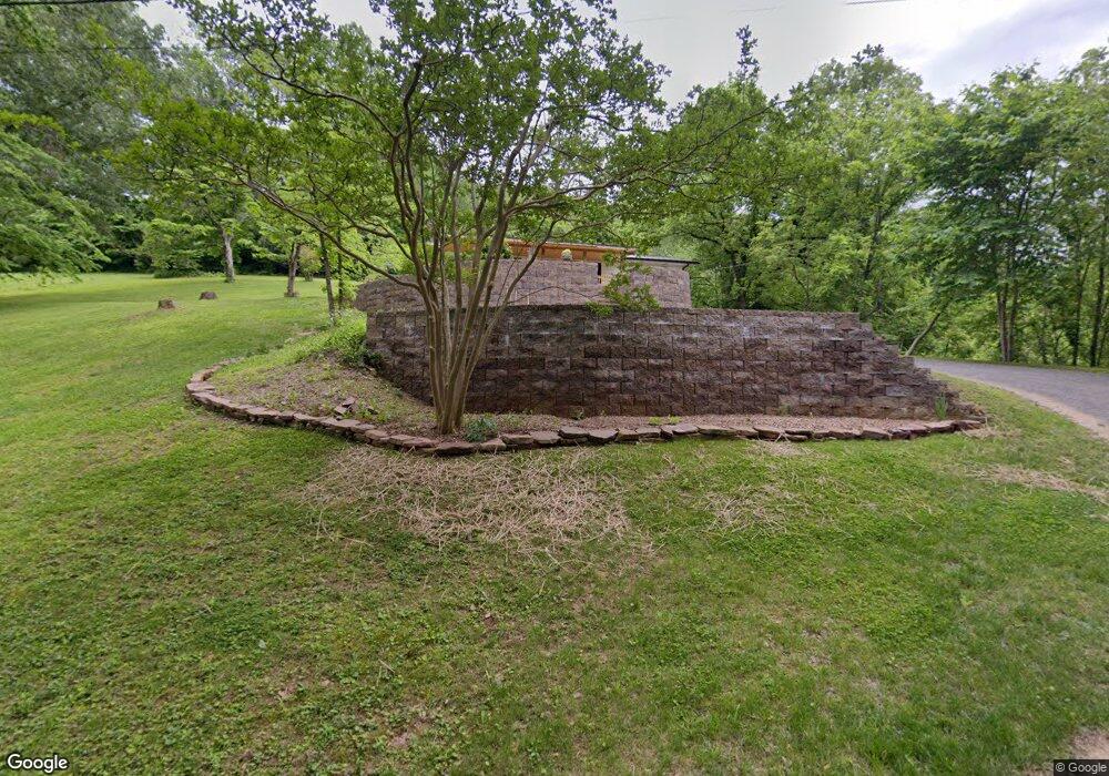
120 Clabough Rd Townsend, TN 37882
Estimated Value: $412,000 - $602,000
--
Bed
2
Baths
1,196
Sq Ft
$423/Sq Ft
Est. Value
About This Home
This home is located at 120 Clabough Rd, Townsend, TN 37882 and is currently estimated at $506,399, approximately $423 per square foot. 120 Clabough Rd is a home located in Blount County with nearby schools including Townsend Elementary School, Heritage Middle School, and Heritage High School.
Ownership History
Date
Name
Owned For
Owner Type
Purchase Details
Closed on
Jun 12, 2015
Sold by
Taunton David
Bought by
Spruce Barry
Current Estimated Value
Home Financials for this Owner
Home Financials are based on the most recent Mortgage that was taken out on this home.
Original Mortgage
$150,000
Outstanding Balance
$116,757
Interest Rate
3.89%
Mortgage Type
New Conventional
Estimated Equity
$389,642
Purchase Details
Closed on
Dec 26, 2001
Sold by
Clabough David
Bought by
Taunton David
Purchase Details
Closed on
Aug 20, 1956
Bought by
Clabough James C and Clabough Jean M
Create a Home Valuation Report for This Property
The Home Valuation Report is an in-depth analysis detailing your home's value as well as a comparison with similar homes in the area
Home Values in the Area
Average Home Value in this Area
Purchase History
| Date | Buyer | Sale Price | Title Company |
|---|---|---|---|
| Spruce Barry | $150,000 | -- | |
| Taunton David | $150,000 | -- | |
| Clabough James C | -- | -- |
Source: Public Records
Mortgage History
| Date | Status | Borrower | Loan Amount |
|---|---|---|---|
| Open | Spruce Barry | $150,000 |
Source: Public Records
Tax History Compared to Growth
Tax History
| Year | Tax Paid | Tax Assessment Tax Assessment Total Assessment is a certain percentage of the fair market value that is determined by local assessors to be the total taxable value of land and additions on the property. | Land | Improvement |
|---|---|---|---|---|
| 2024 | $1,003 | $63,075 | $16,425 | $46,650 |
| 2023 | $1,003 | $63,075 | $16,425 | $46,650 |
| 2022 | $960 | $38,850 | $13,950 | $24,900 |
| 2021 | $971 | $39,325 | $13,950 | $25,375 |
| 2020 | $971 | $39,325 | $13,950 | $25,375 |
| 2019 | $971 | $39,325 | $13,950 | $25,375 |
| 2018 | $914 | $37,000 | $15,600 | $21,400 |
| 2017 | $914 | $37,000 | $15,600 | $21,400 |
| 2016 | $914 | $37,000 | $15,600 | $21,400 |
| 2015 | $796 | $37,000 | $15,600 | $21,400 |
| 2014 | $841 | $37,000 | $15,600 | $21,400 |
| 2013 | $841 | $39,125 | $0 | $0 |
Source: Public Records
Map
Nearby Homes
- 21 Tennessee 73
- 7539 W Old Highway 73
- 7641 Powderhorn Trail
- 224 Webb Rd
- 503 Domar Ct
- 259 Black Mash Hollow Rd
- 308 Black Mash Hollow Rd
- 247 Boat Gunnel Rd
- 311 Domar Dr
- 0 Shooting Star Loop
- 229 Bishops Cap Cir Unit 106
- 235 Bishops Cap Cir Unit 102
- 235 Bishops Cap Cir Unit 103
- 326 Shooting Star Loop Unit 101
- 326 Shooting Star Loop Unit 203
- 326 Shooting Star Loop Unit 202
- 326 Shooting Star Loop Unit 201
- 311 E Chestnut Hill Rd
- 358 Webb Rd
- 358 Boat Gunnel Rd
- 118 Smoky Dr
- 120 Smoky Dr
- 120 Smoky Dive
- 122-126 128 Smoky Dr
- 116 Smoky Dr
- Lot 2 Smoky Dr
- 7622 E Lamar Alexander Pkwy
- 114 Smoky Dr
- Lot 3 Smoky Dr
- 146 Smokey Dr
- 110 Black Mash Hollow Rd
- 196 Tennessee 73
- 117 Tennessee 73
- 138 Smokey Dr
- 7621 E Lamar Alexander Pkwy
- 0 Flamingo Cir Unit 610650
- 0 Flamingo Cir Unit 680598
- 113 Smoky Dr
- 7650 Old Highway 73
- 147 Smoky Dr
